


Join thousands of book lovers
Sign up to our newsletter and receive discounts and inspiration for your next reading experience.
By signing up, you agree to our Privacy Policy.You can, at any time, unsubscribe from our newsletters.
This ultimate guide to coffee contains comprehensive details on the beans and brews of more than 35 countries.
Embark on a grand tour of Europe with the 'Europe - Tourist and Motoring Atlas (A4-Spiral)'! Published by Michelin Editions on January 19, 2023, this atlas is a must-have for any avid traveler or motor enthusiast. This comprehensive guide provides detailed maps and touring information, making it easy to plan your next European adventure. The A4 spiral binding allows for easy use and durability, making it the perfect travel companion. Whether you're planning a road trip through the scenic countryside or exploring bustling city streets, this atlas has got you covered. Don't miss out on this essential guide, brought to you by the renowned publisher, Michelin Editions. Navigate Europe like never before!
An alternative guide to the hidden everyday objects in a city, from the hugely successful podcast 99% Invisible
Looking for an eco-friendly and convenient way to explore Europe? This ultimate guide to train travel reveals how to make the most of the continent's high-speed services, sleeper trains and scenic routes. Packed with maps and insider tips, you'll discover everything from how to piece together your trip to ways to book the best value tickets.
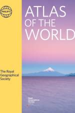
The latest edition of the world's most prestigious and authoritative world atlas, containing up-to-date world maps and thematic information curated by experts in geography and cartography.
A new edition of this detailed road atlas of Scotland - part of a series of Navigator regional atlases featuring Philip's exceptionally large-scale and detailed Navigator maps in an easy-to-handle format.
An atlas that takes us across the oceans of the world to fifty remote islands. It features rare animals and lost explorers, marooned slaves and lonely scientists, mutinous sailors and forgotten castaways.
All-in-one, two-directional, hiking route guide, maps and accommodations for the popular Hadrian's Wall Path long-distance trail that follows the old Roman wall for 84 miles (135km) across the north of England.Includes 59 large-scale maps (3 1/8 inches to 1 mile); 8 town plans and 6 overview maps. Full details of all accommodations and campsites, restaurants and pubs; plus full public transport information. Includes day-walks.
Uniting National Geographic's incomparable photography with state-of-the-art cartographic technology, this is the most compelling, authoritative, and up-to-the-moment visual atlas on the market.
Discusses the history of wine, grape varieties, wine-making techniques, vintages, and more.
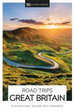
With its idyllic market towns, romantic castle ruins and stunning natural landscapes, Great Britain is the perfect destination for a leisurely road trip. It's yours to explore with Road Trips Great Britain, which contains 25 drives across the country, from the sweeping sandy beaches of Cornwall to the dramatic peaks of the Scottish Highlands.Includes insider tips and information, this easy-to-use e-guide reveals Great Britain at its best: spectacular sights, hidden gems and authentic local experiences. We've also worked hard to make sure our information is as up-to-date as possible following the COVID-19 outbreak.You'll discover:- 25 easy-to-follow driving tours, each lasting one to five days, including sleepy Cotswold villages, the majestic unspoiled waters of the Lake District and scenic Brecon Beacons National Park- Ideas for discovering the character of each area en route: great views, delightful detours along peaceful back roads, walks through historic towns and villages, wine tours and boat trips, and activities such as hiking, cycling and kayaking. Plus you'll savour the best local experiences with our pick of the most authentic places to stay, eat and shop- All the British rules of the road, postcodes for use with satnav and detailed directions for easy navigation, information on road conditions and parking tips- Covers Cornwall, Devon, the Jurassic Coast, Salisbury, Bath, Glastonbury, the Cotswolds, the Chilterns, the South Downs, Brighton, Kent, Cambridgeshire, Norfolk, the Brecon Beacons, West Wales, Snowdonia, Offa's Dyke, the Peak District, Yorkshire, the Lake District, Northumbria, Edinburgh, Fife, the Scottish Highlands, the Scottish Lochs, Aberdeen, Inverness, and moreLooking for even more inspiration for your trip to Great Britain? Try our DK Eyewitness Great Britain.
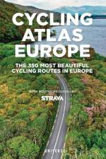
Featuring lovely scenery and dramatic panoramas, these carefully selected tours of the most beautiful places to pedal throughout Europe are for both seasoned and novice cyclists and feature the groundbreaking user-sourced mapping technology of the Strava app.
This A-Z map of Scotland is a full colour regional road atlas featuring 92 pages of road mapping covering the whole of the country.
2 falsede kort over Mallorca i meget detaljeret målestok 1:50.000 indsat i plastomslag. Kortene har cykelruter indtegnet. Det ene kort dækker den nordlige del af øen, det andet den sydlige del.I plastomslaget ligger også et hæfte på 86 sider med beskrivelse af cykelruterne samt link til flere oplysninger, top-10 tips til seværdigheder samt register over byer og tilhørende postnumre samt bykort.
Der Reiseatlas Island 1:150.000 ist der ideale Wegbegleiter für alle, die Island mit dem Auto oder öffentlichen Verkehrsmitteln erkunden möchte. Der Straßenatlas kann nicht nur für die Planung herangezogen werden, sondern erweist sich auch während der Reise als unverzichtbare Orientierungshilfe.Mit dem detailreichen Kartenbild und dem genauen Maßstab lässt sich das gesamte Straßennetz auf der Insel, inklusive der Hochlandstraßen, nachverfolgen. Die Ringstraße (Hringvegur) ist mit einer eigenen Straßensignatur hervorgehoben und sowohl der Golden Circle (Gullni hringurinn) als auch der Arctic Coast Way (Norðurstrandarleið) sind als touristische Straßen gekennzeichnet.Autofahrer können besonders nützliche Informationen aus dem Autoatlas herauslesen, wie etwa Straßenbelag, Furten (Flussüberquerungen), Rastplätze, Tankstellen und Autowerkstätten. Wohnwagenfahrer und Camper finden ein nützliches Verzeichnis von Campingplätzen und Stellplätzen. Für alle Reisenden, die lieber mit dem Bus unterwegs sind, steht eine Übersichtskarte mit den öffentlichen Verkehrsmitteln zur Verfügung.Informationen zum Reiseatlas IslandIsland 1:150.00018 Stadt- und Ortspläne232 Seiten, Format 21 x 29,7cm (A4)Halbverdeckte SpiralbindungCamping- und Stellplätze, Unterkünfte30 Highlights beschriebenOrts- und GewässerverzeichnisDamit sich Islandbesucher auf der Insel zurechtfinden, wurden in den Karten touristisch relevante Informationen, darunter Nationalparks und Naturschutzgebiete, schöne Ausblicke, Wasserfälle, heiße Quellen und beliebte Orte für die Walbeobachtung, visualisiert.Der Inselstaat Island (Ísland) ist wie kein anderes europäisches Land von schlummernden Vulkanen, kahlen Lavafeldern, mächtigen Gletschern, speienden Geysiren, tosenden Wasserfällen, naturbelassenen Flüssen sowie heißen und kalten Quellen geprägt. Es ist das Land der Extreme, wo das Wasser gemächlich aus dem Boden blubbert, Fontänen wild aus dem Untergrund herausschießen und die Erde in regelmäßigen Abständen bebt, aber wo sich auch fruchtbare Flusstäler und sanfte Küstenbereiche erstrecken.Gedruckt in Österreich.
Dieses Kompendium von 300 Reisezielen stellt Ihnen einige der dunkelsten Ecken der Welt vor, die der Autor fast alle (zu 95%) selbst besucht hat. Der 'Atlas of Dark Destinations' ist der erste Reiseführer dieser Art und beschreibt spezielle Orte, die den Leser auf sehr unterschiedliche Weise in ihren Bann ziehen. Von Atombunkern bis hin zu seltsamen medizinischen Museen ist für jede*n etwas dabei!
'The best whisky book ever - a must-read for drinkers!' - Forbes'The perfect go-to reference guide for the whisky lover's bookshelf' - Whisky MagazineAward-winning author and whisky expert Dave Broom profiles more than 400 distilleries and tastes more than 800 whiskies. There has been major growth in the world of whisky in the last decade, with many more distilleries opening, and this new edition brings the world of whisky right up to date.The World Atlas of Whisky is the only guide the connoisseur and newcomer will ever need in order to understand everything there is to know about the world of whisky. This is a beautifully illustrated, in-depth and comprehensive journey through the history, process, distilleries and expressions of world whiskies, featuring detailed full-colour maps. Heritage, romance, flavour and craftsmanship are all celebrated in this complete study of this most versatile of drinks.
Hæftet miniatlas over den kendte pilgrims vandrerute i målestokken 1:150.000. Kortet dækker fra St-Jean-Pied-de-Port til Santiago de Compostela. Indeholder oversigt over herberger og refugier samt praktisk information.
Think of Athens and the first things that spring to mind are ancient ruins and camera-toting crowds (before they hotfoot it to the island-bound ferries at the port of Piraeus, that is). It's true, the Acropolis is ever present and during summer the city thrums with schools of holidaymakers. But there's much more to the Greek capital than temples and tourists.We've looked beyond the admittedly awe-inspiring Parthenon and explored the city's modernist marvels, from circular school to colonnaded embassy. We've combed the cobbled streets for independent boutiques offering straw hats, hand-thrown ceramics and golden jewellery - all proudly "Made in Greece". When you're feeling peckish, choose between traditional family-run tavernas and contemporary restaurants spicing up classic Greek dishes.Attica is a region of riches and, of course, some of the nearby islands are simply too good to miss - so we've included a short and sharp list of our top stopovers. For now, though, strap up your sandals and allow us to introduce you to this chaotic but ever-so-charismatic city.
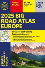
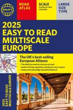
The latest edition in Philip's best-selling European Atlas range, now in a practical paperback format with place-holder flaps. The 2025 Philip's Easy to Read Multiscale Road Atlas of Europe contains mapping at the best scales for driving in Europe alongside the rules and regulations for every country.
Sign up to our newsletter and receive discounts and inspiration for your next reading experience.
By signing up, you agree to our Privacy Policy.