


Join thousands of book lovers
Sign up to our newsletter and receive discounts and inspiration for your next reading experience.
By signing up, you agree to our Privacy Policy.You can, at any time, unsubscribe from our newsletters.
Imbarca in una straordinaria spedizione in Norvegia attraverso le pagine coinvolgenti di "Norway Travel Guide 2024". Questa guida meticolosamente realizzata è il tuo passaporto per scoprire la magia che si trova all'interno dei fiordi, delle città e delle gemme nascoste di questo paese delle meraviglie nordico. Mentre pervedi queste pagine, ti ritrovi trasportato in un regno dove l'antica mitologia e l'innovazione moderna coesistono armoniosamente. Dai paesaggi maestosi dei fiordi ai vivaci paesaggi urbani di Oslo e Bergen, ogni pagina svela un nuovo aspetto dell'accattivante fascino della Norvegia. Tuttavia, questa guida non è solo una mappa: è un portale per sperimentare l'essenza della Norvegia. Tuffati nel ricco arazzo della cultura locale, dalle intricate tradizioni del popolo Sami al brivido di assistere all'affascinante aurora boreale. Concediti i tuoi sensi nei sapori dell'autentica cucina norvegese ed esplora i racconti dietro le reliquie storiche vichinghe e l'architettura medievale. Al di là dei punti di riferimento familiari, "Norway Travel Guide 2024" ti invita a portare alla luce i tesori meno noti che definiscono il fascino del paese. Attraversa i villaggi costieri di Lofoten, intraprendi viaggi panoramici ferroviari attraverso le montagne e assisti allo splendore dei parchi nazionali norvegesi. Ogni raccomandazione all'interno di queste pagine è stata accuratamente selezionata per offrirti un'esperienza autentica e coinvolgente. Che tu sia un avventuriero in cerca di emozioni all'aria aperta, un appassionato di cultura attratto da racconti antichi o un cercatore di tranquillità affascinato dalle viste sui fiordi, questa guida è la tua bussola per un viaggio straordinario. Con informazioni aggiornate, approfondimenti e suggerimenti inestimabili, assicura che la tua esplorazione della Norvegia sia a dir poco notevole. Quindi, armati di curiosità e intraprendi un'odissea di scoperta. Consenti a "Norway Travel Guide 2024" di guidarti attraverso i fiordi, le foreste e i fjells e lascia che serva come chiave per sbloccare la bellezza, la cultura e i ricordi che ti aspettano in questo accattivante regno nordico.
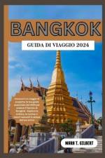
Immergiti nel vibrante polso di Bangkok con la "Bangkok Travel Guide 2024". Questa guida meticolosamente curata è la tua porta d'accesso a un viaggio straordinario attraverso l'accattivante capitale della Thailandia. Mentre navighi in queste pagine, entri in una città dove antichi templi si trovano giustapposti a moderni grattacieli, dove i mercati affollati prosperano accanto a oasi serene. Ogni capitolo svela un nuovo strato del fascino enigmatico di Bangkok, offrendo approfondimenti sulla sua ricca storia, cultura e meraviglie contemporanee. Tuttavia, questa guida è più di una semplice raccolta di raccomandazioni: è un invito a sperimentare l'anima di Bangkok. Approfondisci le intricate complessità della cucina tailandese, assaporando sapori che danzano sul tuo palato. Assisti alla riverenza dei monaci nelle cerimonie tradizionali e perditi nel colorato caos dei mercati locali. Al di là dei punti di riferimento iconici, "Bangkok Travel Guide 2024" ti porta fuori dai sentieri battuti, rivelando gemme nascoste che incapsulano la vera essenza della città . Naviga nei khlong, o canali, di Thonburi, scopri l'arte e la creatività in quartieri eclettici e vivi la tranquillità di antichi templi lontano dalla folla. Che tu sia un esploratore desiderosi di incontri autentici, un appassionato di cultura attratto da tradizioni secolari o un avventuriero culinario in cerca di nuovi gusti, questa guida è il tuo compagno inestimabile. Con informazioni aggiornate, consigli utili e una vasta gamma di raccomandazioni, garantisce che il tuo viaggio attraverso Bangkok sia a dir poco straordinario. Quindi, abbraccia l'incantesimo e immergiti nella vivace vivacità di Bangkok. Lascia che la "Bangkok Travel Guide 2024" sia la tua guida, portandoti nel cuore di questa città accattivante, un luogo dove ogni svolta promette una nuova scoperta, dove storia, cultura e modernità convergono per creare un'avventura indimenticabile.
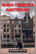
Ti sei mai chiesto cosa rende Amsterdam così affascinante e irresistibile? Se stai pianificando un viaggio nella meravigliosa capitale olandese, allora questa guida è proprio ciò che stai cercando! La "GUIDA TURISTICA AMSTERDAM: La Tua Guida Definitiva alle 10 Attrazioni Principali della Città " è la tua compagna perfetta per scoprire le attrazioni più affascinanti e i segreti meglio custoditi di questa città mozzafiato. Da una cultura ricca di storia a un'atmosfera cosmopolita, Amsterdam ha qualcosa da offrire a ogni viaggiatore curioso. Con questa guida, sarai in grado di pianificare il tuo itinerario perfetto, assicurandoti di non perdere le principali attrazioni come i famosi canali di Amsterdam, i musei di fama mondiale e i quartieri vivaci che ti cattureranno dal primo momento. Ma non è tutto! Oltre alle principali attrazioni, scoprirai anche tesori nascosti, come incantevoli cortili segreti e pittoreschi mercati locali, dove potrai immergerti nella vera essenza di Amsterdam. Questo libro è il risultato di ricerche approfondite e dei migliori consigli da parte di esperti locali, quindi puoi fidarti di ottenere informazioni autentiche e preziose per rendere il tuo viaggio un'esperienza indimenticabile. Non perdere l'opportunità di scoprire Amsterdam con questa guida completa e dettagliata! Acquistala ora e inizia il tuo viaggio nella città dei canali e dei tesori culturali. Vieni a scoprire il fascino senza tempo di Amsterdam - prenota ora la tua avventura nella capitale olandese e preparati a creare ricordi che dureranno per sempre!
ABECEDAIRE de l'eau: histoires diverses sur les bateaux, l'Histoire, des aventures, des lieux du monde qu peuvent inspirer ou faire rêver
Learn from the best with this popular book on creating successful maps with any GIS or illustration product, written by an expert cartographer.For more than 18 years, Designing Better Maps: A Guide for GIS Users has been essential reading for all mapmakers who use geographic information systems (GIS) across industries and sectors, including government, commercial, creative, or academic. This third edition continues the reliable legacy of this book, distinctive in its clear and efficient emphasis on core cartographic concepts and updated with new and revamped design practices.With more than 400 full-color illustrations, this book applies map design best practices to both reference and statistical mapping, guiding you through the processes of planning maps, using scale and time, understanding and using color, customizing symbols, and more.Whether you face the challenge of making well-designed maps or are already adept at GIS data management and analysis but need better ways to visually communicate spatial information and results, Designing Better Maps teaches how to use GIS tools to design maps in provocative and accessible ways.Award-winning author Cynthia A. Brewer uses her sophisticated mix of experiences--conducting academic research, teaching novice cartographers, mentoring research and mapmaking by advanced students, and collaborating with analysts and mapmakers at various federal agencies--to present this practical information. Brewer is a professor and chair of the Department of Geography at Pennsylvania State University. She teaches introductory cartography and map design courses and advises graduate students working in cartography. She has worked as a map and atlas design consultant for the US Census Bureau, National Cancer Institute, National Center for Health Statistics, and National Park Service.
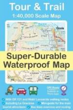
Water-proof, split-proof, tear-proof, adventure-proof. Lanzarote Tour & Trail Super-Durable Map is simply the toughest, most accurate, easy to read, easy to use multipurpose map that you can get. A large 960mm by 694mm double sided map sheet covers Lanzarote and its neighbouring island La Graciosa at 1:40,000 scale.
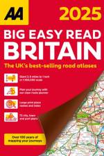
This A4 format atlas has been revised and updated for 2025 containing up-to-date mapping from the experts at the AA in a giant 2.3 miles to 1 inch scale. Features include a large print place names and index, top 300 AA-Inspected caravan and camping sites and over 240 service areas along with a 6 page clear route planner map.
This A3 format atlas has been revised and updated for 2025 containing up-to-date mapping from the experts at the AA in a giant 2.5 miles to 1 inch scale. Features include a large print place names and index, 72 city, town and port plans, top 300 AA-Inspected caravan and camping sites, over 1,800 golf courses and a 4 page route planner .
This A3 format atlas has been revised and updated for 2025 containing up-to-date mapping from the experts at the AA in a giant 2.5 miles to 1 inch scale. Features include large print place names and index, 72 city, town and port plans, top 300 AA-Inspected caravan and camping sites, over 1,800 golf courses and a 4 page route planner .
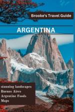
The Brooke's Travel Guide to Argentina is available to assist you whether you want to experience the tango in Buenos Aires, taste wine in Mendoza, or trek through Patagonia's glacial landscape.With the help of Brooke's Argentina Travel Guide, you can streamline the process of planning your trip and make the most of your time. This new edition has undergone a complete redesign with new content, an easy-to-read layout, and gorgeous color photos.In Brooke's travel guide to Argentina, you'll find: An illustrated guide to the best sights and activities is available at ULTIMATE EXPERIENCES.MANY ITINERARIES to efficiently plan your days and make the most of your time.MAP DETAILS to aid in confident navigation.COLOR PHOTOS all through to whet your appetite for travel!AUTHENTIC LOCAL RECOMMENDATIONS on the top attractions, eateries, lodging options, nightlife, activities, side trips, and more."The Best Outdoor Activities in Argentina," Additionally, "What to Eat and Drink in Argentina"TRIP-PLANNING TOOLS AND PRACTICAL TIPS, such as when to go, how to navigate, how to avoid crowds, and how to conserve time and money.A wealth of context on the local people, politics, art, architecture, food, dance, geography, and more is provided by historical and cultural insights.Iguaz Falls-specific features, Spanish language primer with helpful words and key phrasesCurrent coverage includes information on Buenos Aires, Igaz Falls, tango dancing, Patagonia, and more.Enjoy!
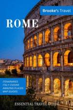
Whether you want to visit the Roman Forum, the Vatican, or the Colosseum, the Brooke's Travel Guide in Rome can help! It's jam-packed with maps, carefully curated recommendations, and everything else you need to streamline your trip planning and maximize your time. This new edition has been completely redesigned, with an easy-to-read layout, updated information, and stunning color photographs.Brooke's Rome travel guide includes the following items: MULTIPLE ITINERARIES TO EFFECTIVELY ORGANIZE YOUR DAYS AND MAXIMIZE YOUR TIME AN ILLUSTRATED ULTIMATE EXPERIENCES GUIDE TO THE TOP THINGS TO SEE AND DODETAILED MAPS to assist you in navigating confidently COLOR PHOTOS throughout to pique your wanderlust!BEST OF FEATURES WITH PHOTOS on Best Museums, Best Ancient Sites, Under the Radar Things to Do in Rome and more.TRIP-PLANNING TOOLS AND PRACTICAL TIPS, such as when to go, how to get around, how to avoid crowds, and how to save time and moneyCOVERAGE INCLUDES: Vatican City, the Roman Forum, the Colosseum, St. Peter's Basilica, the Pantheon, Trastevere, the Trevi Fountain, the Spanish Steps, and much more.
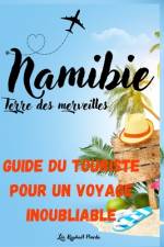
Découvrez l'âme sauvage de l'Afrique avec "Namibie, Terre des Merveilles: Un Guide du touriste pour un voyage inoubliable" !Vous avez toujours rêvé d'explorer des paysages à couper le souffle, de vous plonger dans une culture riche et diversifiée, ou d'observer de près la faune sauvage en toute liberté ? Notre guide est votre billet pour une aventure namibienne inoubliable.Du désert du Namib, le plus ancien du monde, à la Côte des Squelettes, mystérieusement belle, en passant par le Parc National d'Etosha, un véritable éden pour les amoureux de la faune, nous vous emmenons bien au-delà des sentiers battus. Grâce à nos conseils pratiques, nos astuces de voyage et nos ressources supplémentaires, vous serez prêt à vivre le voyage de vos rêves en toute sérénité.Embarquez dans cette aventure captivante, découvrez la Namibie comme vous ne l'avez jamais vue et créez des souvenirs qui resteront gravés à jamais dans votre coeur.N'attendez plus, commandez dès maintenant ce guide et laissez-vous emporter dans l'extraordinaire voyage de votre vie.
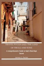
Find the hidden gems of Puglia with TRAVEL PUGLIA comprehensive travel manual! Ideal for first-timers. This manual takes you off the beaten path and shows you the authentic, lesser-known side of this enchanting region. Immerse yourself in the rich history, culture, and cuisine of Puglia, from the enchanting ridge towns to the perfect beaches and everything in between. With insider tips, family travel tips, must-see sights, and dishes, TRAVEL PUGLIA will assist you in planning a definitive Puglia experience and making memories that last forever.Find out in this book vast information on accommodations, transportation, travel requirements, and lots on Puglia travel! "Ready to uncover the magic of Puglia and experience the genuine heart of Italy?Get your copy now and begin planning your unforgettable trip to Puglia!"
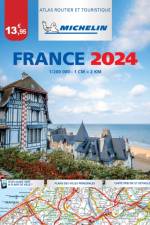
Michelin's France paperback A4 atlas offers, in addition of Michelin's clear and accurate mapping, an enhanced view of your journey thanks to its scale 1/200,000. The route planner as well as the time distance charts will help you plan and optimise journey. Michelin's safety alerts warn you about dangerous driving areas and zones subjet to tighter speed checks. Michelin's paperback France atlas also includes information on tourist sights, leisure facilities and scenic routes, as well as service areas to add pleasure and comfort to your journey.Michelin's France paperback tourist and motorist atlas features:- Scale 1/200,000: for an enhanced view of your journey- Key to map pages: to quickly access the region of your interest- A complete town index: To easily indentify to destination of your choice- Distance and time chart: to help you plan your trip- 6 major town plans: Paris, Bordeaux, Lille, Lyon, Marseille & Nantes- Michelin's danger alerts: to help you identify zones at risks for drivers and controlled speed areas- In English language: Keys, indexes and information- The atlas is also cross-referenced with the famous Michelin's Green Guide with tourist sights, scenic routes and leisure facilities.
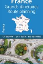
Updated annually, MICHELIN National Map France Route Planning (map 726) will give you an overall picture of your journey thanks to its clear and accurate mapping scale 1/1 000 000. Our map will help you easily plan your safe and enjoyable journey in France thanks to a comprehensive key, a complete name index as well a clever time & distance chart. Michelin's driving information will help you navigate safely in all circumstances. In addition, MICHELIN National Map France Route Planning includes information on service stations and areas so that you can have enjoyable break during your journey! With MICHELIN National Maps, find more than just your way!MICHELIN NATIONAL MAPS feature:- Up-to-date mapping- A scale adapted to the size of the country- A clear and comprehensive key- Distance and time chart- Place name index- Driving and road safety information
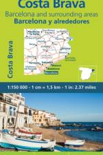
MICHELIN zoom map Zoom Barcelona & Costa Brava is the ideal travel companion to fully explore this tourist destination thanks to its easy-to-use format and its scale of 1/150,000. In addition to Michelin's clear and accurate mapping, MICHELIN Zoom map highlights all the leisure activities available, such as golf clubs and tourist trains. MICHELIN Zoom Maps also include star-rated scenic routes, tourist sights & attractions, as well as camping sites and hotels selected in the famous MICHELIN guides. Make the most of your stay with MICHELIN Zoom Maps!MICHELIN ZOOM MAPS are perfect to discover major tourist areas, with a high level of details in an easy to use format. They nicely complement our Michelin Guides and include: - Various leisure activities, such as water parks, tourist trains, horse racing, etc- Scenic routes and tourist sights crossed referenced with the famous Michelin's Green Guides- Camping sites information from Michelin's Camping Guides- Hotel information from the world famous MICHELIN Guides
The MICHELIN Bouches du Rhone, Var local map, scale 1/150,000 is the ideal companion to fully explore this northern part of France and provides star-rated Michelin tourist itineraries and attractions, as well as impressive 3D relief mapping. MICHELIN local maps are perfect for cyclist and outdoor enthusiasts with over 20 leisure symbols, extensive coverage of cycling paths and nature trails. With MICHELIN local maps, find more than just your way! - Impressive & realistic 3D relief mapping - Michelin selected itineraries and must-sees of the area - A clear and comprehensive key with 20 leisure symbols, as well as cycling paths and nature trails. - Star rated tourist sights and attractions cross referenced with the famous MICHELIN Green Guides. - Main cities plans and a comprehensive place name index
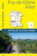
The MICHELIN Allier, Puy de Dome local map, scale 1/150,000 is the ideal companion to fully explore this northern part of France and provides star-rated Michelin tourist itineraries and attractions, as well as impressive 3D relief mapping. MICHELIN local maps are perfect for cyclist and outdoor enthusiasts with over 20 leisure symbols, extensive coverage of cycling paths and nature trails. With MICHELIN local maps, find more than just your way! - Impressive & realistic 3D relief mapping - Michelin selected itineraries and must-sees of the area - A clear and comprehensive key with 20 leisure symbols, as well as cycling paths and nature trails. - Star rated tourist sights and attractions cross referenced with the famous MICHELIN Green Guides. - Main cities plans and a comprehensive place name index
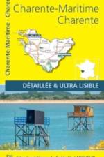
The MICHELIN Charente, Charente Maritime local map, scale 1/150,000 is the ideal companion to fully explore this northern part of France and provides star-rated Michelin tourist itineraries and attractions, as well as impressive 3D relief mapping. MICHELIN local maps are perfect for cyclist and outdoor enthusiasts with over 20 leisure symbols, extensive coverage of cycling paths and nature trails. With MICHELIN local maps, find more than just your way! - Impressive & realistic 3D relief mapping - Michelin selected itineraries and must-sees of the area - A clear and comprehensive key with 20 leisure symbols, as well as cycling paths and nature trails. - Star rated tourist sights and attractions cross referenced with the famous MICHELIN Green Guides. - Main cities plans and a comprehensive place name index
The MICHELIN Bas Rhin, Haut Rhin, Territoire de Belfort local map, scale 1/150,000 is the ideal companion to fully explore this northern part of France and provides star-rated Michelin tourist itineraries and attractions, as well as impressive 3D relief mapping. MICHELIN local maps are perfect for cyclist and outdoor enthusiasts with over 20 leisure symbols, extensive coverage of cycling paths and nature trails. With MICHELIN local maps, find more than just your way! - Impressive & realistic 3D relief mapping - Michelin selected itineraries and must-sees of the area - A clear and comprehensive key with 20 leisure symbols, as well as cycling paths and nature trails. - Star rated tourist sights and attractions cross referenced with the famous MICHELIN Green Guides. - Main cities plans and a comprehensive place name index
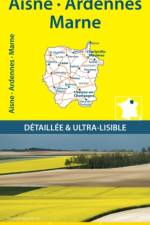
The MICHELIN Aisne, Ardennes, Marne local map, scale 1/150,000 is the ideal companion to fully explore this northern part of France and provides star-rated Michelin tourist itineraries and attractions, as well as impressive 3D relief mapping. MICHELIN local maps are perfect for cyclist and outdoor enthusiasts with over 20 leisure symbols, extensive coverage of cycling paths and nature trails. With MICHELIN local maps, find more than just your way! - Impressive & realistic 3D relief mapping - Michelin selected itineraries and must-sees of the area - A clear and comprehensive key with 20 leisure symbols, as well as cycling paths and nature trails. - Star rated tourist sights and attractions cross referenced with the famous MICHELIN Green Guides. - Main cities plans and a comprehensive place name index
Ride where the adventure never ends!Adventure is calling as a new snowmobile season arrives in snow country! The Maine 2023-2024 Snowmobile Trail Atlas includes over 14,000 miles of groomed and backcountry snowmobile trails created from over 100 individual maps to show the most up-to-date and accurate trails possible! Discover new routes, plan scenic day rides, and epic multi-day adventures with the 2023-2024 Maine Snowmobile Trail Atlas. Now, you can plan the adventure of a lifetime for you and your crew!Unforgettable Rides and ExperiencesThe map shows ITS trails, snowmobile club trails, and ungroomed trails where you can lay first tracks after a fresh snowfall! Also included on the map are scenic and awesome hot spots and side trips like the Abandoned Locomotives, B-52 Crash Site, and Coburn Mountain Summit (the highest elevation you can reach by snowmobile in Maine). Now, you can plan ahead to see scenic views and unique landmarks instead of discovering them out on the trail when you're out of time! Maine's three legendary loop trails, the Moose Loop, Katahdin Loop, and Black Fly Loop, are clearly marked on the map for those who enjoy touring scenic and dynamic terrain. The Winter 2023-2024 edition includes marked trailer parking locations and fuel stops!2023-2024 Maine Snowmobile Trail Atlas Includes: ITS Primary Corridor TrailsITS Secondary Connector TrailsSnowmobile Club TrailsUngroomed TrailsLake Crossing TrailsTrail Route Numbers and NamesMore Detailed MapsGas StationsParking LocationsParts and Repair LocationsSnowmobile Club InformationMaine's Legendary Loop Trails: Moose LoopKatahdin Loop TrailBlack Fly LoopHot Spots and Side Trips: Grand FallsAbandoned LocomotivesCoburn Mountain (the highest elevation you can reach by snowmobile in Maine)Moxie FallsB-52 Crash SiteLow's Covered BridgeScenic OverlooksMany more remote historic sites and natural landmarks!Terrain Features & Elevations***PLEASE NOTE***These maps are intended for trip planning purposes only and are not for navigation. Maine's snowmobile trail routes can change daily due to weather conditions, logging operations, landowner requests, etc.Contact local snowmobile clubs for the most updated information on trail routes and closures.
The Military Grid Reference System (MGRS) is the standard use by all NATO military forces to locate any point on Earth down to one meter locations. This is called a "geocode" - a unique identifier for any location or object that is short and can be fairly easily read by humans.The MGRS coordinate system is a vital part of land navigation and location coordination during operations. However, information online about the system is not particularly easy to understand. This book is intended to provide both a broad explanation of MGRS, but also deeper detail on elements of MGRS that are not immediately obvious. It also explains some practical uses to assist with land navigation, like calculating distances and azimuths.
An ideal gift for anyone with an intrigue for geographical curiosities.Defined as sovereign states with a very small population, land area, or both, microstates serve as fascinating case studies of geopolitical significance. This atlas explores the unique history, politics, and self-determination of the world's smallest states.
Sign up to our newsletter and receive discounts and inspiration for your next reading experience.
By signing up, you agree to our Privacy Policy.