


Join thousands of book lovers
Sign up to our newsletter and receive discounts and inspiration for your next reading experience.
By signing up, you agree to our Privacy Policy.You can, at any time, unsubscribe from our newsletters.
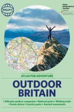
Ever wanted to explore Britain's finest National Parks, go surfing on the best beaches or follow the Pilgrims' Trail? Philip's RGS Outdoor Britain maps it all, from the majestic heights of the Scottish Highlands to the lush valleys of Wales and all the heritage and activities in between.
Whether you've always dreamed of skirting the US on a motorcycle, are looking to go coast-to-coast in an RV or simply want to roll down your car windows and plug into a classic playlist, Road Trips in the USA will give you all the inspiration you need for a road trip to remember.
A comprehensive alphabetically arranged list of Welsh place-names with their English meanings. New edition. First published in 1983; ISBN 9780000676504.
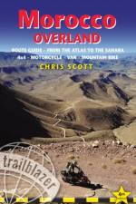
For the independently-mobile traveller the mountains and deserts of southern Morocco are a year-round destination offering a thrilling variety of experiences. Covering over 10000km from the High Atlas to the Mauritanian border, Morocco Overland features detailed GPS off-road routes for 4WDs, motorcycles and mountain bikes as well as scenic byways suitable for any vehicle.
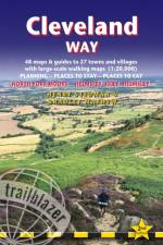
All-in-one hiking route guide, maps and accommodations for the 109-mile Cleveland Way, set in the North York Moors National Park. Includes 48 large-scale walking maps (3 1/8 inches to 1 mile); 8 town maps and 12 overview maps. Full details of all accommodations and campsites, restaurants and pubs; plus full public transport information. Includes day-walks.
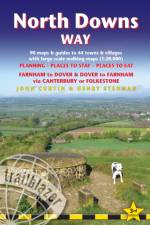
All-in-one hiking route guide, maps and accommodations for the 131mile North Downs Way, from Farnham to Dover via Canterbury. Includes 90 large-scale walking maps (3 1/8 inches to 1 mile); 15 town maps and 14 overview maps. Full details of all accommodations and campsites, restaurants and pubs; plus full public transport information. Includes day-walks.
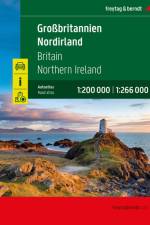
Der Autoatlas Großbritannien - Nordirland 1:200.000 - 1:266.000 ist der ideale Begleiter für alle, die mit dem Auto unterwegs sind und dabei nicht nur die Hauptstraßen und Autobahnen nutzen möchten. Er ist ideal für die Planung und erweist sich auch während der Reise als unverzichtbare Orientierungshilfe. Mit dem detaillierten Kartenbild und dem genauen Maßstab lassen sich auch weniger befahrene Nebenstraßen entdecken, die in Übersichtskarten meist gar nicht eingezeichnet sind. Informationen zum Straßenatlas Großbritannien - Nordirland Großbritannien - Nordirland 1:200.000 - 1:266.000 Spiralbindung Camping- und Stellplätze Touristische Informationen Ortsregister 64 Innenstadtpläne 328 Seiten, Format 22,5 x 30 cm Der ideale Autoatlas für Großbritannien und Nordirland Das dichte Straßennetz ist exakt abgebildet und viele Ausflugsziele sind in der Karte eingezeichnet. Auto- und Motorradfahrer schätzen die exakte Kartographie besonders für die Planung und Orientierung vor Ort. Damit die Reise auch mit Wohnmobil, Wohnwagen oder Camper gut planbar ist, sind alle Camping- und Stellplätze im Atlas eingezeichnet. Spiralbindung Der Autoatlas Großbritannien und Nordirland ist besonders komfortabel in der Handhabung da er sich durch die Spiralbindung bequem aufklappen lässt. So bleibt die gewünschte Seite auch während der Fahrt immer geöffnet. Innenstadtpläne Mit den 64 enthaltenen Cityplänen kann man sich in den Städten gut orientieren, darunter etwa Liverpool, London, Manchester, Bristol und Edinburgh.
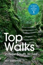
Discover 66 great bushwalking tracks across New South Wales state in Australia, in this handy guide.
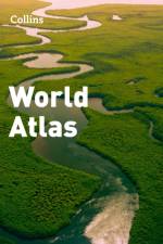
Eighth edition of this popular atlas from the prestigious and authoritative Times Atlas range. Latest satellite images and fascinating historical maps. This world atlas contains the breadth, scale and detail to make it an ideal reference resource for school, home and business.
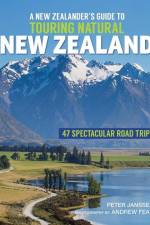
Catering for the 'new' wave of tourists - New Zealanders actually holidaying in New Zealand! Wild coasts, jaw-dropping cliffs and caves, tranquil bays, thermal hotspots, towering alps, primeval forests, lakes and braided rivers, offshore islands...New Zealand's wonders are top of anyone's must-see list. This magnificent touring guide dedicated to natural attractions is structured geographically around itineraries - 22 in the North Island and 25 in the South - each of which takes in several sites within one area, describing their natural beauty and listing a few good short walks or detours that show off the scenery at its best. The itineraries are flexible, allowing the reader to simply follow the book or use it as back-up for more personalised touring plans. The text is supported by route instructions, detailed maps, illustrated panels on notable plants and animals, and stunning images from Andrew Fear.
The Ninth Edition of the Oxford & Grand Union Canal Companion has been extended to an unprecedented 176 pages.
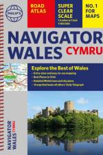
Explore the many attractions of Wales with this easy-to-use road atlas showing all the top spots. Easy-to-read mapping, superb extra detail, and a great lie-flat format make this the ultimate Welsh road trip companion.
A beautiful gift for the adventurers in your family.A new, fully updated edition of this bestselling atlas of the world. Great value and contains all the world maps you need in a budget atlas, for family, study and business use.
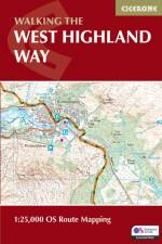
This compact booklet of maps shows the full route of the 95 mile West Highland Way Scottish Long Distance Route, via Loch Lomond and Rannoch Moor. This booklet is included with the Cicerone guidebook to the trail, and shows the full route on Ordnance Survey 1:25,000 maps.
Sign up to our newsletter and receive discounts and inspiration for your next reading experience.
By signing up, you agree to our Privacy Policy.