


Join thousands of book lovers
Sign up to our newsletter and receive discounts and inspiration for your next reading experience.
By signing up, you agree to our Privacy Policy.You can, at any time, unsubscribe from our newsletters.
Re-envisioning Remote Sensing Applications: Perspectives from Developing Countries aims at discussing varied applications of remote sensing, with respect to upcoming technologies with diverse themes. Organized into four sections of overlapping areas of research, the book covers chapters with themes related to agriculture, soil and land degradation studies; hydrology, microclimates and climate change impacts; land use/land cover analysis applications; resource analysis and bibliometric studies, culminating with future research agenda. All the topics are supported via case studies and spatial data analysis. Features:Provides the applications of remote sensing in all fields through varied case studies and spatial data analysis Includes soil and land degradation, microclimates, and climate change impactsCovers remote sensing applications in broad areas of agriculture, hydrology, land use/land cover change and resource analysis Discusses usage of GPS-enabled smartphones and digital gadgets used for mapping and spatial analysisExplores future research agenda for applications of remote sensing in post-COVID scenarioThis book is of interest to researchers and graduate students in environmental sciences, remote sensing, GIS, agricultural scientists and managers, forestry scientists and managers, and water resources scientists and managers.
The concept of mental maps is used in several disciplines including geography, psychology, history, linguistics, economics, anthropology, political science, and computer game design. However, until now, there has been little communication between these disciplines and methodological schools involved in mental mapping.Mental Maps: Geographical and Historical Perspectives addresses this situation by bringing together scholars from some of the related fields. Ute Schneider examines the development of German geographer Heinrich Schiffers' mental maps, using his books on Africa from the 1930s to the 1970s. Efrat Ben-Ze'ev and Chloé Yvroux investigate conceptions of Israel and Palestine, particularly the West Bank, held by French and Israeli students. By superimposing large numbers of sketch maps, Clarisse Didelon-Loiseau, Sophie de Ruffray, and Nicolas Lambert identify "soft" and "hard" macro-regions on the mental maps of geography students across the world. Janne Holmén investigates whether the Baltic and the Mediterranean Seas are seen as links or divisions between the countries that line their shores, according to the mental maps of high school seniors. Similarly, Dario Musolino maps regional preferences of Italian entrepreneurs. Finally, Lars-Erik Edlund offers an essayistic account of mental mapping, based on memories of maps in his own family.This edited volume book uses printed maps, survey data and hand drawn maps as sources, contributing to the study of human perception of space from the perspectives of different disciplines.The chapters in this book were originally published as a special issue of the Journal of Cultural Geography.
All information has been checked and updated in the new edition of this trusty camping guide.
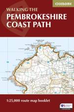
A booklet of all the mapping needed to walk the Pembrokeshire Coast Path National Trail between Amroth near Tenby and St Dogmaels by Cardigan. Covering 290km (180 miles) and over 10,500m of ascent, this trail takes around 2 weeks to complete. The full route is shown on 1:25,000 OS maps The map booklet can be used to walk the trail in either direction Sized to easily fit in a jacket pocket or rucksack The relevant extract from the OS Explorer map legend is included High tide and military range closure alternate routes are provided An accompanying Cicerone guidebook - Walking the Pembrokeshire Coast Path is also available, which includes a copy of this map booklet
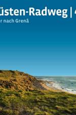
Kilometerlange Sandstrände ziehen sich bis zum Horizont, weite heidebewachsene Dünenfelder fließen in sanften Wellen um Sie herum, märchenhaft-romantische Wälder - an Ronja Räubertochter erinnernd - umgarnen Sie, hohe Sanddünen wandern durch Ihr Blickfeld und weißschillernde Möwen segeln durch die Lüfte über Ihnen. Auf den über 800 Radkilometern durch die vielgestaltige dänische Küstenlandschaft von Nordsee, Skagerrak und Kattegat genießen Sie mal ungebändigte, mal liebliche Natur und lassen sich stets eine erfrischende Meeresbrise um die Nase wehen. Außerodentliche Naturerlebnisse prägen die Reise, doch auf Kultur muss keineswegs verzichtet werden. Das Stadtbild des ehemaligen Bischofssitzes Ribe wird Sie begeistern, Esbjerg zeigt sich als moderne Hafenstadt und Frederikshavn präsentiert sich als pulsierendes Zentrum des Nordens. Obendrein laden zahlreiche kleine Städtchen und verträumte Fischerdörfer zur Rast und zur Stärkung mit frischem Fisch ein. Und selbstverständlich darf auch ein Bad an einem der vielen traumhaften Strände inmitten der mannigfaltigen Vogelwelt nicht fehlen.
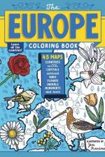
Learn the borders and national symbols of all the nations that make up Europe in this comprehensive coloring book.
Sign up to our newsletter and receive discounts and inspiration for your next reading experience.
By signing up, you agree to our Privacy Policy.