


Join thousands of book lovers
Sign up to our newsletter and receive discounts and inspiration for your next reading experience.
By signing up, you agree to our Privacy Policy.You can, at any time, unsubscribe from our newsletters.
"A spellbinding tour, filled with stories and photographs, of some of the world s most fascinating architectural mysteries."--
ITMB is pleased to introduce this new map, using our own artwork, for Madrid, covering essentially all the area within the circular ring road motorway. All the streets are named and included in a place names index. Parks, touristic attractions, hotels, shopping areas, churches, mosques, restaurants, pubs, transit lines its all there. Coverage is from the railway station in the south to the university in the north and from the Parque del Oeste in the west to the bull fighting ring in the east. The reverse side is a detailed regional map for the Castilla La Mancha province to the south of Madrid, with Toledo, Albacete, Murcia, and Cordoba. All roads and parks are shown, as well as major touristic attractions.
Falset kort i målestokken 1:500.000 over staterne New York, Vermont, New Hampshire, Massachusetts, Connecticut, Rhode Islands samt dele af Ontario, Maine New Jersey samt Pennsylvania. Med register påtrykt bagsiden.
From the deep forests of the Canadian Northwest to the red-rock deserts of the American Southwest, North America offers a myriad of opportunities for hiking, camping, trekking, and simply enjoying the abundance of the natural world. This opulent volume highlights 41 of those wilderness locations.Filled with authoritative maps, data-driven graphics, awe-inspiring photographs, and thoughtful essays, this vivid book will feed the soul of everyone who loves wild places. Six lush chapters take readers from the eastern woodlands to the central plains, from the northern wilderness to southwestern desert lands—including key wilderness areas in Canada and Mexico. You’ll discover the fascinating history of the High Peaks of the Adirondacks, learn about fossil remains on the Upper Missouri River, gaze through the rainforest canopy of Alaska’s Tongass National Forest, and experience Grand Canyon Parashat’s Dark Sky Park. A special section rich in maps and graphics highlights 13 thematic topics, such as the National Scenic Trail System and the human impact on wilderness areas.This beautiful book, bursting with information and lyricism, will inspire all who have journeyed into the wild—and intrigue many who still hope to do so.
Philip's created this new series for walkers, cyclists and local explorers at a scale that provides greener options to uncover all the nature and hidden gems in your local area. From Barnstaple to Totnes, we cover Devon in enticing detail.
This book introduces the use of various remote sensing data such as microwave, hyperspectral and very high-resolution (VHR) satellite imagery; mapping techniques including pixel and object-based machine learning; and geostatistical modelling techniques including cellular automation, entropy and land fragmentation. Remote sensing plays a vital role in solving urban and environmental challenges at the landscape level. Globally, more than half of the urban population is facing severe environmental and social challenges, especially those relating to climate change, agricultural land encroachment, green infrastructure and environmental degradation, mobility due to rapid rural¿urban transformation and anthropogenic interventions. Mapping and quantification of such threats at the landscape level are challenging for experts using traditional techniques; however, remote sensing technology provides diverse spatial data at a varying scale, volume and accessibility for mapping and modelling, and it also analyses challenges at urban and landscape levels.Together, they address challenges at urban and landscape levels to support the Sustainable Development Goals (SDGs).
Perfect for professional drivers to use whilst on the road and when planning routes, this large format A3 atlas has a clear 3 miles to 1 inch scale and included over 3,600 bridge height restrictions clearly located, 23 port plans and clear route planner map and Network Rail's #wiseupsizeup campaign with information on how to prevent bridge strikes.
This book brings together ten empirically rich and theoretically informed contributions that aim to clarify both geo-historical specificities and common transnational and global features of the cultures and practices of boundary making that shaped modern statehood. Written by scholars from Spain, France, Italy, Argentina, Brazil and Mexico, the essays included in this volume provide a comparative international perspective on the processes of border formation, as well as an integrative approach that seeks to strengthen the links between renewed geo-historical studies and more contemporary-oriented border studies. The book is addressed to a wide range of researchers, including geographers, historians, political scientists and specialists in geopolitics and the history of international relations.
This book covers all aspects of inertial navigation systems (INS), including the sensor technology and the estimation of instrument errors, as well as their integration with Global Navigation Satellite Systems, specifically the Global Positioning System (GPS) for geodetic applications. The text is of interest to geodesists, including surveyors, mappers, and photogrammetrists; to engineers in aviation, navigation, guidance, transportation, and robotics; and to scientists involved in aerogeophysics and remote sensing. The most recent developments are covered with this second edition that also features an updated treatment of the classical material. Detailed mathematical derivations of the principles of measurement and data processing of inertial measurement units for both stabilized and strapdown systems. Complete treatment of the error dynamics from a statistical viewpoint, including the Kalman filter. A self-contained description of GPS with emphasis on kinematic applications. Key concepts supported by illustrations and numerical examples.
Navigate your way around Great Britain with this detailed and easy-to-use A-Z Road Atlas
Navigate your way around Great Britain with this detailed and easy-to-use A-Z Road Atlas
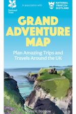
A full-size folding map with every National Trust and National Trust for Scotland place markedPacked with practical information and quirky triviaBeautiful illustrationsFeatures the `National Trust 80¿, a dream route around the UK
Navigate your way around Great Britain with this detailed and easy-to-use A-Z Road Atlas
Navigate your way around Great Britain with this detailed and easy-to-use A-Z Road Atlas
Der internationale Radfernweg Berlin - Kopenhagen bietet genau die Mischung von Kultur und Natur, die das Herz eines jeden Radreisetouristen höher schlagen lässt. Nach dem glanzvollen Auftakt der Tour in Berlin hat man viel Zeit, die Seele baumeln zu lassen und die Natur zu genießen. In Brandenburg und Mecklenburg-Vorpommern säumen Schlösser, Herrenhäuser und Klöster den Radweg. Die Seen laden zu einer Bootspartie und zum Baden ein. Nach der Fährfahrt vom Überseehafen Rostock erwarten Sie die kontrastreiche dänische Ostseeküstenlandschaft, schroffe und bizarre Küstenabschnitte gehen in weiße Sandstrände über. Kulturelles gibt es auch hier zu entdecken, idyllische Dörfer, Burgen, Schlösser und Großsteingräber. Ziel des Radfernweges ist die dänische Hauptstadt mit ihrem weltoffenen Flair und ihrem lebendigen Stadtleben - viel Spaß!
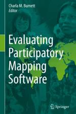
This volume provides a framework for evaluating geospatial software for participatory mapping. The evaluation is based on ten key indicators: ethics, cost, technical level, inclusiveness, data accuracy, data privacy, analytical capacity, visualization capacity, openness, and accessibility (i.e., mobile friendly or offline capabilities). Each application is evaluated by a user and cross analyzed with specific case studies of the software¿s real-world application. This framework does not discriminate against assessing volunteered geographic information (VGI) applications, as a form of participatory mapping, in circumstances that its application is spearheaded by underrepresented groups with the intent to empower and spark political or behavioral change within formal and informal institutions. Each chapter follows a strict template to ensure that the information within the volume can be updated periodically to match the ever-changing technological environment. The book covers ten different mapping applications with the goal of creating a comparative evaluation framework that can be easily interpreted by convening institutions and novice users. This will also help identify gaps in software for participatory mapping which will help to inform application development in the future and updates to current geospatial software.
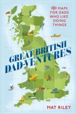
When you're stuck for a great gift for Dad, look no further than GREAT BRITISH DAD-VENTURES: the ultimate guide to helping Dad discover adrenaline-inducing, mind-expanding or stomach-pleasing mini or big adventures around the British Isles - and families of all ages can join in the fun too!Using maps of all the Scottish and English counties and the Welsh principal areas, the book pinpoints almost 1,000 destinations and activities, including plenty of free and baby-friendly options (and a few that are for Dad's friends only). Whether he's looking for something interesting to do nearby at the weekend or heading off on holiday around our vast and varied British Isles, GREAT BRITISH DAD-VENTURES has all the inspiration Dad needs to get off his screen and do something exciting. Activities include: - walks, hikes, cycling and mountain biking - castles and museums - watersports, wild swimming and boat trips - nature reserves and safari parks - orienteering and bushcraft experiences - scenic driving routes and walking tours - climbing, coasteering and gorge walking - brewery and vineyard tours - and plenty of activities that are unique to the local areas.
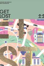
From iconic landmarks to hidden shortcuts, GET LOST! takes your eyes on a journey and allows readers to explore the lands through the eyes of Illustrators. Before GPS systems and Google Maps were invented, folded paper maps and guidebooks were always our trusty companions while on the road. While paper maps are becoming increasingly obsolete, there's more to cartography than just bearings and scales. Illustrated maps hone the ability to bring a place to life through vivid drawings, leaving a unique impression filled with the illustrator's own experiences. GET LOST! boasts four different jacket designs, featuring city maps of London, Paris, Los Angeles or Singapore. Orders will be fulfilled at random from evenly mixed cartons.
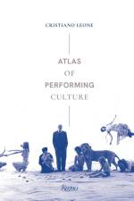
Through examining more than 120 organizations on a global scale, this work shows how almost every human expression involves performing culture.Atlas of Performing Culture is an illustrated voyage across five continents—Asia, Africa, Europe, Oceania, and the Americas—involving the study of venues and events related to performance, the dynamic and unrepeatable mode of artistic activity capable of uniting the audience—who becomes the protagonist—with artists and works of art, architecture, and nature.The volume is organized around five thematic sections related to the physical spaces, venues, and typologies of events. The unique experience of performing art can involve an island museum in Japan, the Rio Carnival, a Brussels theatrical debut, a rave party in the British countryside, and a cultural center housed in a former funeral home in the outskirts of Paris. Alongside theaters, concert halls, and festivals, we also find museums, sculpture parks, and hybrid cultural centers that elude any attempt of cataloging.By breaking down the traditional frontiers between performance art, visual art, and performing arts, this volume takes the reader—whether specialist, practitioner, academic, or simply art aficionado—on a journey to some of the main cultural sites and performative experiences around the world. Each section offers a specific overview into leading cultural organizations, as well as a selection of similar international institutions.
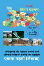
Hello everyone, Bihar Atlas book is very important for the Bihar Public Service Commission (BPSC) and all other competitive exams of Bihar. This book is based on the map, which will make it easier for the candidates to read and understand.
A father-and-son designed activity book full of games and puzzles that teaches you about cities, countries and more. Great for children and adults alike.
"This is the first English-language monograph on the early history of cartography in China. Its chief players are three maps found in tombs that date from the fourth to the second century BCE and together constitute the entire known corpus of ancient Chinese maps (ditu). A millennium separates them from the next available map from 1136 CE. Most scholars study them through the lens of modern, empirical definitions of maps and their use. This book offers an alternative view by drawing on methods not just from cartography but from art history, archaeology, and religion. It argues that, as tomb objects, the maps were designed to be simultaneously functional for the living and the dead-that each map was drawn to serve navigational purposes of guiding the living from one town to another as well as to diagram ritual order, thereby taming the unknown territory of the dead. In contrast with traditional scholarship, The Art of Terrestrial Diagrams in Early China proposes that ditu can "speak" through their forms. Departing from dominant theories of representation that forge a narrow path from form to meaning, the book braids together two main strands of argumentation to explore the multifaceted and multifunctional diagrammatic tradition of rendering space in early China"--
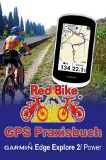
Der Edge + Du = Echte FreundeGlaubst Du nicht? Dann ist dieses Buch genau das Richtige für Dich.Locker und einfach beginnen wir die Bedienung und Einstellungen des Edge Explore 2 in seiner Funktion als Fahrrad-"Tacho" zu entdecken sowie zusätzliche Anwendungen bei einer bestehenden Verbindung zum Smartphone zu nutzen.Mit dem Thema zur Navigation beschäftigen wir uns in einem separaten Kapitel. Darin zeige ich Dir mit welchen Einstellungen diese im Edge angewandt wird. Touren auf die Schnelle am Handy suchen und zum Edge senden? Das und vieles mehr wird Dir als GPS-Einsteiger leicht verständlich erklärt. Eine umfangreiche Bebilderung zeigt stets wie es in der Praxis aussehen sollte.Natürlich sehen wir uns auch die detaillierte Tourenplanung am PC sowie die Möglichkeiten zur Auswertung, Verwaltung und Nachbearbeitung Deiner aufgezeichneten GPS- und Fitnessdaten an. Am Ende wirst Du ihn mögen - Deinen Edge Explore 2(PC-Anleitung für Windows-Nutzer bestens geeignet, Mac mit Abweichungen)
The Ultimate Campers' Guide to RV Parks & Campgrounds in the USA is the new age handbook for campers, nature enthusiasts, and anyone who wants to explore RV Parks across the US. This user friendly handbook has very useful information arranged by indexes and look-up charts. It is listed by State and each listing includes: a State map that illustrates the RV Parks and Campgrounds spread in that region, and a listing of the RV Parks for each US states under 4 indexes - Profile index, Amenities index, Activity index, and Rental index. The guide also has an overview section that provides insight into the RV Parks industry in the US, recent camping trends and redefined lifestyles of specific groups of the US population.
The basis of this proposal is the study of quality of life from an interdisciplinary perspective. This volume presents a set of contributions from different sciences that analyse the quality of life in Argentina. The contributions come from the social disciplines (Geography, Economics, Demography, History) and from the field of health (Nutrition, Medicine, Psychology) as well as the applied sciences (Statistics, Applied Mathematics). The purpose is to present various dimensions related to the well-being of the population, particularly in relation to poverty, human development, health, nutrition and morbidity. Although there are works from different sciences associated with the object of study, they all have a geographic component based on cartography. Consequently, the importance of geography is highlighted, as the territorial base allows for the study quality of life from a unique perspective where the map emerges as a fundamental descriptive tool. Such an approach is useful to diagnose the quality of life and its uneven spatial distribution, either through index or different associated variables. Thus, the maps are fundamental to study the territorial configuration of the quality of life at the different scales of analysis, showing spatial inequalities and the areas where it is necessary to take measures to improve the population's living conditions.
Sign up to our newsletter and receive discounts and inspiration for your next reading experience.
By signing up, you agree to our Privacy Policy.