


Join thousands of book lovers
Sign up to our newsletter and receive discounts and inspiration for your next reading experience.
By signing up, you agree to our Privacy Policy.You can, at any time, unsubscribe from our newsletters.
This book describes and illustrates 80 of the larger, more conspicuous and charismatic tree species likely to be seen while travelling in the Kruger National Park. With the aim of assisting readers to make accurate identifications of these majestic plants, each spread contains photographs and succinct text with minimal botanical jargon.
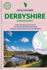
Philip's created this new series for walkers, cyclists and local explorers at a scale that provides greener options to uncover all the nature and hidden gems in your local area. From Buxton to Swadlincote, we cover Derbyshire and the Peaks in enticing detail.
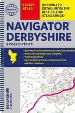
The only county Street Atlas with all the named streets of Derbyshire and the Peak District and perfect back-up for emergency services, delivery drivers, visitors and locals.
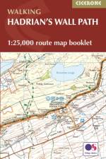
Map of the 84 mile (135km) Hadrian's Wall Path National Trail, from Bowness-on-Solway to Wallsend, Newcastle. This booklet is included with the Cicerone guidebook to the trail, and shows the full route on OS 1:25,000 maps. The trail typically takes a week to walk, and is suitable for walkers at all levels of experience.
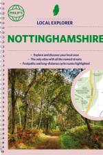
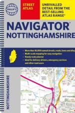
Philip's created this new series for walkers, cyclists and local explorers at a scale that provides greener options to uncover all the nature and hidden gems in your local area. From Beeston to Tickwell, we cover Nottinghamshire in enticing detail.
The only county Street Atlas with all the named streets of Nottinghamshire and perfect back-up for emergency services, delivery drivers, visitors and locals.
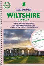
Philip's created this new series for walkers, cyclists and local explorers at a scale that provides greener options to uncover all the nature and hidden gems in your local area. From Chippenham to Wilton, we cover Wiltshire and Swindon in enticing detail.
The only county Street Atlas with all the named streets of Wiltshire and Swindon and perfect back-up for emergency services, delivery drivers, visitors and locals.
Das Elsass ist nicht nur ein Schlaraffenland für Feinschmecker und Weinkenner - auch landschaftlich ist diese Region äußerst vielfältig und bietet für jeden Radler eine geeignete Tour. Im Radatlas Elsass finden Sie eine Auswahl von über 1.500¿Kilometern zuverlässig beschriebener Radtouren, die ein grenzenloses Radvergnügen im gesamten Elsass versprechen. Für Familien mit Kindern sind die einstigen Treidelwege entlang der Kanäle bestens geeignet. Naturaffine Radfahrer können sich an den Touren durch die Au- und Seengebiete erfreuen.Sportliche Radfahrer werden bei Bergtouren in den Vogesen gefordert und Genießer lockt eine genüssliche Rundfahrt durch die romantischen Winzerdörfer entlang der malerischen elsässischen Weinstraße. Auf kulturell Interessierte warten Strasbourg, das sich als Hauptstadt Europas versteht, die zweisprachige Stadt Mulhouse mit ihren Technik-Museen und die für ihr gut erhaltenes architektonisches Erbe aus sechs Jahrhunderten bekannte Stadt Colmar.
This book contains the best peer-reviewed papers accepted for presentation at the 2nd Springer Conference of the Arabian Journal of Geosciences (CAJG-2), organized in Sousse, Tunisia, in November 2019. The short papers cover various topics from the fields of (1) geological and geotechnical engineering, (2) geomechanical studies based on numerical and analytical methods, and (3) geo-informatics and remote sensing. The content of these papers provides new scientific knowledge for further understanding on landslides, new stabilization techniques, importance of geophysics for engineering geology investigations as well as new empirical approaches for easily predicting some physical and hydrogeomechanical properties of geomaterials. The book is of interest to all researchers, practitioners, and students in the fields of geological and mining engineering, geotechnical engineering, hydrogeomechanics, engineering geology, geotechnologies, and natural hazards.
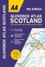
A5 Atlas of Scotland with an easy to read 4 mile to 1 inch scale with up-to-date mapping. Including Historic Scotland, National Trust sites and Ireland mapping. Scenic routes and touring information are shown along with top AA-inspected caravan & camping sites, AA listed golf courses, town plans of central Edinburgh and Glasgow.
Illustrated stories of far-flung lighthouses which transport the reader to the some of the most remote places on earth.
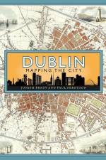
Maps are essential tools in finding our way around, but they also tell stories and are great depositories of information. Through a carefully chosen selection of maps, the book traces the growth and development of Dublin from the early seventeenth century to the present day, offering a fascinating snap-shot of how the city has changed over time.
First published to critical acclaim in 2006, enlarged and revised editions of the London Rail Atlas followed, the most recent being in 2018. This latest fully revised sixth edition reflects the dynamic and evolving railway network in the capital and will include additions such as the Elizabeth Line finally due to open in 2022 after many delays, and the Battersea Power Station extension of the Northern Line which opened in 2021.The Atlas presents detailed mapping of all the lines which traverse the city, including those of London Underground, the DLR and Network Rail. Each map also illustrates the geographical relationship between overground and underground lines. The maps on the large format pages show all tracks and platforms. London Rail Atlas features all the lines in the capital, both open and closed, stations, changes of station name and station opening and closing dates.The maps are drawn to a high degree of accuracy and include detail on industrial railways. The coverage reaches beyond London to include places such as Tilbury, Gravesend, Windsor and Redhill. In addition to the wealth of information, the Atlas is a superb achievement in terms of the clarity of its cartography. As a reviewer in Railway Magazine wrote of a previous edition, 'the maps are akin to works of art, so detailed and finely drawn are they'.
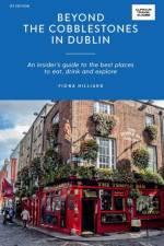
The perfect guide for locals and visitors alike, discover the best of Dublin's cosy pubs through to sustainable design boutiques and buzzing nightlife.
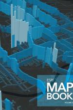
Every year, works of mapmakers from around the world are selected for the Esri Map Book to demonstrate how geographic information system (GIS) technology helps our governments, businesses, and citizens. Esri Map Book, Volume 38, continues this tradition, showcasing maps and applications that use Esri's ArcGIS technology to evaluate the sustainability of resources, determine efficient transportation routes, mitigate the effects of natural disasters, and much more. Each map or application includes a description of its purpose and how it was produced. Esri Map Book, Volume 38, is an important collection of maps for GIS users, cartographers, collectors, and map libraries.
Welcome to the ultimate travel guide to your most-loved shows and movies! Meticulously researched and compiled by superfans and travel experts, THE SCREEN TRAVELLER'S GUIDE is a gloriously geeky compendium, filled with travel inspirations and clever maps of real-life locations behind dozens of pop-culture cornerstones.
An insider's guide to the best places to eat, drink and explore in Washington, DC
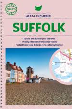
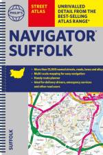
Philip's created this new series for walkers, cyclists and local explorers at a scale that provides greener options to uncover all the nature and hidden gems in your local area. From Bury St Edmunds to Woodbridge, we cover Suffolk in enticing detail.
The only county Street Atlas with all the named streets of Suffolk and perfect back-up for emergency services, delivery drivers, visitors and locals.
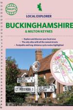
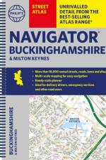
Philip's created this new series for walkers, cyclists and local explorers at a scale that provides greener options to uncover all the nature and hidden gems in your local area. From Aylesbury to Wolverton, we cover Buckinghamshire in enticing detail.
The only county Street Atlas with all the named streets of Buckinghamshire and Milton Keynes and perfect back-up for emergency services, delivery drivers, visitors and locals.
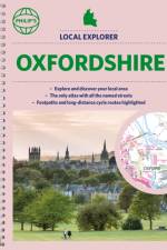
Philip's created this new series for walkers, cyclists and local explorers at a scale that provides greener options to uncover all the nature and hidden gems in your local area. From Abingdon-on-Thames to Wootton, we cover Oxfordshire in enticing detail.
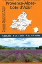
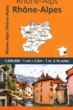
MICHELIN Regional Map scale 1/200,000 will provide you with an extensive coverage of primary, secondary and scenic routes for this French region. In addition to Michelin's clear and accurate mapping, this regional map includes all the practical information for a trouble free journey, including major town plans as well as tourism information and camping sites to make the most of your journey. With MICHELIN Regional Maps, find more than just your way!MICHELIN REGIONAL MAPS include practical information for a trouble free journey and show primary & secondary road networks. - Administrative boundaries - Scenic routes and tourist sights - Place name index - Time and distance charts - Plans for a selection of major towns - Practical information: danger alerts, service stations, picnic areas
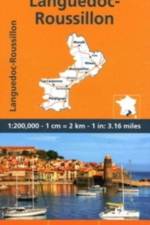
MICHELIN Regional Map scale 1/200,000 will provide you with an extensive coverage of primary, secondary and scenic routes for this French region. In addition to Michelin's clear and accurate mapping, this regional map includes all the practical information for a trouble free journey, including major town plans as well as tourism information and camping sites to make the most of your journey. With MICHELIN Regional Maps, find more than just your way!MICHELIN REGIONAL MAPS include practical information for a trouble free journey and show primary & secondary road networks. - Administrative boundaries - Scenic routes and tourist sights - Place name index - Time and distance charts - Plans for a selection of major towns - Practical information: danger alerts, service stations, picnic areas
MICHELIN Regional Map scale 1/200,000 will provide you with an extensive coverage of primary, secondary and scenic routes for this French region. In addition to Michelin's clear and accurate mapping, this regional map includes all the practical information for a trouble free journey, including major town plans as well as tourism information and camping sites to make the most of your journey. With MICHELIN Regional Maps, find more than just your way!MICHELIN REGIONAL MAPS include practical information for a trouble free journey and show primary & secondary road networks. - Administrative boundaries - Scenic routes and tourist sights - Place name index - Time and distance charts - Plans for a selection of major towns - Practical information: danger alerts, service stations, picnic areas
Sign up to our newsletter and receive discounts and inspiration for your next reading experience.
By signing up, you agree to our Privacy Policy.