


Join thousands of book lovers
Sign up to our newsletter and receive discounts and inspiration for your next reading experience.
By signing up, you agree to our Privacy Policy.You can, at any time, unsubscribe from our newsletters.
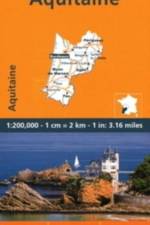
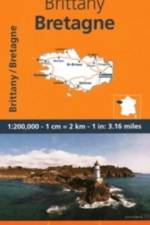
MICHELIN Regional Map scale 1/200,000 will provide you with an extensive coverage of primary, secondary and scenic routes for this French region. In addition to Michelin's clear and accurate mapping, this regional map includes all the practical information for a trouble free journey, including major town plans as well as tourism information and camping sites to make the most of your journey. With MICHELIN Regional Maps, find more than just your way!MICHELIN REGIONAL MAPS include practical information for a trouble free journey and show primary & secondary road networks. - Administrative boundaries - Scenic routes and tourist sights - Place name index - Time and distance charts - Plans for a selection of major towns - Practical information: danger alerts, service stations, picnic areas
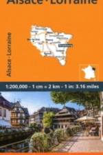
MICHELIN Regional Map scale 1/200,000 will provide you with an extensive coverage of primary, secondary and scenic routes for this French region. In addition to Michelin's clear and accurate mapping, this regional map includes all the practical information for a trouble free journey, including major town plans as well as tourism information and camping sites to make the most of your journey. With MICHELIN Regional Maps, find more than just your way!MICHELIN REGIONAL MAPS include practical information for a trouble free journey and show primary & secondary road networks. - Administrative boundaries - Scenic routes and tourist sights - Place name index - Time and distance charts - Plans for a selection of major towns - Practical information: danger alerts, service stations, picnic areas
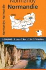
MICHELIN Regional Map scale 1/200,000 will provide you with an extensive coverage of primary, secondary and scenic routes for this French region. In addition to Michelin's clear and accurate mapping, this regional map includes all the practical information for a trouble free journey, including major town plans as well as tourism information and camping sites to make the most of your journey. With MICHELIN Regional Maps, find more than just your way!MICHELIN REGIONAL MAPS include practical information for a trouble free journey and show primary & secondary road networks. - Administrative boundaries - Scenic routes and tourist sights - Place name index - Time and distance charts - Plans for a selection of major towns - Practical information: danger alerts, service stations, picnic areas
MICHELIN Regional Map scale 1/200,000 will provide you with an extensive coverage of primary, secondary and scenic routes for this French region. In addition to Michelin's clear and accurate mapping, this regional map includes all the practical information for a trouble free journey, including major town plans as well as tourism information and camping sites to make the most of your journey. With MICHELIN Regional Maps, find more than just your way!MICHELIN REGIONAL MAPS include practical information for a trouble free journey and show primary & secondary road networks. - Administrative boundaries - Scenic routes and tourist sights - Place name index - Time and distance charts - Plans for a selection of major towns - Practical information: danger alerts, service stations, picnic areas
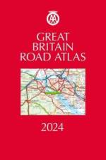
Fully revised and updated for 2024 and with up-to-date mapping from the experts at the AA, this A4 road atlas showcasing Britain's clearest mapping at 3.2 miles to 1 inch. Large 3.2 miles to 1 inch scale in a luxurious leather binding. Features include top 300 AA-inspected caravan and camping sites and over 1,800 golf courses.
Handy, flexibound glovebox sized road atlas, combining large-scale mapping at 4 miles to 1 inch in an easy-to-carry A5 format. Up-to-date mapping from the experts at the AA, revised and updated for 2024 Features include top 300 AA-inspected caravan and camping sites, over 240 service areas and National Trust and Heritage sites.
In the Artist's Journey, follow in the footsteps of some of the world's most famous painters, and the journeys which inspired some of their greatest works.
This book, with contributions from leading academics - and including reviews and case studies from Ethiopian Church forests - provides a valuable reference for advanced students and researchers interested in forest and other natural resource management, ecology and ecosystem services as well as restoration options. The book addresses various aspects including a general overview of Ethiopian church forests, the present role and future challenges of church forests. It also discusses their structure and diversity in the context of sustainability and discusses restoration options for surrounding landscapes, under consideration of the circumstances of the land and the needs of surrounding communities. The intended readership includes natural resource professionals in general as well as forestry professionals in particular (practitioners, policymakers, educators and researchers). The book will provide the reader with a good foundation for understanding Ethiopian forest resources and restoration options of degraded landscape.
Sign up to our newsletter and receive discounts and inspiration for your next reading experience.
By signing up, you agree to our Privacy Policy.