


Join thousands of book lovers
Sign up to our newsletter and receive discounts and inspiration for your next reading experience.
By signing up, you agree to our Privacy Policy.You can, at any time, unsubscribe from our newsletters.
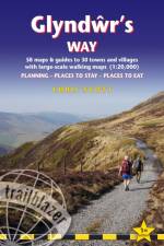
All-in-one hiking route guide, maps and accommodations for the 135-mile Glyndwr's Way, in Wales. Includes 58 large-scale walking maps (1:20,000 or 3 1/8 inches to 1 mile); 10 town maps and 10 overview maps. Full details of all accommodations and campsites, restaurants and pubs; plus full public transport information. Includes day-walks.
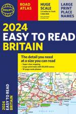
Introducing '2024 Philip's Easy to Read Britain Road Atlas' by renowned cartographer, Philip's Maps. This comprehensive atlas, published by the Octopus Publishing Group in 2023, is your perfect companion for navigating the highways and byways of Britain. The genre of this book is travel and geography, providing detailed and easy-to-read maps of the entire UK. The author, Philip's Maps, is renowned for their precision and attention to detail, making this atlas a must-have for any traveller. The publication year, 2023, ensures that the content is up to date, reflecting any recent changes in road layouts or new points of interest. Octopus Publishing Group, the publisher, is known for their high-quality publications, and this book is no exception. The atlas is written in English, making it accessible to a wide range of readers.
The book is presented as an Atlas where the map plays a fundamental role in the study of quality of life, as it shows its progression in Argentina from the 19th to the 21st Century. In the book, it can be observed how the concept has evolved along with the dimensions and variables that better represent its spatial distribution. This is one of the original points of the book: the temporal study of the living conditions of the argentine population, empirically and spatially, emphasizing their territorial representation.Although the book maintains the same socioeconomic dimensions (education, health and housing), the tour through the different chapters offers a historical window that allows the reader to know what the forms of information collection were like in different historical moments.This book is written for geographers and members of the scientific community interested in the study of the well-being of the population. It also allows us to observe the evolution of the quality of life from the 19th century to the 21st, so it may be of interest to historians as well.
This book presents an original study on how contemporary artists are exploring urban spaces through mapping. Despite a long history of representations of cities in maps, and the relationships that can be envisaged between art maps and cities in the contemporary world, little research is dedicated to investigating how artists intervene in the realm of urban cartography. The research examines a century-old history of art maps and draws on academic debates challenging traditional notions of maps as scientific artefacts produced through accurate measurement and surveying. The potential of art maps to construct personal narratives, through contestation, embodiment and play, is analysed in the city context, where spaces are shaped by urban planning and design, political ideologies and socio-economic forces. Adopting an exploratory and interpretative research approach that investigates the confluence of theories originated in different domains, this book conducts the reader to discover what artistic practices can bring into a more creative, while inquisitive, understanding of cities. A series of semi-structured interviews with visual artists, enquiring how they apprehend, process and re-create urban spaces in artworks, explores cartographic process and methods in visual art practices in the twenty first century, which incorporates digital technologies and critical thinking.
Sign up to our newsletter and receive discounts and inspiration for your next reading experience.
By signing up, you agree to our Privacy Policy.