


Join thousands of book lovers
Sign up to our newsletter and receive discounts and inspiration for your next reading experience.
By signing up, you agree to our Privacy Policy.You can, at any time, unsubscribe from our newsletters.
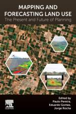
Mapping and Forecasting Land Use: The Present and Future of Planning is a comprehensive reference on the use of technologies to map land use, focusing on GIS and remote sensing applications and methodologies for land use monitoring. This book addresses transversal topics such as urbanisation, biodiversity loss, climate change, ecosystem services and participatory planning, with the pros and cons of various aerial technologies in mapping and land use. It follows a multidisciplinary approach and provides opinions and evidence from leading researchers working in academic institutions across the globe. The book's second half moves from theory and research advancement into case studies, compiling global examples to provide real-world context and evidence of the techniques and applications. Mapping and Forecasting Land Use is a valuable guide for graduates, academics and researchers in the fields of geography, geographic information science and land use science who want to effectively apply GIS and remote sensing capabilities to mapping or wider land studies. Researchers in geosciences, environmental science and agriculture will also find this of value in utilising 21st-century technologies in their field.
Don't want to embarrass yourself in front of your Italian host family?Don't want to stick out like a sore thumb in Sicily (or Florence, or Milan, or Venice)?>Don't leave for Italy without this book! Traveling to Italy is a dream of many. The country is beautiful, the people are warm and vibrant, and don't even get me started on the cuisine! As exciting as Italy is, it can be intimidating for those who have never spent a significant amount of time there. There are different customs to master, different foods than we're used to (and different ways to eat them), and just a different way of doing things in general. As Americans living over 5,000 miles and an ocean away, Italy can seem like a totally different world! Luckily, you have someone on the inside who can tell you the 55 most important things you need to know before you go. With five years of experience being an American in Italy, I can tell you exactly how to avoid mistakes, embarrassment, and misunderstandings, as well as correct some of the misconceptions we have about Italy based on our television shows and movies. You don't have to make any "foreigner faux pas" because I've already made them all for you! How to Be an American in Italy is a friendly, authoritative guide written by an American for other Americans who are visiting or moving to Italy. It will help you fit into your new Italian life without losing your American spirit, and it will give you the confidence to live that new life to the fullest. Featuring a new cover beginning November 2021!
The 8 Best India Travel Guide Books - TRIPSAVVY - 12/09/19"This book takes a culturally minded look at women's safety in the country to inform women both before they leave and while they're in-country about how they can travel safely throughout the country. Written by J.D. Viharini, the book informs women on how to minimize the risk of problems while they're exploring the country by addressing and explaining cultural factors and mindsets. Chapters address how foreign women are shown in the media (promiscuously), standards of dress in India, the types of places that are and aren't safe for women to stay in, and what to do if you are sexually assaulted. Although, of course, the burden shouldn't be on women to avoid violence-it's a larger cultural issue-it's hard to change that in a single trip, and this guide does a great job of helping women navigate the country safely in the meantime. "- KRYSTIN ARNESON Updated 12/09/19 Krystin Arneson is a writer and editor based out of Berlin, Germany. She covers an array of hotels, products and destinations for TripSavvy.Lifeline to getting the most from solo, female travel"I met J.D. Viharini in Nepal recently and listened, first-hand, to accounts of her Indian travels. She is authentic, wise, experienced, expert in the advice she offers. Having travelled to 56 countries, read countless travel books and spoken to people all over the world, I was amazed at the tips I learned in reading this book. In addition, she speaks from a deeply embodied understanding of India, suggesting a nuanced approach to cultural competency, adopting an 'impression management' style of travel which offers an alternative approach to compromising one's own cultural values and identity. Fears are addressed and alleviated. Yet, this book is so simple, practical, easy and wide-ranging in application. Just excellent!"- Jo-Ann Zyla (reviewed on amazon.ca)
Unlock the Secrets to True Happiness-Beyond the 9-to-5 Grind!Have you ever wondered why, despite career success, you still feel unfulfilled? The Freedom Project: Happiness is not just another book about work-it's a blueprint for rediscovering joy and meaning in life. Whether you're climbing the corporate ladder or running your own business, this book will challenge your assumptions about success and guide you toward a life of true freedom and happiness.Acclaimed author and entrepreneur Wilko van de Kamp takes you on a personal journey from the pressures of the corporate world to a life filled with passion, purpose, and fulfillment. In this groundbreaking book, Wilko reveals how his pursuit of traditional success left him feeling empty and unhappy, and how he ultimately found freedom by redefining what happiness truly means.What You'll Discover in This Book: The Illusion of Success: Understand why climbing the corporate ladder or achieving entrepreneurial success doesn't always lead to happiness.Breaking Free from the Rat Race: Learn how Wilko walked away from a high-powered career and avoided the pitfalls of entrepreneurship that nearly led to bankruptcy.The Path to True Fulfillment: Explore how reconnecting with your passions can lead to a life of genuine happiness, free from the constraints of traditional work.Living a Life of Freedom: Discover strategies for creating freedom in your life-financially, geographically, and emotionally.Bringing Travel's Freedom Home: Learn how to integrate the sense of freedom and adventure from travel into your everyday life, making each day as fulfilling as your best vacations.Praise for The Freedom Project: Happiness: "I absolutely love this book. It's rare to find such honest advice in such an easily readable and accessible format. This book, which is full of wisdom on what really matters to be truly happy, is destined to become a classic." - Jack Canfield, coauthor of the Chicken Soup for the Soul(R) series and The Success Principles(TM)Wilko van de Kamp shares personal stories and hard-earned lessons on the quest for happiness beyond the corporate cubicle. This book isn't about quick fixes or temporary escapes-it's about creating lasting change that leads to a more meaningful and joyful life.Get your copy today and start your journey to true happiness!
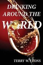
Drinking Around the World examines the history, culture, customs and present-day role of drinking alcohol in over 20 countries around the world. Describes the smallest, largest, busiest, oldest and most famous drinking spots on earth. Discusses the puzzling fact that all the Allied leaders in WW11 were major drinkers: Churchill, Stalin, Truman, and Roosevelt; while the Axis group: Hitler, Mussolini, and Tojo were all teetotalers. Outlines which city in the world has the most bars and which one has the best bars; which country has the largest and best fairs, the largest carnival, and the best fiesta. Answers why alcohol, rather than any other substance, is used throughout the world in every country, to celebrate, commemorate or honor all of life's important occasions, from birth and weddings to victories, and even death---and it's been used for thousands of years. Where to Drink Around the World examines the history, culture, customs and present-day role of drinking alcohol in over 20 countries around the world. Describes the smallest, largest, busiest, oldest, and most famous drinking spots on earth. Discusses the puzzling fact that all the Allied leaders in WW11 were major drinkers: Churchill, Stalin, Truman, and Roosevelt; while the Axis group: Hitler, Mussolini, and Tojo were all teetotalers. Outlines which city in the world has the most bars and which one has the best bars; which country has the largest and best fairs, the largest carnival and the best fiesta. Answers why alcohol, rather than any other substance, is used throughout the world in every country, to celebrate, commemorate or honor all of life's important occasions, from birth and weddings to victories, and even death---and it's been used for thousands of years.
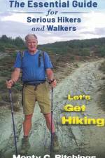
Are you planning a big hike?How about a long distance walk, like one of the Caminos in Spain?Whether you are walking around your neighborhood or walking the full 500 miles of the Camino Frances in Spain, being prepared with the right equipment and the right knowledge is vital to your success and enjoyment while on your journey.. Do you have the right backpack(s) for the type of hike you are doing?Do you have the right boots?How are you going to handle your money? How are you going to prevent other people from handling your money for you?Do you speak the language? How will you communicate with the locals, especially if you are lost? Doing a big hike or a long walk needs proper preparation.Let's Get Walking was written to provide you with the information you need before you get out there and wish you had the right information. Preparation is more than buying a nice backpack or a snazzy pair of boots. This book is the best investment you will ever make when it comes to getting ready for your big walk or hlke, and it links you to some great stores to help you.
A must have for anyone wanting to learn more about London through the unique medium of one of its most enduring and endearing institutions, pubs. Read this and you'll never look at your local in the same way again!
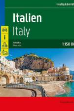
Der Straßenatlas Italien 1:150.000 ist der richtige Begleiter für alle Urlauber die Italien mit dem Auto entdecken und das Dolce Vita auch links und rechts der Autobahn kennenlernen wollen. Er ist ideal für die Planung und erweist sich auch während der Reise als unverzichtbare Orientierungshilfe.Mit dem detaillierten Kartenbild und dem genauen Maßstab lassen sich auch weniger befahrene Nebenstraßen entdecken. Landschaftlich schöne Strecken sind farblich hervorgehoben.Informationen zum Straßenatlas ItalienMaßstab 1:150.000Spiralbindung verdecktTouristische InformationenOrtsregister mit PostleitzahlenCamping- und Stellplätze24 Innenstadtpläne528 Seiten, Format 23.5 x 29,7 cmDer ideale Autoatlas für Italien Das dichte Straßennetz ist exakt abgebildet, landschaftlich schöne Abschnitte und Touristenstraßen sind farblich hervorgehoben und viele Ausflugsziele sind in der Karte eingezeichnet.Auto- und Motorradfahrer schätzen die exakte Kartographie von freytag & berndt besonders für die Planung und Orientierung vor Ort. Damit die Reise auch mit Wohnmobil, Wohnwagen oder Camper gut planbar ist, sind alle Camping- und Stellplätze im Atlas eingezeichnet. Verdeckte Spiralbindung Der Autoatlas Italien ist besonders komfortabel in der Handhabung da er sich durch die Spiralbindung bequem aufklappen lässt. So bleibt die gewünschte Seite auch während der Fahrt immer geöffnet. Innenstadtpläne Mit den 24 enthaltenen Cityplänen kann man sich in den Städten gut orientieren: Ancona, Aosta, Bari, Bologna, Bozen, Cágliari, Campobasso, Catanzaro, Florenz, Genua, L'Aquila, Meran, Mailand, Neapel, Palermo, Perúgia, Potenza, Rom, Turin, Trento, Triest, Venedig, Vatikan, San Marino.Gedruckt in Österreich
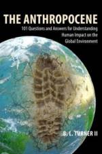
An authoritative desk-top reference work for students of geography, the environment and sustainability, which through a series of 101 interconnected questions and answers spanning ten thematic sections, provides a comprehensive survey of humankind's impact on the global environment from the Late Stone Age to the present day.
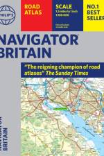
Philip's Navigator are Britain's bestselling road atlases - exceptional for their scale and clarity. 'A map that beats all others' The Daily Telegraph 'Scale, accuracy and clarity are without parallel' Driving Magazine 'No.1 in the UK for clear maps' Independent research survey - Scale: 1.5 miles to 1 inch = 1:100,000 (Northern Scotland: 3 miles to 1 inch = 1:200,000) - Super-detailed 6-page route-planning section. - Every street in Britain is marked on the maps. - Over 3000 roads clearly named. - Featuring major National Trails such as: Hadrian Wall's Path, Offa's Dyke Path, Pennine Way, South Downs Way, Thames Path, The Ridgeway, West Highland Way and Southern Upland Way. - 100 indexed town-centre maps plus approaches maps to 12 major urban areas. - Exceptional road detail, from motorways to country lanes, with every junction, roundabout and slip-road shown. - Thousands of individually named farms, houses and hamlets. - The No.1 Choice of Road Atlas for the serious motorist. Available in a robust flexiback binding, Philip's Navigator Britain is widely used by professional drivers and the emergency services, including national police training, and is recommended in the motoring press and national newspapers. No other road atlas of Britain offers this level of detail and clarity.
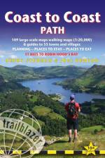
All-in-one hiking route guide, route maps and accommodations for this classic 191-mile walk across northern England from the Irish Sea to the North Sea, inspired by Alfred Wainwright. Includes 109 large-scale maps (3 1/8 inches to 1 mile); 10 town plans and 14 overview maps. Full details of all accommodations and campsites, restaurants and pubs; plus full public transport information. Includes day-walks.
This vintage book contains a detailed description of Hardknott Castle, an archaeological site containing the remains of the Roman fort Mediobogdum, located on the western side of the Hardknott Pass in the English county of Cumbria. Including maps and a comprehensive account of it history, this volume is not to be missed by those with an interest in this particular site and in Roman British history in general. Robin George Collingwood, FBA (1889 - 1943), was an English historian, philosopher, and archaeologist most famous for his philosophical works including "The Principles of Art" (1938) and "The Idea of History" (1946). Other notable works by this author include: "Religion and Philosophy" (1916), "Roman Britain" (1923), and "Speculum Mentis; or The Map of Knowledge" (1924). Many vintage books such as this are increasingly scarce and expensive. It is with this in mind that we are republishing this volume now in an affordable, modern, high-quality edition complete with a specially-commissioned new biography of the author.
Cet ouvrage de vulgarisation géographique, rédigé en 1875-1876, soit six ans après Histoire d'un ruisseau, s'adresse au public jeune et au public populaire.Comme dans son précédent ouvrage Histoire d'un ruisseau, Elisée Reclus mêle ici l'étude scientifique, climat, géologie, flore, faune, à une réflexion morale et politique sur le progrès et le bonheur. L'exploration de la montagne se fait en compagnie d'un berger. Un classique.
Waldfeucht, der Ort dem sich die Nr. 106 des Rheinischen Städteatlas widmet, wurde erstmals 1240 erwähnt und in Folge der weiteren Entwicklung 1350 als Stadt bezeichnet. Außer den beiden Toren aus Mauerwerk war Waldfeucht von wassergefüllten Gräben sowie von heckenbestandenen Wällen umgeben. Ab 1499 gehörte der Ort zum Herzogtum Jülich. 1816 wurde die Mairie Waldfeucht Bürgermeisterei und 1935 kam es zur Bildung des Amts Waldfeucht mit den Orten Braunsrath, Haaren und Saeffelen. 1972 gründete man die neue Gemeinde Waldfeucht. Nach Waldfeucht führte eine Wallfahrt zum hl. Rochus. Auf diese Weise entwickelte sich der Ort zu einem religiösen und administrativen Mittelpunkt, der zur Ansiedlung von Handwerkern führte. Bereits 1277 sind ein Markt und Handwerker erwähnt. Bis ins 19. Jh. hinein wurde in Waldfeucht auch die Leinen- und Samtweberei betrieben. Bedingt durch den fehlenden Eisenbahnanschluss konnte die Industrialisierung kaum Fuß greifen. Als größere Firma siedelte sich 1970 nur eine Eiskremfabrik an, die sich zum größten Arbeitgeber entwickelte.
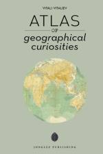
Atlas of Geographical Curiosities is an intriguing work by the renowned author Vitali Vitaliev. Published in 2022 by Jonglez, this book falls under the genre of geography and exploration. It's a fascinating journey across the world, revealing the most unusual, hidden, and unexpected facets of our planet. Vitaliev, with his characteristic wit and keen observation, takes you on an unforgettable tour, filled with geographical wonders and oddities. From the world's most remote islands to the least inhabited corners, this atlas uncovers the world's most remarkable geographical curiosities. Whether you're a geography enthusiast or a casual reader, this book is sure to captivate your imagination. Published by Jonglez, a publisher known for its unique and offbeat travel guides, Atlas of Geographical Curiosities is a must-have for every explorer at heart.
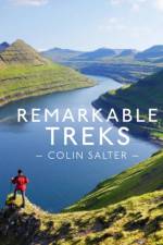
Remarkable Treks is a compendium of exhilarating walks from around the planet - some lasting weeks, some lasting just a few days, but all of them set against spectacular backdrops.
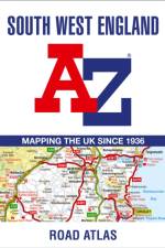
This full-colour road atlas features 30 pages of continuous road mapping. Includes Cornwall, Devon, Dorset, Plymouth Somerset and Torbay.
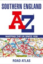
A full-colour regional road atlas featuring 39 pages of continuous road mapping. Covering an extensive area, including Bristol, Swindon, Reading, Slough, Guildford, Littlehampton, Portsmouth, Isle of Wight, Bournemouth, Cardiff, Newport, Weymouth, Sidmouth, Taunton and Weston-Super-Mare.
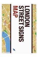
London's street signs reflect centuries of history through their letters, whether carved in stone, enameled or tiled. These unassuming signs serve as rich visual markers of the city's ongoing evolution. Explore London's most interesting examples as selected by Alistair Hall with this map, which includes descriptions, an introduction and photography.
Sign up to our newsletter and receive discounts and inspiration for your next reading experience.
By signing up, you agree to our Privacy Policy.