


Join thousands of book lovers
Sign up to our newsletter and receive discounts and inspiration for your next reading experience.
By signing up, you agree to our Privacy Policy.You can, at any time, unsubscribe from our newsletters.
Navigate your way around Norwich with this detailed and easy-to-use A-Z Street Atlas.Printed in full-colour, paperback format, this atlas contains 42 pages of continuous street mapping. More than 4,500 streets indexed. Large scale 4 inches to 1 mile map.
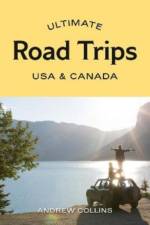
Ultimate Road Trips: USA & Canada provides detailed itineraries for 32 amazing driving routes and adventures, from enthralling national parks to charming small towns.Including epic journeys like California’s Highway 1, the Canadian Rockies, coastal New England, Hawaii and Alaska, each chapter features route maps and color photos. This guide also has descriptions of all the must-see highlights including short hikes, family-friendly attractions and world-class museums, and the best places to eat and sleep, from quirky diners and hip cafes to retro-cool motels, cozy cabins and stylish glamping resorts. You'll learn the best times to go both for great weather and avoiding the crowds, and find invaluable tips on ensuring a smooth ride. Award-winning travel writer Andrew Collins crisscrossed the region numerous times, having driven through every US state and Canadian province. Car vacations were already gaining in popularity before the pandemic.Now, with travel picking up again, there's an even stronger interest in the independent journey; when your significant other, family or a group of friends can just hop into a car, hit the open road, and seek out less-crowded encounters with natural beauty.
Mit dem E-Bike zu den schönsten Ausblicken entlang naturnaher Höhenradwege oder auf eine längere Radtour ohne sich körperlich zu verausgaben. Der bikeline E-BIKE GUIDE präsentiert vielfältigste Touren und nimmt sich dabei den speziellen Bedürfnissen von E-Bike Piloten an. Exakte topographische Karten plus präzise Informationen zu Ladestationen, Aussichtspunkten, Sehenswürdigkeiten, Orten, Übernachtung sowie Tipps rund um die E-Bike-Tour.
KOMPASS Karten Verlag - seit 1953 arbeiten wir daran Dich sicher an Dein Ziel zu bringen und neue Wege zu entdecken. Unsere Produkte sollen Dich begeistern und inspirieren. Wir wollen Dich mit der Leidenschaft anstecken, die wir an unserem Standort im Herzen der Alpen in Innsbruck, für die Natur und die Berge verspüren.
Delve into the social and cultural history of 100 of the world's most important cities.From the first towns in Mesopotamia to today's global metropolises, cities have marked the progress of civilization. Written in the form of illustrated "e;biographies"e;, Great Cities offers a rich historical overview of each featured city, brought to vivid life with paintings, photographs, timelines, maps, and artefacts. The latest title in the series style of Artists, Writers, Philosophers, and Composers, this lavish ebook goes under the skin of cities both ancient and modern - from Persepolis and Tikal, Paris and Vienna to Prague, Amsterdam, Tokyo, and Dubai. Which ancient civilization founded the precursor to Mexico City? Why was Venice the gateway to the East? What was the Belle Epoque? Which was the first city to build sewers? Great Cities takes you there, and tells you all this and more. Stunning images of city life and key moments in history are complemented by close-ups of revealing details and feature panels that provide additional context. An ebook not just about history but also about art, architecture, commerce, and politics, Great Cities provides a fascinating insight into what has shaped the places where we live. Perfect for history, geography, and arts enthusiasts and a stunning gift for armchair explorers of all ages, it is your window into the world's most fascinating cities.
Follow in the footsteps of early twentieth-century explorers on twenty treks spanning six continents that range from Everest Base Camp to a pilgrimage across the Pyrenees. They include: the mysterious Ruwenzori mountains in the heart of Africa; five classic Himalayan tours, including the Annapurna Circuit and seldom-visited Snow Lake; an adventure to the Tekes River Valley in central Asia, country rarely seen by Westerners since the Soviets sealed off the region in the 1920s; sunset from the summit of Mount Kilimanjaro, Tanzania, the highest point in Africa; a hut-to-hut trek in Italy's storied Dolomites; and a llama trek through the surreal redrock desert canyons of southern Utah's Escalante.
The book describes facilities, geological & physical highlights, plant communities, and animals, including mammals, birds, reptiles, amphibians, and fish for 33 sites in a clear, simple, easy to use format. This guide also covers wildlife observation tips, seasonal highlights, and Berkshire natural history, and includes detailed maps, illustrations and directions.
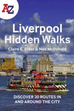
Discover hidden gems around Liverpool with 20 walking routes. Featuring 20 walks in and around the city, including lesser-known circuits and details on popular walks. Accompanied by guided walking instructions and written by a local expert, A-Z Liverpool Hidden Walks is the perfect way to explore the city in a new light.
Discover hidden gems around Brighton with 20 walking routes. Featuring 20 walks in and around the city, including lesser-known circuits and details on popular walks. Accompanied by guided walking instructions and written by a local expert, A-Z Brighton Hidden Walks is the perfect way to explore the city in a new light.
Navigate your way around Glasgow with this detailed and easy-to-use A-Z Street Atlas. Printed in full-colour, paperback format, this atlas contains 168 pages of continuous street mapping.
Falset landkort over Mallorca i målestokken 1:50.000. Lille indsat hæfte på 70 sider med indeks og tilhørende GPS koordinater. Hæftet indeholder også en lille guide til de mest kendte destinationer på øen.
Dieses Buch behandelt die begrifflichen und sachlichen Grundlagen der Flugnavigation sowie die mathematisch-geometrischen Zusammenhänge mit zahlreichen Berechnungsbeispielen. Wegen des engen Bezugs zur Kartographie, welche die benötigten raum- und sachbezogenen Informationen für die thematischen Karten und Navigationsdatenbanken bereitstellt, sind die theoretischen Aspekte sowie der praktische Gebrauch und die Interpretation moderner Navigationskarten inhaltlicher Schwerpunkt. Weiterer Schwerpunkt ist die leistungsbasierte Navigation, wie diese in der heutigen Luftfahrtpraxis mithilfe integrierter bordseitiger Navigationssysteme in Verbindung mit den Ab- und Anflugverfahren realisiert wird. Hierbei werden Funk-, Trägheits- und Satellitennavigation kombiniert. Mithin widmet sich dieses Buch den Letzteren in einer angemessenen Detailtiefe sowie der Architektur der Bordsysteme am Beispiel der weltweit verbreiteten Airbus A320-Flugzeugfamilie. Des Weiteren werden relevante Aspekte der Flugsicherung einbezogen. Zielgruppe sind alljene, die ihre Ausbildung zum Piloten oder Fluglotsen mit einem Studium im Bereich der Luftfahrt kombinieren, Verfahrensplanende bei der Flugsicherung, Studierende des Verkehrsingenieurwesens oder der Geowissenschaften und alle, die sich für Navigationskarten und -systeme sowie die damit verbundenen aktuellen Technologien begeistern. Die vorliegende zweite Auflage ist gleichermaßen geeignet für Neueinsteiger und Fortgeschrittene, die Praxisbeispiele verhelfen zum "Ankommen". Zahlreiche hochwertige Abbildungen fördern die Anschaulichkeit, großer Wert wird auf Allgemeinverständlichkeit gelegt bei dennoch mathematischer Fundierung. Das Buchkonzept mit dem Schwerpunkt auf aktueller Thematik bindet die traditionellen Navigationssysteme jedoch soweit ein, dass die Leserinnen und Leser Kenntnisse erwerben, welche ihnen dazu verhelfen, oben genannte Systeme als alleinige Navigationsmittel anwenden zu können. Auch werden die vom Luftfahrtbundesamt für die Ausbildung zum Verkehrsflugzeugführer im Fach Navigation geforderten Inhalte im Wesentlichen abgedeckt.
Zwei Karten, gefalzt auf DIN A5 in PE-Hülle, serienmäßig auf wasserfester Folie ("Yupo"®)!erste Karte: Planungs-und Wildwasserübersicht im Maßstab 1: 450 000, 71x63cm, für Kanuten und Ruderer einschließlich Hinweisen zu Wasserständen, Wehranlagen / Schleusen, Campingplätzen, Kanu- u. Rudervereinen, Gewässersperrungen, Fluss-Kilometer, vor allem auch Wildwasser-Schwierigkeitsstufen aller Gewässer zweite Karte: Donaukarte im Maßstab 1: 75.000 DIN A1, Passau bis Bratislavafür Kanuten, Ruderer, Radwanderer und Yachtsportler: genaue Gewässerdarstellung mit Strömungsgeschwindigkeiten, Rast- und Biwakplätzen, auch Donau-Altarme+ Nebengewässer enthalten, Camping +Vereine +Häfen mit Anschriften-Ausstattungsliste, einschl. Donau-Radwanderweg mit Fahrradfreundlichen Quartieren
Part of the bestselling Ultimate series, this is the definitive guide to cycling in Australia.
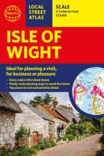
This pocket-sized street atlas of the Isle of Wight gives detailed coverage of the whole of the island and mainland towns nearby.
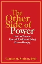
"Many people who have fulfilled the 'power dream' found it empty and have given it up; the American Dream has become a dead-end street."-Dr. Claude Mr. Steiner, 1981
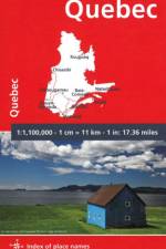
MICHELIN National Map QUEBEC will give you an overall picture of your journey thanks to its clear and accurate mapping scale 1/1,100,000. Our National Map Series will help you easily plan your safe and enjoyable journey thanks to a comprehensive key, a complete name index as well a clever time & distance chart. Michelin's driving information will help you navigate safely in all circumstances. In addition, some MICHELIN National Maps are cross-referenced with the MICHELIN Green Guide highlighting destinations worth stopping for! With MICHELIN National Maps, find more than just your way! MICHELIN NATIONAL MAPS feature: - Up-to-date mapping - A scale adapted to the size of the country - A clear and comprehensive key - Distance and time chart - Place name index - Driving and road safety information - Tourist sights information
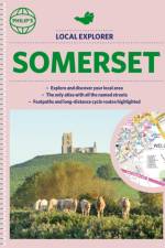
Philip's created this new series for walkers, cyclists and local explorers at a scale that provides greener options to uncover all the nature and hidden gems in your local area. From Bath to Yatton, we cover all of Somerset in glorious detail.
Sign up to our newsletter and receive discounts and inspiration for your next reading experience.
By signing up, you agree to our Privacy Policy.