


Join thousands of book lovers
Sign up to our newsletter and receive discounts and inspiration for your next reading experience.
By signing up, you agree to our Privacy Policy.You can, at any time, unsubscribe from our newsletters.
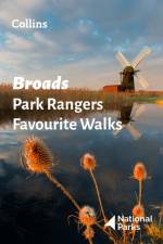
Walking guide to the Broads National Park, with 20 best routes chosen by the park rangers. Each walk varies in length from 2 to 10 km and can be completed in less than 4 hours.
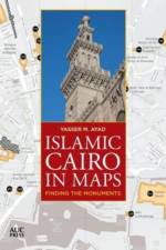
A portable, easy-to-use map guide that locates over 700 hundred Islamic-era monuments in historic Cairo using the most sophisticated Geographic Information Systems (GIS) technology This portable, easy-to-use map guide helps you locate over seven hundred Islamic-era monuments in Cairo's historic core, stretching from the city's northern walls all the way southward to the Mosque of Ibn Tulun and the Citadel, and beyond to Coptic Cairo, which includes monuments that pre-date Islamic rule. Clearly divided into six digestible main sections, the first five contain clusters of monuments, while the sixth covers structures scattered all around the old Cairene urban fabric. The clear, uncluttered cartographic style makes finding where you want to go a pleasure, and the maps are accompanied by a comprehensive index of monuments that gives their dates where known, their location referenced to their corresponding map pages, and a timeline of key periods and dynasties. Attractively designed in full color and including over twenty photographs of key monuments, this guide is conveniently packed into a slim 104 pages--handy enough to take anywhere and great for planning and remembering excursions. It is not only an ideal companion for the city's visitors and residents but an invaluable resource for historians, writers, and students.
Dartmoor, a captivating book released on 2021-06-03, is a literary masterpiece that you simply can't put down. This book, published by the renowned Ordnance Survey, takes you on a thrilling journey like no other. Although the author's name remains undisclosed, the book's quality speaks volumes about their talent. The genre of this book is a well-guarded secret, adding to the allure and mystery of what lies within its pages. Dartmoor is not just a book; it's an experience that will leave you wanting more. Dive into the world of Dartmoor today and embark on an adventure you won't forget.
The English Lakes South-Eastern Area, a captivating book published by Ordnance Survey on May 17, 2021. This book provides an in-depth exploration of the South-Eastern area of the English Lakes, a region known for its stunning landscapes and rich history. The author's thorough research and engaging writing style make this book a must-read for anyone interested in learning more about this beautiful part of England. The book falls under the genre of travel and geography, providing valuable insights and information about the area. Published by the renowned Ordnance Survey, known for their detailed maps and travel guides, this book is a reliable source for both adventurers and those curious about the region. It's a recent publication, making it a relevant and up-to-date resource for anyone planning a visit or simply wishing to expand their knowledge about the English Lakes South-Eastern Area.
The market-leading atlas for pupils at primary schools, Philip's RGS Junior School Atlas has been fully revised and updated for its 11th edition.
In Philip's RGS Children's Atlas, clear and accurate maps are combined with fascinating facts about the countries of the world to provide essential geographical information for young readers aged 7-12. Guidance for parents and teachers is given on how to use the maps, encouraging the early development of geographical skills.
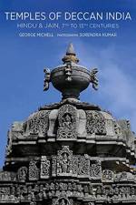
A visual exploration of the Deccan Indian architectural history. Contains maps guiding would-be travellers to these temple sites.
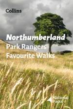
Walking guide to the Northumberland National Park, with 20 best routes chosen by the park rangers. Each walk varies in length from 2 to 10 km and can be completed in less than 4 hours.
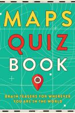
Become the ultimate map reader with this quiz book for all ages
What's in a name? Quite a lot - the tales behind the most popular, common, unusual, famous and amusing street names
Sign up to our newsletter and receive discounts and inspiration for your next reading experience.
By signing up, you agree to our Privacy Policy.