


Join thousands of book lovers
Sign up to our newsletter and receive discounts and inspiration for your next reading experience.
By signing up, you agree to our Privacy Policy.You can, at any time, unsubscribe from our newsletters.
Become the ultimate map reader with this quiz book for all ages
What's in a name? Quite a lot - the tales behind the most popular, common, unusual, famous and amusing street names
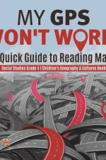
Smartphones are equipped with GPS, making it easy to navigate through unfamiliar roads. But what if GPS fails? Would you be able to read maps correctly? This book will talk about the different types of maps, what their uses are, and how they are read correctly. In addition, it will also discuss how maps are created around certain guidelin
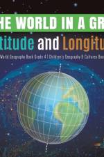
Use this book to better see the world. Travel through its continents, oceans and hemispheres. Learn some interesting facts, especially information on their similarities and differences. Study carefully the cultures and traditions in different regions of the Earth, too. Knowledge on geography and culture will make you realize how diverse t
The geographic coordinate system is expressed latitude and longitude. Latitude represents the vertical geographic position while the longitude represents the horizontal position. Both the latitude and the longitude are composed of a set of numbers. Reading the coordinates now is important in finding your way around the world tomorrow. Sta
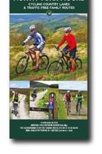
Explore the North York Moors by bike with this laminated, waterproof map. With 16 circular, clearly-marked routes this easy-to-use map will help you discover the very best of the North York Moors along the quietest country lanes.
Explore the wonders that the world forgot with award-winning travel writer Oliver Smith - from breathtaking buildings with a dark past to decaying reminders of more troubled times.
A milestone of graphic reporting, this groundbreaking 'atlas with attitude' keeps pace with the speed of change with informed analysis and graphically analyses every key indicator and vital statistic of modern life. This statistically meticulous and beautiful presentation of trends is essential to understand the world today.
This book discusses developments in the history of British house names from the earliest written evidence to the twentieth century.
This 2-volume set provides all the information required to complete the main ridge traverse on Skye's Black Cuillin. Strategy, gear, training, navigation and logistics are covered, and 10 classic scrambles are described. A lightweight second guidebook gives the scrambler detailed maps, topos and route description for the ridge traverse itself.
Filled with the history, geography, sociology and anthropology this 2nd revised edition contains more than 7000 names of features throughout the state - towns, mountains, rivers, canyons, post offices, even abandoned settlements, offering glimpses of the lives and values of the people who named them.
Field names are not only interesting in themselves, but also a rich source of information about the communities originating them. This is a pioneering history, by the author of the standard Dictionary of Field Names.
Walking guide to the Yorkshire Dales National Park, with 20 best routes chosen by the park rangers. Each walk varies in length from 2 to 10 km and can be completed in less than 4 hours.
An information-packed, bestselling hardback world atlas from Philip's, published in association with the Royal Geographical Society - fully revised and updated for the curious traveller.
The latest information-packed and topical world atlas from Philip's, published in association with the Royal Geographical Society - fully revised and updated in paperback for today's fast-changing world.
'Terrifying yet funny, surprising yet predictable, simple yet poignant' Chris PackhamA shocking but informative, eye-catching and witty book of maps that illustrate the perilous state of our planet.The maps in this book are often shocking, sometimes amusing, and packed with essential information:· Did you know that just 67 companies worldwide are responsible for 67 per cent of global greenhouse emissions? · Or that keeping a horse has the same carbon footprint as a 23,500-kilometre road trip? · Did you know how many countries use less energy than is consumed globally by downloading porn from the internet?· Do you know how much of the earth's surface has been concreted over?· Or how many trees would we have to plant to make our planet carbon-neutral?Presenting a wealth of innovative scientific research and data in stunning, beautiful infographics, 99 Maps to Save the Planet provides us with instant snapshots of the destruction of our environment. At one glance, we can see the precarious state of our planet - but also realise how easy it would be to improve it Enlightening, a bit frightening, but definitely inspiring, 99 Maps to Save the Planet doesn't provide practical tips on how to save our planet: it just presents the facts. And the facts speak for themselves. Once we know them, what excuse do we have for failing to act?
Provides spatial information about Maldives and thematic maps necessary for assessing future development investments in terms of climate risks and geophysical hazards. The atlas is also intended to support the formulation of cobeneficial options for climate change adaptation and disaster risk reduction and management.
Provides spatial information about Maldives and thematic maps necessary for assessing future development investments in terms of climate risks and geophysical hazards. The atlas is also intended to support the formulation of cobeneficial options for climate change adaptation and disaster risk reduction and management.
This renowned reference title provides up-to-date impartial commentary on political and economic developments in the region, alongside extensive and updated statistical and directory information.
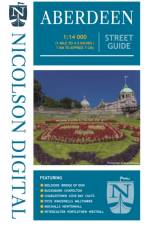
Folding street map of Aberdeen. Updated to show all the recent developments
Sign up to our newsletter and receive discounts and inspiration for your next reading experience.
By signing up, you agree to our Privacy Policy.