


Join thousands of book lovers
Sign up to our newsletter and receive discounts and inspiration for your next reading experience.
By signing up, you agree to our Privacy Policy.You can, at any time, unsubscribe from our newsletters.
In a handy flexibound format, this fully revised edition of Philip's Compact Britain Road Atlas features updated cartography from the Philip's digital database, which has been voted Britain's clearest and most detailed mapping in an independent consumer survey.
Falset kort i målestokken 1:100.000 med indsat bykort over Thorshavn, stednavneregister og turistinformationer. Smukt suppleret med farvefotos fra øerne. Tegnforklaring på dansk.- Campingpladser- Vandreruter med højdeangivelser- Fuglerugepladser- Færger- Bykort over Thorshavn- Byregister- Vandafvisende og rivefastFormat: 84 x 121 cm i udfoldet tilstandKortet er trykt på stenpapir(Stenpapir er et alternativ til almindeligt papir. I stedet for at lave papir af træ, laves stenpapir af 80% kalk og 20% HDPE. Da kalk er naturligt hvidt, og HDPE er gennemsigtig, anvendes der ikke blegemidler i produktionen, hvilket man anvender til almindelig papirproduktion. Modsat almindeligt papir, bruges der heller ikke vand eller kemikalier til produktionen af stenpapir.Ved produktionen af stenpapir, undgår man fældning af træer, brug af kemikalier, blegemidler, vand og forurening af spildevand.
Michelin's France 100% laminated A4 atlas offers, in addition of Michelin's clear and accurate mapping, an enhanced view of your journey thanks to its scale 1/250,000.Convenient and easy to use thanks to its spiral bound cover, this atlas comes with extra-resistant laminated pages on which you can trace and erase your journey. The route planner as well as the time distance charts will help you plan and optimise journey. Michelin's new safety alerts warn you about dangerous driving areas and zones subjet to tighter speed checks. Michelin's laminated France atlas also includes information on tourist sights, leisure facilities and scenic routes, as well as service areas to add pleasure and comfort to your journey. Michelin's France laminated tourist and motorist atlas features:- Scale 1/250,000: for an enhanced view of your journey- Extra resistant pages: to draw/erase your journey as you go along- Key to map pages: to quickly access the region of your interest- A complete town index: To easily indentify to destination of your choice- Distance and time chart: to help you plan your trip- 6 major town plans: Paris, Bordeaux, Lille, Lyon, Marseille & Nantes- Michelin's danger alers: to help you identify zones at risks for drivers and controlled speed areas- In English language: Keys, indexes and information
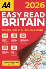
Up-to-date mapping from the experts at the AA. Easy Read Britain Atlas 2026 features include a giant 2.3 miles to 1 inch scale, A4 format revised and updated for 2026, 6 page clear route planner map, top 300 AA-Inspected caravan and camping sites and over 240 service areas.
Road atlas covering Spain and Portugal with clear detailed road mapping, including 50 city street plans and 10 large scale approach maps. Features include distance chart and travel information, map legends and page title in 12 European languages and £10 off AA European Breakdown cover offer.
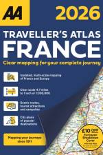
Fully updated for 2026, this A4 format road atlas of France provides clear mapping at 4.7 miles to 1 inch. Featuring detailed city maps of Paris, Lille and Lyon,16 pages of overview mapping of Europe, France and scenic routes, campsites and tourist attractions and £10 off AA European Breakdown Cover promotion.
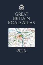
The AA Great Britain Road Atlas is a premium hardback A4 road atlas showcasing Britain's clearest mapping at 3.2 miles to 1 inch. With up-to-date mapping from the experts at the AA in a large 3.2 miles to 1 inch scale.
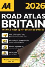
The AA Road Atlas Britain, fully updated for 2026 includes a large 3.2 miles to 1 inch scale in A4 format and a 6 page clear route planner map. This top-selling road atlas showcases Britain's clearest mapping from the experts at the AA. Each page has been titled with its geographical location so you can turn to the page you need more easily.
Up-to-date mapping from the experts at the AA. Easy Read Britain Atlas 2026 features include a giant 2.3 miles to 1 inch scale, A4 format revised and updated for 2026, 6 page clear route planner map, top 300 AA-Inspected caravan and camping sites and over 240 service areas.
The AA Big Road Atlas Britain is an A3 road atlas showcasing Britain's clearest mapping at 3 miles to 1 inch. Fully updated, features include large 3 miles to 1 inch scale including Ireland at 16 miles to 1 inch, 68 city, town and port plans, top 300 AA-Inspected caravan and camping sites and over 1,800 golf courses.
The AA Big Road Atlas Britain is an A3 road atlas showcasing Britain's clearest mapping at 3 miles to 1 inch. Fully updated, features include large 3 miles to 1 inch scale including Ireland at 16 miles to 1 inch, 68 city, town and port plans, top 300 AA-Inspected caravan and camping sites and over 1,800 golf courses.
Updated A3 format atlas providing giant scale mapping at 2.5 miles to 1 inch. Features include 72 city, town and port plans, top 300 AA-Inspected caravan and camping sites, over 1,800 golf courses and 4 page route planner.
Updated A3 format atlas providing giant scale mapping at 2.5 miles to 1 inch. Features include 72 city, town and port plans, top 300 AA-Inspected caravan and camping sites, over 1,800 golf courses and 4 page route planner.
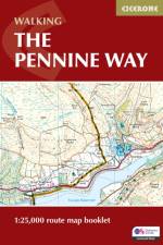
Map of the 270 miles (435km) Pennine Way National Trail, between Edale in the Peak District and Kirk Yetholm in the Scottish Borders. This booklet is included with the Cicerone guidebook to the trail, and shows the full route on OS 1:25,000 maps. This popular long-distance route typically takes three weeks to complete.
This volume fills a gap in the literature on Digital Humanities in the Hispanic context by gathering a heterogeneous group of specialists who, from different standpoints in the Humanities, explore Spanish texts as the object of study, Digital Humanities as the work methodology, and Medieval and Early Modern Times as the historical framework.
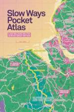
An atlas of walking routes connecting all of Britain's towns, cities and national landscapes. Slow Ways is an ambitious citizen-made, peer-reviewed national walking network.
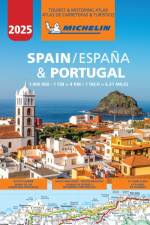
Updated annually - Michelin Spain & Portugal tourist and motoring Atlas is the perfect companion for a safe and enjoyable drive. Convenient and easy to use thanks to its spiral bound cover, the Michelin Spain and Portugal atlas will provide you with precise and reliable information with its annually updated mapping scaled 1/400 000 (1 cm = 4 km) and safety alerts. The route planner, as well as the time and distance charts will help you plan and optimise your journey, whilst the new location map on top of each page and the hightly practical street maps will provide you with an easy navigation within the atlas. Tourist sights, leisure facilities, and scenic route will add pleasure to your journey. Michelin touring and motoring atlas Spain & Portugal features: * Detailed and easy-to-use mapping with a scale 1/400 000 * Mileage chart and journey times to help you plan your journey * Key to Map Pages to quickly access your region of interest * 64 town plans for easy navigation in urban areas * An extensive place name index to easily identify the destination of your choice * Comprehensive and detailed key to symbols used * Tourist information with place of interest and leisure facilities, as well as scenic routes * Location maps on top of each pages for an easy navigation within the atlas * Highly practical street map pages embedded in the mapping of their surrounding areas
The seventh edition of Isles of Scilly is an indispensable guide for anyone seeking to sail this stunning archipelago, located twenty-two nautical miles off the coast of Cornwall, England.
In Artists' Journeys that Shaped Our World, follow in the footsteps of some of the world’s most famous painters, and the journeys which inspired some of their greatest works.
The A-Z Adventure series features the accuracy and quality of OS Explorer mapping in a convenient book, complete with index.
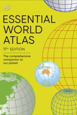
From the vast Sahara desert to the smallest European cities, and with over 65 maps using the latest digital mapping, the Essential World Atlas 9th Edition brings you the Earth in more detail than ever before. The Essential World Atlas 9th Edition is the indispensable guide to our fascinating planet, mapping the political and physical world, the global economy, time zones, population, languages, climate, region, and global conflict with information, photographs, and diagrams, Explore data profiles of each country with detailed facts, key statistics and time zones from across the globe. Delve further into the geography of our planet with a full index of over 20,000 entries, making the Essential World Atlas 9th Edition the perfect reference for business, home or school.Previous edition ISBN 9781409366096
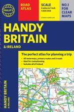
The essential handy road atlas for planning a trip in Britain and Ireland. Keep it in the glove box or your travel bag for quick and easy reference.
Falset kort i målestokken 1:200.000 med indsat hæfte som indeholder register samt 6 bykort.
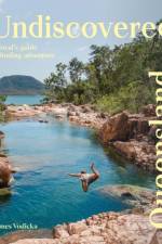
A stunning guide to Queensland featuring hidden secrets and hotspots of the Sunshine State.
Sign up to our newsletter and receive discounts and inspiration for your next reading experience.
By signing up, you agree to our Privacy Policy.