


Join thousands of book lovers
Sign up to our newsletter and receive discounts and inspiration for your next reading experience.
By signing up, you agree to our Privacy Policy.You can, at any time, unsubscribe from our newsletters.
While a few people called the area we know as Cary home in the 1700s, it was not until 1854 that signs of a village began to appear. The enterprising businessman Allison Francis "Frank" Page bought 300 acres on which he operated a sawmill and did some farming. The railroad soon reached Cary, and in 1868, Frank saw the opportunity to start a new venture and built a hotel, which served meals and provided accommodations to train passengers. Cary was incorporated in 1871. By 1880, there were nearly 300 residents, and by 1930, that number had tripled. The timber industry kept Cary alive, as well as cotton gins and other manufacturing businesses. Cary had a private boarding school by 1870, and in 1907, it became the first publicly funded school and attracted students from around the state. Doctors, lawyers, merchants, churches, and many other businesses sprang up. However, it was the creation of Research Triangle Park that caused Cary's explosive growth.
Within 20 years of the end of the Civil War, Chattanooga was becoming the "Dynamo of Dixie." Entrepreneurs and capital from the North were welcomed to the city. New railroads made the area a transportation hub. Fortunes were made in finance, industry, and tourism. Located at the foot of Lookout Mountain, St. Elmo was Chattanooga's first suburb. The founder of the then-independent town, A. M. Johnson and other community leaders chartered the Forest Hills Cemetery in the late 1870s. Many Chattanooga-area families obtained sites within the cemetery, now on the National Register of Historic Places. A rarity for the Reconstruction South, these families included a number of African Americans. From the famous to the infamous, from the remembered to the nearly forgotten, Images of America: Chattanooga's Forest Hills Cemetery highlights a number of Chattanoogans interred in this picturesque historic cemetery.
The uniqueness of Winn Parish is its vast history not only of deep-rooted politics, but also of scattered communities that once prospered on its timber, railroads, salt mine, and rock quarry. The arrival of railroads more than a century ago opened virgin pine forests to commercial logging, and timber mills sprang up, flourished, and then disappeared as resources were depleted. Centuries' use of a saltworks foretold development of a successful salt mine, but the discovery of a nearby rock quarry was an accident. Winn was carved from the north-central Louisiana parishes of Natchitoches, Catahoula, and Rapides by an 1852 legislative act. Parish seat Winnfield is readily known as the birthplace of populist demagogue Huey P. Long, and it was also home to two other governors, brother Earl K. Long and handpicked successor O.K. Allen. The parish had its dark side, too, as bandits like the West and Kimbrell Clan roamed the southern regions.
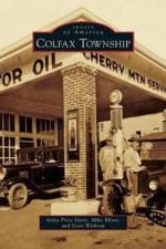
Located at the Rutherford-Cleveland County line, Colfax Township was a response to the 1868 state mandate to divide North Carolina counties into townships. Colfax Township took its name from Schuyler Colfax, the 17th vice president of the United States (1869-1873). The 53.1 square miles of the township remain mainly rural, and most residents have lived here for five years or more. Such stability generates community pride and considerable participation in Big Days, the Colfax Free Fair, the Fiddler's Conventions, and other celebrations. The Colfax Museum reflects the interest in the area. Images of America: Colfax Township--a pictorial retrospective--celebrates the life and times of the area.
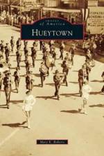
The City of Hueytown was incorporated on May 6, 1960. Since then, city officials, past and present, have provided excellent laws and codes that offer a well-designed city for its citizens. Native Americans were the first to settle along Valley Creek, while the following prominent names helped develop and establish the area: the Huey, Waldrop, Salter, Knight, Dabbs, Parsons, Vines, Crooks, and Robertson families. The Woodward Iron Company was the first major employer, and the Tennessee Coal and Iron Company, later called United Steel Company, also provided jobs and security for many citizens. A group of famous NASCAR race car drivers from Hueytown, "The Alabama Gang," helped create an interest in racing. In addition, Hueytown has had many devoted educators who staffed the area's schools and encouraged students to strive for the best.
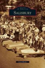
In 1732, Salisbury Towne was founded on the eastern coast of Maryland on 15 acres, which belonged to William Winder. The town flourished, and upon the founding of Wicomico County in 1867, its county seat was declared Salisbury. Both the town and the county grew rapidly, earning Salisbury the nickname "Crossroads of Delmarva," a fitting moniker for what is today the most populated city between Virginia Beach, Virginia, and Dover, Delaware.
The late-19th- and early-20th-century vision of the New South relied upon economic growth and access. The development of the Dixie Highway from 1914 to 1927--with its eastern and western branches running from Ontario, Canada, south to Miami, Florida--would help facilitate this dream attracting industry, tourists, and even new residents. Images of America: Tennessee's Dixie Highway: Springfield to Chattanooga tells the story of people, places, politics, and organizations behind the construction of the road from Springfield, Tennessee, to Chattanooga. This section is particularly important, as it was roughly the halfway point of the route and contained the headquarters of the Dixie Highway Association in Chattanooga. It also included the seemingly insurmountable Monteagle Mountain in Marion County--the very last portion of the national north-south highway to be completed.
Located roughly 4 miles west of downtown Nashville and bordered by Charlotte Pike, Richland Creek, and the railroad lines, the area now known as Sylvan Park has a fascinating history. The pioneer "Father of Nashville," Gen. James Robertson named it "Rich Land" and claimed it for his homestead. Natural springs, rich soil, and abundant game made it valuable to early Native Americans, pioneers, and plantation owners. The 1887 grand opening of the area as a residential development included the firing of cannon and a brass band. Envisioned as an independent satellite city of Nashville, the area became home to businesses, schools, grocery stores, and churches. Businesses that started here included one of the most famous makers of jeans and one of the most famous makers of doughnuts. The deadliest train accident in American history happened here in 1918, a catastrophic head-on collision between ponderous iron behemoths at a combined speed of 110 miles per hour. Images of America: Nashville's Sylvan Park includes more than a dozen previously unpublished pictures of the aftermath.
Local businessman and inventor John Ellis Fowler introduced the concept of the flying machine to Mobile and South Alabama. Fowler's innovative designs mark the beginning of the remarkable aviation heritage of Alabama's port city, a legacy further enhanced by the evolution of military and civilian aviation on Alabama's Gulf Coast. A mild climate and abundance of flat terrain made the region attractive for the establishment of military flight training programs during the World War II while the availability of air, rail, and sea transportation made Mobile an ideal location for construction of a supply and repair depot to support military aviation in the Southeast. Images of Aviation: Mobile Aviation is the story of the first century of powered flight in Mobile and South Alabama.
Believed to have been named for the citizens who settled the area as early as the 1840s, Germantown and Schnitzelburg are located just east of downtown Louisville. The first parcels purchased and settled were part of the 1,000-acre land grant that was awarded to Col. Arthur Campbell in 1790 for his service to Virginia in the Indian Wars. Spanning more than 160 years of growth, the area developed from farms and dairies in the 1850s, to the industrialization of the 1880s, and then the halcyon era of the 1950s as a safe haven of family, community, and church. Remarkable historic landmarks include a Victorian-era cotton mill, DuPont Manual High School's football stadium, and the eclectic collection of residential architecture classified as "shotgun" and "camelback." Numerous neighborhood taverns and bakeries are both historic landmarks and popular eateries in this community. Look inside and enjoy the history and beauty of a bygone era and the development of a thriving community.
With dreams of building a vast steel production operation, Memphis planter Enoch Ensley founded a city in the wooded valley at the heart of Jefferson County, Alabama. He named the city Ensley, after himself, and established the Ensley Land Company to acquire and develop 4,000 acres for industrial facilities and a town. As field workers left their farms to work in steel mills and businesses sprang up on the valley floor, Ensley became a diverse place of hopes and desires. A strong community of churches, businesses, civic clubs, and neighborhoods developed around the factories and railroads. Jazz music was the social thread of Ensley's African American community, known as Tuxedo Junction. Musicians such as Erskine Hawkins famously mastered the style. The annexation of Ensley into Birmingham established the "Magic City" as the largest and wealthiest in Alabama and the heart of the Southern steel manufacturing economy.
Hoke County is located in the Sandhills region of North Carolina between the beaches and mountains. In the beginning, the countryside was covered with magnificent pine forest. Most of the early settlers were Highland Scots who started many of the region's churches. As communities grew, families were concerned about the education of their children. The first high school, Raeford Institute, was established in 1891. The village of Raeford, now the county seat, was chartered in 1901. J. W. McLauchlin, known as the father of Hoke County, was a state senator from Cumberland County. He introduced a bill in 1911 to form Hoke County from parts of Cumberland and Robeson Counties. Today the county has two golf courses, a wind tunnel, an ethanol plant, the Carolina Horse Park, Burlington Industries, and Unilever. The Fort Bragg Military Reservation covers a large part of the county, increasing the military population. Hoke is one of the top five fastest growing counties in North Carolina due to Base Realignment and Closure (BRAC).
The "ugliest" base in the nation, as one officer called it, closed shortly after World War II ended. It was beloved by many but no longer needed in peacetime. However, the story of Buckingham Army Air Field doesn't end there. Planes still land and take-off at a modern-day airport at the site, roads once traveled by military jeeps are now residential streets, and to this day, spent bullets, dog tags, old coins, and other mementos of that long-ago era are still found in the area. Even more importantly, the base spurred the growth of Southwest Florida--hundreds upon hundreds of veterans from Buckingham returned here to settle down. Some came soon after the war; others retired here later in life--Introduction."
Bracken County is home to Augusta, named one of the top 10 historic sites in the state by Kentucky's foremost historian, Dr. Thomas D. Clark. Early historians referred to Augusta as a "beautiful situation" where the Ohio River flows below its banks for 9 miles without bends. From the Ohio River, early settlers such as William Bracken and Philip Buckner risked death to travel the hollow hills in search of salt wells and fertile soil. However, they returned to the area adjacent to the river where Buckner brought settlers to inhabit the former Fort Ancient Native American burial grounds. Those who followed brought with them a desire for a cultivated life. The early trustees founded private schools, Bracken Academy, and the first Methodist college in the world so that their sons and daughters could receive a superior education.
A pictorial history of Tucson's famous outdoor, living museum - the Arizona-Sonora Desert Museum - featuring photographs of the people who were instrumental in its origin, the animals featured its exhibits, and the changes that have occurred over its fifty-year history.
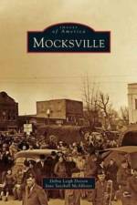
Old photographs offer subjective and evocative evidence of the way we lived and worked in years past. Images of America: Mocksville shares the photographic story of the development of the town of Mocksville and its people to the mid-1900s. Named the seat of newly created Davie County in 1839, the town of Mocksville, originally known as Mocks Old Field, existed as early as the Revolutionary War. Photographs support documentary evidence of various trades as well as agricultural pursuits. Not all buildings or homes survive a town's growth, and Mocksville provides evidence of the passing parade of homes that did not survive. History comes alive as we rediscover and share old photographs and contemplate what they divulge of past times and lives.
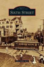
Now listed in the National Register of Historic Places, Sixth Street began more than 170 years ago as the only level pathway into the town of Austin from the east. Originally called Pecan Street, throughout its history the street was also a level playing field for merchants and minorities, for moneyed dynasties and little mom-and-pop places. When Austin was a segregated society, Sixth Street was a standout exception where people of all races lived and worked. By 1871, the arrival of the railroad kindled the explosive development of Pecan Street into Austin's first mercantile center. It was home to Austin's first hotel, Bullock's at Congress Avenue and Pecan Street; the first fight with the government of the new Republic of Texas; and the first brothel. In the 1970s, the commercial district suffered some deterioration. Then, as it has done before, Sixth Street was reborn, this time as the Sixth Street Historic Entertainment District. Loved by Austin residents and visitors alike, Sixth Street is Texas's most famous thoroughfare.
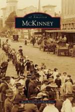
McKinney's very first settlers began arriving from Kentucky, Arkansas, and Tennessee in the early 1840s. Collin County was created by the Texas legislature on April 3, 1846, and due to a provision violation requiring the county seat to be within 3 miles of the center of the county, McKinney replaced Buckner as the seat in 1848. The vote deciding the new seat, however, went in McKinney's favor primarily because flooding kept many citizens from casting ballots. On March 16, 1848, the state legislature passed an act to name the new town in honor of Collin McKinney, one of five original draftees of the Texas Declaration of Independence. Today McKinney is one of America's fastest growing cities and has seen a population boom from approximately 16,000 residents in 1985 to more than 120,000 in 2010.
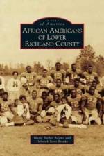
Lower Richland County encompasses approximately 360 square miles in the heart of South Carolina's geographic center. The Wateree River cradles it to the east, and the Congaree River borders the south and southwest. Virginia settlers discovered this rich land over 250 years ago. They became wealthy planters and accumulated large land tracts, creating plantation systems that sustained the economy. From 1783 until 1820, cotton was the principal cash crop, and the slave population increased tremendously and played a vital role in the development of agriculture and the economy in the area.
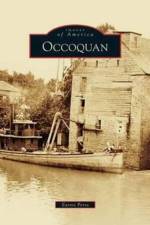
Although Native Americans have lived along the banks of the Occoquan for thousands of years, John Smith was the first European to visit the area, arriving at the river's mouth in 1608. Here he encountered the Dogue Indians, from whose language the river and town take their names. With the coming of settlers, Occoquan's location at the meeting of the Tidewater and Piedmont made it ideal for water-related industry and commerce. By the end of the 18th century, it boasted one of the first automated gristmills in the nation. During the Civil War, Occoquan housed both Union and Confederate troops and was the sight of several small engagements. In 1972, the river, which had provided so many commercial and recreational benefits, revealed a more dangerous side as flooding from Hurricane Agnes caused severe damage. The people of Occoquan rebuilt, and the town evolved into the wonderful mixture of old and new that gives it the unique character seen today.
Perry County has been a major player in the history of Alabama. Native Americans lived and hunted on its land, and it became a county before Alabama gained statehood. Early citizens chose to name it for Oliver Hazard Perry, a hero of the War of 1812. The people of Perry County have played major roles over the years, which include the following: one married Sam Houston; one served as Alabama's first governor during the Civil War; one designed the Confederate flag and uniform; one married Martin Luther King; one was slain by a state trooper, triggering the Selma-to-Montgomery march; and another was the wife of Andrew Young. Along with its history, Perry County is an educational center and the location of many homes that predate the Civil War. Images of America: Perry County features samples of its rich history in photographs.
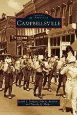
Taylor County became the 100th county in the commonwealth of Kentucky when it was created on March 1, 1848. The county was named after Zachary Taylor, who gained fame as a general in the Mexican War and eventually became president of the United States. The town of Campbellsville, founded in 1817, was selected to serve as the county's seat of government. Throughout its history, the growth of Campbellsville and Taylor County has been marked by both boom periods and years of severe trials and tribulations. Despite the difficulties faced by the residents of Taylor County, its citizens have always shown admirable grit and determination in improving the circumstances of their families and community. Today the county features a diversified economic base that serves a population of 24,069. Of that number, 11,010 reside within Campbellsville's borders.
Sign up to our newsletter and receive discounts and inspiration for your next reading experience.
By signing up, you agree to our Privacy Policy.