Join thousands of book lovers
Sign up to our newsletter and receive discounts and inspiration for your next reading experience.
By signing up, you agree to our Privacy Policy.You can, at any time, unsubscribe from our newsletters.
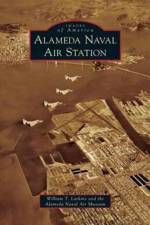
The 56-year history of the Alameda Naval Air Station from 1940 to 1997 was a major military presence in the San Francisco Bay Area. As one of the largest and most important naval air stations in the United States, with a population of 45,000, it occupied 300 buildings to service squadrons and Carrier Air Groups. The large Overhaul and Repair facility operated from 1941 through the jet age, and U.S. Naval Reserve squadrons were added in the postwar years.
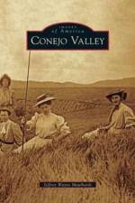
The amorphous Conejo Valley today encompasses the southeastern portion of Ventura County in and around Thousand Oaks, including Newbury Park and Lake Sherwood, near where the I-101 exits Los Angeles County at Westlake Village on its way west and north. Human history in the Conejo Valley dates back to the hunting and gathering days of the Chumash Native Americans. The short Spanish and Mexican periods added a few adobe buildings, erected for respites taken by vaqueros and later cattle rustlers on these rolling grasslands north of the coastal Santa Monica Mountains. In the 19th century, a grand hotel was constructed, and a stage route was established. Grain farmers tried to tame the thirsty hills of the Conejo Valley before the arrival of scenic neighborhoods and malls after World War II.
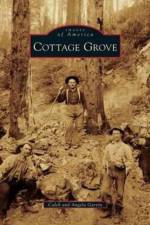
Cottage Grove is a picturesque little hometown nestled in the Willamette Valley. Pioneers following the Oregon Trail west settled in the area in the early 1800s. The Bohemia Mountains were the first major draw to the area after James "Bohemia" Johnson discovered gold in 1863. A gold rush ensued and caused several boom towns to spring up on the route to the mines. After several years, many millions in gold were blasted from the mountains. There is an estimated $14 million in gold remaining in the mountain to this day. With new settlers came the first post offices and schools. When the mining started to slow down, the lumber industry was on the upswing. With easy access to the short line and virgin timber on every hill in the valley, timber became the new boom. Mills sprung up almost overnight, and in some cases burned in a single night. At one time, there were 23 mills on Row River alone.
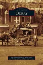
Situated in a spectacular basin surrounded by 13,000-foot peaks, the city of Ouray has captured the eye of adventurers from its beginnings, while the glitter of gold and silver brought prospectors to its mountains. The Uncompahgre Utes hunted and soaked in their sacred hot springs for generations, but about one year after Chief Ouray's death, they were removed from their homelands to a reservation in Utah. Mines and mining camps proliferated in the harsh, remote high country, where rugged terrain hampered the transportation of ore and supplies, even after toll roads and railroads lessened isolation. Ouray (pronounced "Yurr-AY") developed into a Victorian community with families, churches, and schools contrasted with rowdy saloons and so-called "fancy ladies." Ouray further embraced tourism after mining waned, and heritage preservation remains an ongoing concern.
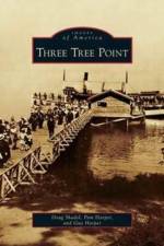
Three Tree Point is a prominent peninsula on the eastern shore of Puget Sound about 14 miles south of Seattle. Its name came from three massive fir trees that stood on the north side of the point at the beginning of the 20th century. The area remained largely undeveloped until 1903 when the Three Tree Point Company began marketing the community as a place to build summer homes. Seattle's business elite built houses at the point to take advantage of the beach lifestyle for which it has become known. Over the years, Three Tree Point and its 2.5 miles of waterfront emerged as one of the Northwest's most unique residential communities. Its history is a diverse mixture of family life, unusual characters, Fourth of July celebrations, shipwrecks, fishing derbies, and storytelling.
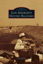
Baseball's long and storied history in Los Angeles has been played at venues including the turn-of-the-century Chutes Park, which was part of an amusement park, as well as Gilmore Field, where the Hollywood Stars played, and Wrigley Field, where many movies and television shows were filmed. The 1923-vintage Los Angeles Memorial Coliseum became the Dodgers' first home in California in 1958, when they moved from Brooklyn. Greater Los Angeles also featured professional baseball at Olive Memorial Stadium in Burbank, Brookside Park in Pasadena, on Catalina Island, plus at numerous diamonds throughout Orange and Riverside Counties, where legends including Babe Ruth, Joe DiMaggio, and Connie Mack appeared. Most fans know Dodger Stadium and Angel Stadium, but many other historic ballparks existed in Southern California. Their images are collected together here for the first time.
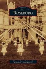
Originally called Deer Creek, Roseburg was the creation of entrepreneur Aaron Rose. After becoming county seat for Douglas County in 1854, the city's growth was assured. Roseburg became the bridge between the populated Willamette Valley and the mining districts of Southern Oregon. Situated in a panoramic valley created by the North and South Umpqua Rivers, Roseburg's population increased dramatically over the next 155 years. In 1872, the Oregon and California Railroad arrived and the city became a major center of commerce in Oregon. Today Roseburg continues to present a serene and picturesque face to cars rushing by on I-5.
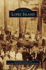
The story of Lopez Island is a story of community. Skilled, brave, generous people like Sampson Chadwick, Mother Brown, Captain Barlow, and Amelia Davis carved a spirited, nurturing community out of seaside wilderness. Homesteaders cleared forests, built farms, grew food, and raised large families, surviving then thriving together. The hamlets of Port Stanley, Richardson, and Lopez emerged, creating hubs with stores, post offices, and schools as well as thriving fishing, canning, and shipping industries. The community fostered education, music, writing, dances, chivarees, baseball, quilting, a birthday club, and grand Fourth of July celebrations. Living self-reliant lives while helping friends, neighbors, and newcomers, Lopezians created a unique community character that abides today.
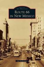
New Mexico is "The Land of Enchantment," offering a fascinating blend of Native American, Spanish Colonial, and Western American cultures. The travelers from the East knew they had arrived in the great Southwest when they entered New Mexico--the towns along Route 66 were ablaze in neon, and the motels lured travelers with Western themes, Pueblo Revival architecture, and Native American trading posts. An adventure still awaits the traveler today who takes the time to exit I-40 and leave the franchised blandness behind. The neon still flickers at the Blue Swallow Motel in Tucumcari, on Central Avenue in Albuquerque, and at the El Rancho Hotel in Gallup. The "Fat Man" still smiles at Joseph's Bar and Grill in Santa Rosa. The stories behind those landmarks are here, as well as the stories behind establishments that are lost forever or slowly crumbling to dust among the tumbleweeds.
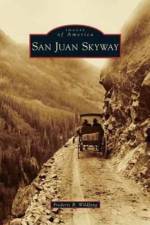
The "scenic route" in southwestern Colorado means the San Juan Skyway, a 236-mile loop created by U.S. Routes 550 and 160 and State Routes 62 and 145. The Skyway wends through glacial valleys and over high passes between some of the most breathtaking, ice-sculpted peaks in the Rocky Mountains. Native Americans, pioneering mountain men, miners, and railroaders inhabited these slopes. Although the Skyway towns of Durango, Silverton, Ouray, Ridgway, Telluride, Rico, Dolores, and Cortez were first connected by wilderness trails and railways, the loop's final modern section of highway between Coal Bank and Molas Passes was completed in the 1940s. The rugged San Juan Mountains were the backdrop for exploits by Butch Cassidy and Wyatt Earp, but, as author Frederic B. Wildfang notes, the scenery is also "a syllabus for a course in geology."
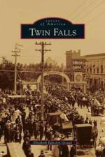
Images of America: Twin Falls tells the story of the transformation of a sagebrush plain into productive farmland at the beginning of the 20th century. Engineers and investors found a way to capture the water of the Snake River for extensive irrigation and completed Milner Dam and the related canal system in 1905. The success of the Twin Falls South Side Irrigation Tract was associated with other reclamation projects in the region, resulting in the permanent settlement of south-central Idaho. New residents built modern schools, fine homes, and imposing business blocks. Prosperous farms and orchards dotted the landscape. Twin Falls became a wholesale center for storing, processing, and shipping agricultural commodities in the United States and abroad.
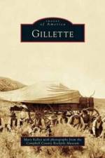
There is an old saying that the Powder River was "a mile wide; an inch deep; too thick to drink; too thin to plow," and yet it was fought over many times in the early settlement of northeastern Wyoming. The lure of free land attracted tough pioneer families and rowdy outlaws to the new town of Gillette. Bars and brothels competed with schools and churches for the cowboys of some of the largest cattle and sheep ranches in the state. The coal that was discovered close to the surface, which first supplied settlers through blizzards and prairie winds, now provides one-third of the nation's energy. Ranching is still important in Gillette's economy but the abundant minerals have truly put Gillette, Wyoming, on the map.
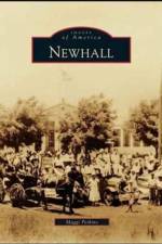
Newhall's many firsts include the first gold discovery in California and the first commercially successful oil well, which led to the first pipeline and oil refinery in California. Some of the earliest movie location filming was done here. First recorded by Juan Crespi on the Sacred Expedition of 1769, the Little Santa Clara Valley was recognized by the Spanish as an important junction between the mountain ranges separating Northern and Southern California. The early city fathers of Los Angeles saw the settlement of Newhall as an integral part of their strategy for growth from the days of the stagecoach and railroad through to the building of Ridge Route and Interstate 5. This book tells the story of the town that never quite lived up to its potential but still managed a varied history with a colorful cast rivaling those of the movies filmed here.
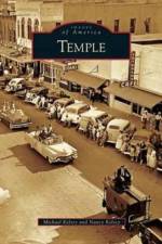
The Gulf, Colorado, and Santa Fe Railroad founded the town of Temple in 1881. Named in honor of the railroad's chief engineer, B. M. Temple, the town lies in the finest agriculture belt in Texas. Prior to the arrival of the railroad, farmers of Bell County transported cotton, grain, and produce to the nearest railroad terminus at Waco, Cameron, Calvert, or Rockdale on a difficult three-day trip. Moving these goods became much easier with the arrival of the railroad, and Temple became an important center for trade. By 1912, Temple was the most important revenue-producing station on the Gulf, Colorado, and Santa Fe Railroad south of Kansas City. Early on, the railroad established a hospital for employees, and by 1900, there were three hospitals: St. Mary's Sanitarium, Santa Fe, and King's Daughters. Temple's importance as a trade center contributed to an early and sustained population growth. The city of Temple promotes the community's history with the annual Pioneer Day celebration.
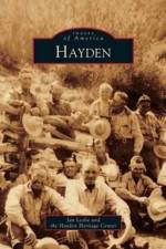
The Hayden area's first settlers, who arrived around 1875, were certain that their hamlet would become the hub of Northwest Colorado. The first regional trading post, Routt County Courthouse, and U.S. post office were established here on the banks of the Yampa River. Nestled in the Yampa's wide, verdant, high-country valley at 6,300 vertical feet, the energetic little town's future was peopled by an assortment of penniless yet hopeful dreamers as well as enterprising ranchers and other businessmen. Ezekiel Shelton brought his family and a myriad of skills. Jim Norvell drifted in on foot and with a few dollars established a mercantile and saloon and later, after "finding religion," a church. While the towns of Craig to the west and Steamboat Springs to the east grew, Hayden retained its familial descendants--"stayers"--enamored of their corner of the beautiful Rocky Mountains and sheltered from most severe weather in the Yampa Valley.
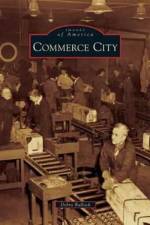
Among Colorado's fastest growing cities in the 21st century, Commerce City was settled in the 1850s, located today 8 miles northeast of Denver's capitol building. Known for hog farms, truck farms, and dairies, as well as refineries and grain elevators, Commerce City was, during World War II, the site of the enormous Rocky Mountain Arsenal, a U.S. Army weapons manufacturing facility. Incorporated in 1952 as Commerce Town, the name was changed to Commerce City in 1962, which adopted home rule in 1970. Commerce City is regionally famous and nationally recognized for parks and recreation, Buffalo Run Golf Course, Mile High Kennel Club (dog racing), and nearby Rocky Mountain Arsenal National Wildlife Refuge. The new Commerce City Civic Center and Dick's Sporting Goods Park, which is home to pro soccer's Colorado Rapids, were completed in 2007. Commerce City remains a speedily changing municipality with a diverse cultural mix and generations of residents with strong community roots.
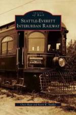
Operating for 29 years, the Seattle-Everett Interurban Trolley traveled over 29 miles of rail carrying passengers and freight to nearly 30 stops along its line. In the first decade of the 1900s, the Boston electrical engineering firm of Stone and Webster had designs of building an interurban electric railway system that would eventually connect Olympia, Washington, and Vancouver, British Columbia. To start the Seattle north link, they purchased the existing Seattle-Everett Interurban Railway Company from Fred E. Sander in 1908. On the early morning of April 30, 1910, the Seattle-Everett Interurban Trolley made its inaugural run, starting in Everett. On February 20, 1939, the trolley left Everett for its last run.
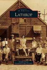
First home to Yokut Indians, then trappers, hunters, and fishermen, Lathrop was founded by Leland Stanford in 1869 as a railroad town and an answer to Stanford's frustration with his railroad attempts in Stockton. Lathrop's rich history includes the railroad, its Delta waterways, manufacturing and distributing industries, and the fascinating tale of California Supreme Court justice David S. Terry's murder (Terry had previously fought and won the last legal duel in California with U.S. senator David C. Broderick just outside of San Francisco). Reportedly named in honor of a relative of Leland Stanford Jr., today's Lathrop evolved from rugged railroad beginnings to a growing and vibrant community of close to 20,000 residents.
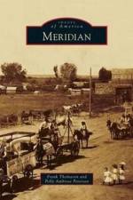
Eight miles west of Idaho's capital city, Boise, the first settlers in what became Meridian found only arid land, sagebrush, and jackrabbits. The lone tree in the area was another 8 miles west in what became Nampa. Originally called Hunter, after a railroad superintendent, Meridian was initially a railway postal drop where workers tossed and hooked mailbags as the train passed through before the arrival of passenger service. By 1893, residents called the village Meridian, after the north-south prime meridian running through Meridian Road. In 1903, the village incorporated but still had a population of only a few hundred with grocery and harness shops and more churches than saloons. Village merchants and residents experienced orchard and dairy/creamery eras that ended in, respectively, the 1940s and 1970. Meridian became a city in the 1940s but 50 years later had a population of only 10,000. That number quadrupled over the next decade and today has nearly doubled again to around 80,000, as Meridian has evolved into the transportation and commercial hub of the Treasure Valley, especially in electronics and health care.
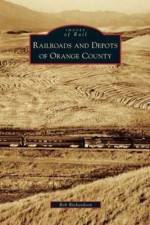
Railroads have been a part of Orange County for over 130 years. The great names of American railroading--Atchison, Topeka, and Santa Fe; Southern Pacific; and Union Pacific--were firmly planted here by the early 1920s and linked with the largest interurban rail system in the United States, the famed Pacific Electric Railway. Thousands of people passed through Orange County's depots during the 1940s as they came to serve at the many military bases located here during World War II. The names have since changed, and yet the county's rail scene remains as dynamic as ever, with Amtrak, Metrolink, and amusement park railroads joining the Burlington Northern Santa Fe and Union Pacific. Railroad depots, new and old, are located across Orange County and continue on both as vital parts of history and the future of transportation for America's fifth most populated county.
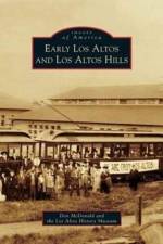
Los Altos would never have existed if not for the Southern Pacific Railroad. Since the 1850s, Los Altos, Spanish for "heights" or "foothills," was the name generally applied to the two ranchos (San Antonio and La Purisima Concepcion) between Palo Alto and Mountain View southwest of El Camino Real. In 1906, visionaries Paul Shoup, who worked for the railroad, and Walter Clark, a Mountain View real estate developer, saw the potential to turn Sarah Winchester's ranch near Stanford University into an ideal San Francisco suburb. They would capitalize on new commuters-those who wanted to live in comfort in the country but work in the city. Slowly, a new town grew in influence well beyond its original Altos Land Company plat, realizing tremendous post-World War II expansion. Now two communities solidly embedded in Silicon Valley, Los Altos and Los Altos Hills share a school system, downtown shopping, libraries, and water system, as well as a history of interesting people.
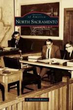
In 1910, the North Sacramento Land Company purchased 3,339 acres to establish the city of North Sacramento. Three years later, Del Paso and Company set up power and water operations, along with rail transport. A police and fire department and school sealed the deal, and the city incorporated on June 18, 1924. In this idyllic hometown, parents allowed their kids to walk "the Boulevard" unattended, skate at Iceland, and cool off in Woodlake Pool, after they stopped in at Li'l Joe's or Sammy's for a bite or a donut at Hoyt's. The city thrived with characters like Mama Marks, Mayor Olga Roth, and entrepreneur Betty "Boop" Bryan. Pugilist Max Baer sparred in the open-air theater before the screen came down to the sawdust floor for a Tom Mix movie.
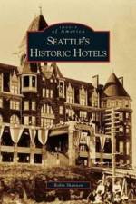
Mary Ann Conklin, also known as "Madame Damnable," ran Seattle's first hotel, the Felker House, which burned to the ground in the Great Seattle Fire of 1889. The Rainier Hotel was erected quickly following the Great Seattle Fire but razed around 1910. The Denny Hotel, an architectural masterpiece later known as the Washington Hotel, was built in 1890 but torn down in 1907 during the massive regrade that flattened Denny Hill. Upon opening in 1909, the Sorrento Hotel was declared a "credit to Seattle" by the Seattle Times. The Olympic Hotel was the place for Seattle's high society throughout the 1920s. The Hotel Kalmar was a workingman's hotel built in 1881 and was razed for the Seattle tollway. The Lincoln Hotel was destroyed by a tragic fire in 1920, along with its rooftop gardens. The famous and grand Seattle Hotel in Pioneer Square was replaced by a "sinking ship" parking garage, thus sparking preservationists to band together to establish Pioneer Square as a historic district.
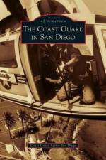
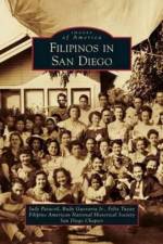
Filipinos have been a part of the history of the United States and San Diego for over 400 years. The Manila-Acapulco galleon trade ships included Filipinos on sailing expeditions to California, including the port of San Diego. After the Philippines became a territory of the United States in 1898, many Filipinos began immigrating to San Diego. The community grew rapidly, particularly in the 1920s and 1930s. After World War II, Filipino veterans returned with their war brides and the community began to build further. The Immigration Act of 1965 increased Filipino immigration into San Diego to include military personnel, especially those enlisted in the U.S. Navy, as well as professionals. Today Filipino Americans are the largest Asian American ethnic group in San Diego.
Sign up to our newsletter and receive discounts and inspiration for your next reading experience.
By signing up, you agree to our Privacy Policy.