


Join thousands of book lovers
Sign up to our newsletter and receive discounts and inspiration for your next reading experience.
By signing up, you agree to our Privacy Policy.You can, at any time, unsubscribe from our newsletters.
In this collection of vintage-photograph postcards, Lyn Bleiler explores the city's past.
Cotton was king during Bryan's early history. Many prominent planters and farmers lived on the high ground between the Brazos and Navasota Rivers in the market town of Bryan, and the cotton crop thrived in the fertile Brazos River Bottom. The railroad's arrival after the Civil War provided a link to textile mills in other parts of the world via the nearby ports of Houston and Galveston. Land availability and economic opportunity attracted settlers not only from the southeastern United States, but also from Italy and Eastern Europe. When cotton's economic dominance began to wane, other agricultural crops, livestock, a strong commitment to education, and oil and gas production diversified the local economy. As the seat of county government, and with its close proximity to Texas A&M University, Bryan today is a vibrant community strategically located in the heart of the Texas Urban Triangle.
The first land-grant college in Texas--called the Agricultural and Mechanical College--was predominantly a military school, built in 1876 in a then-remote area of Central Texas. Like other developments, the institute was a result of the expanding railroad, so a station named "College" was erected to service the new school. Drawing newcomers to the area, the city of College Station was incorporated in 1938, and its size soon rivaled that of neighboring Bryan--the Brazos County seat. The College Station area offers a surprisingly diverse mix of attractions, including the George Bush Presidential Library, the Texas Motor Speedway, and Kyle Field. During the last century, the college has grown from a few hundred students into a major university with more than 48,000 students, making Texas A&M the seventh largest school in the nation. Today College Station is home to some 100,000 people.
During the 1870s, there was wondrous change in West Texas. The area was ripe for settlement, and as the Texas and Pacific Railroad pushed west from Fort Worth, towns began springing up along the tracks. Ranchers coming to the area took advantage of the vast grasslands, and the new arrival of settlers was the beginning of a town named Abilene. Deriving its namesake from the town of Abilene, Kansas, the locals hoped the city would become a shipping point for cattle on their way to eastern markets. The town has since grown to be one of West Texas's most thriving metropolitan areas. The city--which is home to Dyess Air Force Base--is also well known for its numerous parks, schools, universities, and historic neighborhoods that are enjoyed by its 120,000 residents.
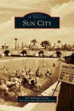
Sun City, Arizona, the nation's first master-planned, active-adult retirement community, reinvented the definition of "retirement living" when it opened its doors in 1960. Located 14 miles northwest of Phoenix, this community was cultivated from the dusty desert cotton fields once known as Marinette Ranch. Developed by master builder Del E. Webb, Sun City combined affordable housing with recreational amenities to create a lifestyle designed to rejuvenate the body and keep the mind and spirit feeling forever young. Sun City's success gave birth to an entirely new industry catering to older Americans. The famous "Sun City Lifestyle" remains as popular today as it was in 1960.
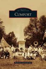
Ernst Altgelt and people from what is now Germany founded Comfort in 1854 in the Guadalupe Valley of the Texas Hill Country. When the Civil War began, many of these freethinking people opposed secession. Some attempted to go to Mexico and were surprised by Confederates near the Nueces River. A few Unionists escaped; some were killed, and others were wounded and later killed. In 1865, friends and relatives retrieved their remains, and they now lie under the Treue der Union Monument. The first school was built in 1856, but not until 1892 did Comfort build a church. Charles Apelt created the Armadillo Farm, which made lamps, purses, and baskets from armadillo shells. Today descendants of original settlers live on family ranches and in houses built by their ancestors. Comfort is unincorporated to this day, and it retains a sense of its freethinking independence.
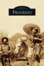
Spanish for "progress," Progreso is famous for the millions of tourists, known as "Winter Texans," who drive through the town to visit Mexico. Rumor has it that Al Capone did the same thing during Prohibition. Perhaps the first visitor captivated by the Rio Grande was Juan Jose Hinojosa, as he asked the Spanish crown for rights to the land that is now Progreso on July 4, 1776. But it was Florencio Saenz, founder of the iconic Toluca Ranch, who requested a U.S. post office in 1896. Connecting to the Spiderweb Railroad in the 1920s gave the town a short-lived commercial farming boom that attracted prominent investors. In the late 1940s, though, two disastrous freezes killed the citrus industry, and farmers switched to vegetables and cotton. After the Progreso International Bridge was built in 1953, growers gained access to the Mexican market, an advantage that continues to attract people to this small town along the Rio Grande.
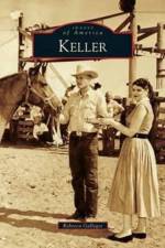
In the late 1800s, pioneers settled in the northeast Texas region of Cross Timbers known as Double Springs. In 1875, Isaac Roberts, a farmer who owned more than 600 acres, left a parcel of his land to A. G. Roberts, who then sold the right-of-way to the Texas and Pacific Railway for $25. A new town was formed, and in 1882, it was named Keller in honor of the railroad foreman who was instrumental in making the area a regular stop along the railroad. With the railroad bringing new visitors and residents, a post office was created in 1888, and new businesses started forming. The Works Progress Administration provided jobs for many Keller residents during the Great Depression, and the results of those projects shaped the way the city looks today. As of 2010, Old Town Keller was undergoing a new phase of revitalization while maintaining its connection to the hardy pioneers that once called Keller home.
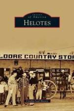
A small town with a big history, Helotes--20 miles northwest of downtown San Antonio--was named for the Spanish word elotes, or corn on the cob. So extensive were the fields of corn along its namesake creek, a Spanish official in 1723 called the area el Puerto de los Olotes, or Corncob Pass. When settlers later arrived, few ancient cornfields remained. Situated along Bandera Road, the town became a stagecoach stop, and a post office was established in 1873. Nevertheless, the settlement remained rural for the next 100 years. Helotes, known as a place to "let down yer hair and kick up yer heels," solidified its reputation in 1946, when John T. Floore Country Store, a dance hall and concert venue for top-rated country musicians, opened for business in downtown Helotes. The annual Cornyval Festival, inaugurated in 1966, continues this tradition. Incorporated in 1981, the town provides a verdant and hilly escape from the city.
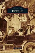
In 1849, German "Freethinkers" had been dreaming of a communal utopia, free from oppression by church and state. They settled in Texas on the Cibolo Creek, where Native Americans and Spanish explorers had gone before them. The experiment evolved into a frontier outpost, a stage stop, a health spa, a railhead, a small village, a brief chapter in the Civil War, and a farm and ranch community. Boerne is now a tourist destination and a lovely place to live. This collection of pictures and stories explores what has been amazing, unique, and a little odd about this bend in the Cibolo, as well as the history of local conservation efforts. As the little town of Boerne goes through its inevitable growing pains, it is important to remember its special people and places, and what is worth saving.
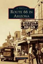
Route 66 in Arizona is a ribbon tying together spectacular natural attractions such as the Grand Canyon, the Petrified Forest, the Painted Desert, and the Meteor Crater. There were plenty of man-made diversions along the way, too. Roadside businesses used Native American and Western imagery to lure travelers to fill up their gas tank, grab a meal, or spend the night. Roadside signs featured shapely cowgirls and big black jackrabbits, or warned of killer snakes and prehistoric monsters. Between wails of "Are we there yet?" children pleaded to stay at motels shaped like wigwams, explore the Apache Death Cave, or pick up a rubber tomahawk at a trading post.
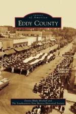
Eddy County's 4,198 square miles were carved from the massive land holdings of Lincoln County, then the largest county in the United States, on February 25, 1889. Early Spanish explorers and Native Americans had used the seemingly endless water supply of the Pecos River, which bisects the county, as a trail to the north. Seven Rivers, the first settlement in the Pecos Valley, battled the newly formed town of Eddy for the honor of remaining county seat. Eddy won by a vote of 331 for and 83 against. Although born in lawlessness and diversity, the county flourished as the discoveries of oil, gas, and potash brought industry to support the established fertile agricultural and cattle foundations. This volume explores the early founding families and pioneers and brings to light many of the long-forgotten towns of Dayton, Lookout, Oriental, and Globe that helped form the Eddy County of today.
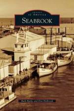
Seabrook enjoys a prime location on Galveston Bay at the outflow of Clear Creek. Formerly a Spanish land grant known as Morris Cove, the town began to assume its modern shape in 1895 when Seabrook Sydnor purchased part of the Morris league and platted the town site. Brothers Albert and Ernest Fay founded the Seabrook Shipyard in 1938, which went on to build submarine chasers and rescue boats during World War II. The year 1961 was a landmark moment for Seabrook: Hurricane Carla hit on September 11, and a week later, the National Aeronautics and Space Administration (NASA) announced that its Manned Spaceflight Center would be built in nearby Clear Lake, launching a period of accelerated growth. Fearing annexation by Houston or La Porte, Seabrook leaders took steps toward incorporation that same year. Today Seabrook is listed on the Great Texas Coastal Birding Trail and is part of the third largest boating community in the United States.
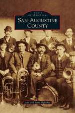
San Augustine has been called the "Eastern Gateway into Texas" for more than three centuries. Many immigrants crossed the Sabine River and followed El Camino Real to the little settlement nestled on each side of this ancient roadway. Alamo-bound David Crockett wrote his last letter to his daughter Margaret from San Augustine on January 9, 1836. Davy's words echoed the favorable impressions expressed by new arrivals to Texas: "I am hailed with hearty welcome to this country . . . The cannon was fired here in San Augustine on my arrival. What I have seen of Texas, it is the garden spot of the world, the best land and the best prospects for health I ever saw, and I do believe it is a fortune to any man to come here." San Augustine County still retains the charm of times past through her well-preserved 19th-century homes and churches. Images of America: San Augustine County profiles these cherished landmarks and others through the vintage photographs of local historical groups, family collections, and private archives.
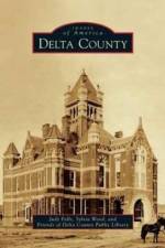
During the frenetic days of Reconstruction, Delta County claimed land between two branches of the Sulphur River, from Lamar and Hopkins Counties, and named itself after its shape and the third letter of the Greek alphabet. From its early days, Delta County became home to prosperous farmers who relocated from the South and who brought with them their knowledge of growing cotton as well as their traditions and cultures. At its heyday in the 1920s, the county boasted the densest rural population in the state. These pioneers believed strongly in education, and more than 40 schools dotted the county at one time, with many graduates of these rural schools becoming doctors, engineers, teachers, politicians, ministers, authors, musicians, lawyers, coaches, scientists, and athletes--as well as one All-American. For those who remained, those who returned, and those who chose this quiet corner of Northeast Texas, Delta County is home, with all the sweet and poignant implications of that word.
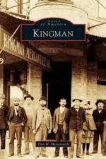
Kingman, county seat of Mohave County in northwestern Arizona, owes its beginning and subsequent prosperity to the building of the Atlantic and Pacific Railroad in 1882. The city was named for the project's chief engineer, Lewis Kingman. The initial railroad siding quickly became a supply center for mining and ranching operations that dotted the beautiful surrounding valleys and mountain ranges. Through the years, Kingman has been at the crossroads of rail, highway, and air transportation routes. A B-17 bomber gunnery training base brought changes by exposing the area's potential to thousands of soldiers during World War II, many of whom would later return. Actor Andy Devine grew up here, Clark Gable and Carole Lombard were married here, and Charles Lindbergh would establish a route for Transcontinental Air Transport through here. Today Kingman is the "Heart of Historic U.S. Route 66" and is located in the middle of the longest remaining stretch of the "Mother Road," making it a must-see destination for thousands of tourists each year.
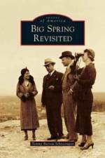
In West Texas, the land that would one day become Big Spring was originally home to Comanche Indians. In 1880, the Texas Rangers were sent ahead of the railroad to establish peace among the ranchers and to protect the western frontier from the Comanche who lived there. New Texans began to follow the railroad from Colorado City to Big Spring, which was named the county seat of Howard County in 1882. The small Texas town once known for its saloons, dance halls, shoot-outs, and gambling grew into an oil- and agriculture-rich community. This pictorial collection illustrates the continual progress that Big Spring has made, from the first wooden buildings thrown together on First and Main Streets to the discovery of oil. Big Spring also experienced economic booms with the building of an oil refinery, an air force base, and the rise of the cattle industry. Today this once-small West Texas town is dotted with wind farms, an oil refinery, and three hospitals.
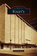
The story of Foley's began in Ireland in the late 1800s when William L. Foley set sail for America. Ambition led him to Houston, where he opened a store and hired his two nephews, Pat C. and James. The nephews quickly felt an entrepreneurial urge to run their own store, so their uncle gave them $2,000 to get started. On February 12, 1900, the Foley Brothers Dry Goods Company at 507 Main Street opened for business. Approximately 44,000 residents visited the store that day, and sales of $128.29 were tabulated. Soon after Spindletop was discovered, Robert I. Cohen of Galveston bought the Foley Brothers company for his son George S. Cohen to operate. Cohen, along with the aid of six of the eight Meyer brothers from Galveston, built it into the largest store in Texas. In 1945, Fred Lazarus, from the department store clan in Ohio, came to Houston to visit his son at Ellington Field. He saw Houston's potential, and in 1946, Foley Brothers became Foley's, owned by Federated Department Stores.
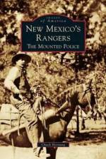
The New Mexico Mounted Police were forged from a frontier civil crisis and hammered to life upon the anvil of necessity. The Sunshine Territory of New Mexico had become the last outlaw haven in the Southwest. In the tradition of their red-coated namesake, the Northwest Mounted Police of Canada, this small band of range riders used their fists, guns, and brains to restore law and order during the closing years of New Mexico's territorial era. They carried their mission forward into the early days of statehood.
The Tucson Mountains are located several miles west of downtown Tucson. For thousands of years, this mountain range has been inhabited, explored, and traveled by Native Americans who settled near the Santa Cruz River. Homesteaders, prospectors, and ranchers arrived in the late 19th century, drawn by the area's close proximity to Tucson and the Southern Pacific Railroad, as well as the promise of land and mineral wealth. During the past 100 years, conservation efforts to preserve and enhance the community's understanding of this geologic treasure have led to the establishment of museums and parks, including Tucson Mountain Park, the Arizona-Sonora Desert Museum, and Saguaro National Park West. Old Tucson Studios has used the surrounding Tucson Mountains as a movie backdrop for more than 70 years. The White Stallion Ranch and the J. W. Marriot at Starr Pass make the Tucson Mountains a popular destination for visitors who want to experience the rugged beauty and character of the American Southwest.
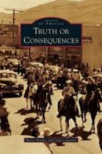
"Hot Springs, New Mexico, Ain't That Any More" was one of the headlines on April 4, 1950, in the Gallup Independent. As a publicity stunt, Ralph Edwards had invited a town to change its name to "Truth or Consequences," the name of his popular radio quiz show, and Hot Springs agreed to do so. Since the late 1800s, the area has attracted health seekers to bathe in and drink from the area's hot mineral springs. The region is home to Elephant Butte Dam and lake, completed in 1916, which remains one of the largest irrigation dams in the United States. Carrie Tingley Crippled Children's Hospital, built in 1937 by New Mexico governor Clyde Tingley, utilized the natural hot mineral waters to treat children with polio. From the placement of the Hot Springs Bathhouse and Commercial District on the State and National Register of Historic Places to the centennial celebration of Elephant Butte Dam, Truth or Consequences continues to grow and develop while still honoring its heritage.
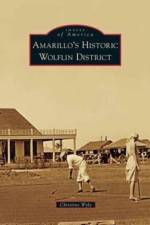
"Author Christine Wyly is an Amarillo realtor whose interests in architectural design and history drew her to this project. Wyly collected vintage images from the pioneer families and current residents of the Woflin Historical District, as well as from the archives of the Amarillo Public Library to tell the story of Amarillo's Historic Wolfin District"--P. [4] of cover.
The Houston and Texas Central Railroad made its way through eastern Ellis County in 1871 and played an integral role in the founding of Ennis, Texas. Eventually, that community would be designated as a division point along the line. The H&TC's arrival also brought growth and prosperity to other communities on the line, including Alma, Garrett, Palmer, and Ferris. It made its mark on the area. The Waxahachie Tap was the vision of many of that city's earliest settlers. Within a decade of its completion in September 1879, Waxahachie's cotton production multiplied and the town would soon earn the moniker "Where Cotton Is King." Midlothian and its surrounding communities would never be the same once connected by the Chicago, Texas, and Mexican Central Railroad in 1881. The rail had arrived and Ellis County was transformed.
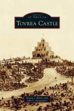
For more than 80 years, the remarkable, wedding cake-like structure located on the eastern fringe of Phoenix has intrigued residents and visitors alike. Perched on a granite promontory, Tovrea Castle at Carraro Heights reflects the dreams of several people. Alessio Carraro started construction in 1929, but the Depression spoiled his dream of a magnificent resort. E. A. Tovrea purchased the property in 1931 but died soon thereafter. Tovrea's widow, Della, after marrying William Plato Stuart in 1936, moved back and forth between the castle and Prescott, depending on the weather. When Stuart died in 1960, Della lived in the castle until her death in 1969. For many years after her death, the castle stood lonely and neglected, and it held its mystique because few people were ever invited inside. In 1993, the castle and surrounding acreage were acquired by the City of Phoenix for a new purpose: transformation into a city park.
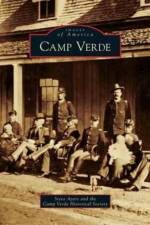
In February 1864, a party of 17 men and two women left the security of the territorial capital at Prescott, Arizona, and headed east into the Verde Valley, homeland of the Yavapai and Apache. Drawn by the promise of ample water, rich bottomland, and lush grassland, the party established a farming and ranching community near the confluence of West Clear Creek and the Verde River. In spite of conflict with the Yavapai and Apache, the settlement survived, due in part to the establishment of a military presence late that summer. Over the next 35 years, the settlement at Lower Verde thrived around the army fort, and became known as Camp Verde. In 1891, Fort Verde was abandoned, and the surrounding land opened to homesteading in 1895. The post sold at auction in 1899. Built among the ruins of the ancient Sinagua culture and situated along the banks of the Verde River, Camp Verde remains an agricultural paradise and a haven for those wanting to escape city life.
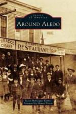
In the mid-19th century, a few hardy settlers of European descent carved out farms in the Clear Fork Valley of present-day Parker County, attracted by the area's springs, tributaries, and a burgeoning market in nearby Fort Worth. For centuries, Comanche and Kiowa had inhabited the land, and a period of dramatic conflict ensued, exacerbated by the Civil War absence of able-bodied husbands and sons. By 1880, ranches and settlements flourished, aided by the Fort Worth-Yuma cattle trail and a Texas and Pacific Railway line connecting Fort Worth to the county seat of Weatherford. As the first mail stop in the newly formed county, Aledo was briefly dubbed Parker Station before having its name changed in 1882--a bow to a railroad engineer's Illinois hometown. Today segments of Bankhead Highway, the nation's first paved transcontinental highway, wind around Aledo, the Annettas, Willow Park, and Hudson Oaks, thriving communities that offer a pastoral lifestyle minutes from the urban amenities of the Fort Worth-Dallas Metroplex. Mere fragments remain of Newburg, Prairie Hill, Willow Springs, and other old settlements, visible only to old-timers and lost to living memory.
Sign up to our newsletter and receive discounts and inspiration for your next reading experience.
By signing up, you agree to our Privacy Policy.