


Join thousands of book lovers
Sign up to our newsletter and receive discounts and inspiration for your next reading experience.
By signing up, you agree to our Privacy Policy.You can, at any time, unsubscribe from our newsletters.
Although once part of a much larger area of southwestern Pennsylvania, Bethel Park has carved its niche into the rolling hills of Allegheny County with its rich history, interesting stories, and fascinating people. Incorporated in 1886 as Bethel Township, Bethel Park has seen its landscape prosper and change from agricultural to industrial and finally into the largest populated suburb in Allegheny County's South Hills neighborhoods. Advances in transportation and industry transformed Bethel Park into an inviting community of family homes, distinguished schools, and well-established local businesses. Bethel Park was also one of the key sites in the famed Whiskey Rebellion; the location of the first documented armored car robbery; the burial site of famed pop artist Andy Warhol; and the home of well-known writer, producer, and narrator Rick Sebak.
Presents a pictorial look at the history of Mount Manresa, the country's first retreat house for the public.
In 1772, portions of Providence received water through a system of hollowed out logs. By 1869, seventeen years after Zachariah Allen campaigned for a public water supply, the public voted in favor of introducing water into the city from the Pawtuxet River in Cranston. By 1900, it was clear that more, purer water was needed. A public law was approved on April 21, 1915, creating the Providence Water Supply Board and granting the power to condemn 14,800 acres to create the Situate Reservoir. Today the reservoir is the largest inland body of water in Rhode Island, supplying over 40 billion gallons of water to residents.
Since its settlement in 1639, the town now known as Wakefield has enjoyed a rich and varied history. Wakefield Revisited celebrates the personality of this community. Featured are some of the town's most unforgettable characters; from 19th-century house painter Franklin Poole, who captured the town's character in a myriad of rare, precise oil paintings, to the fascinating strong women who played a major role in forging the personality of Wakefield. In these pages, the reader will visit nearly forgotten landmarks, buildings, and sites and rediscover the long-lost businesses and industries that made Wakefield "the most enterprising community north of Boston." Capping it all will be images of celebrations, from Grand Army of the Republic marches to the high school relocation procession to the town's trademark Fourth of July parade, which has evolved into the largest Independence Day parade in Massachusetts.
The Susquehanna River meanders through Luzerne County in northeastern Pennsylvania, passing communities historically known for the mining of anthracite coal. Settlement of the area began in 1769 during the first Yankee-Pennamite War. Luzerne County illustrates many boroughs, townships, and villages in a rare collection of photographs, advertisements, and history dating back to the 18th century. Historical photographs from the Luzerne County Historical Society depict businesses, churches, coal culture, street scenes, area disasters, entertainment, railroads, steamboats, and veterans, including the last survivor of the Battle of Wyoming in 1778 and the Civil War.
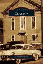
The area now known as Clayton was settled shortly before the American Revolution by Jacob Fisler, the son of a Swedish immigrant. Fisler's land grew to become known as Fislertown, later renamed Fislerville, and in 1864 was deemed Clayton. Jacob Fisler and his business partner, Benjamin Beckett, began the manufacturing of glass in this new town. Clayton's glassblowing industry has had many names, from Moore's to Pierce to Clevenger, and was the heart and soul of the community for well over 100 years. While some of Clayton's historic buildings have fallen victim to the hands of progress, many remain and are inhabited by new businesses, which grow and thrive in this small community. Much has changed in Clayton, yet it continues to be a proud community.
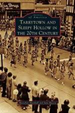
Located just miles north of New York City, the Hudson River villages of Tarrytown and Sleepy Hollow experienced the highs and lows of the 20th century. The villages experienced life in a grand scale from the 1909 Hudson Fulton Celebration to the 1970s village centennial and American bicentennial festivities. Photographs from the collection of the Historical Society serving Sleepy Hollow and Tarrytown bring the 20th century to life. Tarrytown and Sleepy Hollow in the 20th Century includes images of local and world-renowned personalities, the changing business landscape, growth and consolidation of the public schools, participation of the local population in various business and social organizations, changes in fashion over the years, and the construction of the Tappan Zee Bridge in the 1950s.
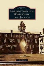
The Cambridge Valley has always been united and divided, each community holding tightly to its identity. In 1773, the Cambridge District was formed, comprised of the current towns of Cambridge, White Creek, and Jackson. In 1788, the area became the Town of Cambridge in Albany County and was annexed to Washington County in 1791. The area was divided into the present town boundaries in 1816. The three communities of Cambridge, North White Creek, and Dorr's Corners, though each only three-quarters of a mile from the next, did not unite into the Village of Cambridge until 1866. Today the village spans the boundaries of the three townships but still divides itself into the East End and the West End.
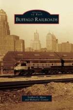
As a growing city on Lake Erie, Buffalo was considered the second largest railroad hub in the Unites States. Given its location, it saw the effects of westward expansion as the country grew and greatly benefited as a result. Buffalo rapidly became a city of importance as the stockyards, grain, steel, automotive, and other industries began to establish themselves in the area. Drawn by vast amounts of freshwater, inexpensive hydropower, and excellent means of transportation, the Buffalo region grew, and with it, the railroads expanded to support the area and help a young nation prosper. Buffalo earned the name of the Queen City as it became the second-largest city in the state of New York, and it was the railroad that brought the city to prominence.
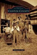
Situated south of Montreal and north of the Adirondacks, Clinton County boasts beautiful lake and mountain vistas. Residents of the county, through 13 history museums and historical associations, celebrate their heritage, taking particular care to note early settlers who came south from Canada and north from the capital region. The county's history includes a long military tradition with a citizen's military training camp and Plattsburgh Air Force Base; an active industrial culture that started with iron ore production and continued with the making of various consumer products, such as automobiles, boats, train cars, and paper products; and a vibrant agricultural heritage based on dairy farming, apple orchards, and maple syrup production. Tourism joined industry and agriculture as a significant economic factor in the county's life.
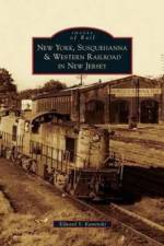
Originally incorporated in 1881, the New York, Susquehanna & Western Railroad has had a long history in New Jersey. The railroad expanded by the early 1890s into the thriving Pennsylvania coalfields and eventually grew to over 200 miles of trackage in the northern portion of New Jersey. Always viewed as an underdog in a marketplace surrounded by much larger railroads, the New York, Susquehanna & Western emerged from 40 years of Erie Railroad control; survived several bankruptcies, reorganizations, abandonments, and retrenchments through innovative passenger and freight service offerings; and transformed into today's regional rail carrier with a size far greater than ever imagined.
In 1948, the first skiers to experience the steep and twisting downhill trails of Mad River Glen had to traverse muddy or frozen dirt roads to get to their destination. The warmth of a country inn was a comfort on those cold winter nights and continues as a hallmark of the Mad River Valley today. Even with the condo boom that developed after the opening of Sugarbush on Christmas Day in 1958, little has upset the ambience of the 20-mile-long valley. The valley developed a distinct personality, attracting "ski bums" who exchanged urban pressures for a laid-back lifestyle that continues today.
Situated along the scenic Connecticut River, East Hartford was once part of the city of Hartford until the town successfully separated from the city in 1783, after numerous petitions before the general assembly. East Hartford's rich, fertile soil encouraged farmers to harvest every available acre, and tobacco grew as their main crop. As America embraced the Industrial Revolution, so did East Hartford, and it became a bustling railroad center. During the 20th century, America's fascination with aviation blossomed here with the construction of the Pratt and Whitney aircraft engine factory and the adjoining Rentschler Field airport. In East Hartford, readers will find many previously unpublished photographs that chronicle the town's history. From the smiling Silver Lane pickle logo to the trains, trolleys, historic buildings, and special events that make up its past, readers will enjoy looking at the changing face of East Hartford.
On July 8, 1929, a Morristown newspaper announced the opening of Morristown Airport on Bernardsville Road. The article stated the airport would be the home of the Country Aviation Club under the supervision of Clarence Chamberlin, the second man to fly across the Atlantic Ocean and the first to take along a passenger. The Great Depression halted any serious development of the airport until 1936, when there was serious talk of the land becoming an East Coast dirigible base for the Hindenburg. However, the destruction of the Hindenburg at Lakehurst, New Jersey, a year later squashed those plans. After World War II, Morristown Airport began to become a reality. General aviation found Morristown convenient and out of the traffic patterns of Newark Airport. The airport grew and prospered, and by July 1966, Morristown Municipal Airport (MMU) was called the "VIP Stop." Today, as a general aviation reliever airport, MMU accepts private, corporate, air taxi, air ambulance, training, and military aircraft and ranks 11th in general aviation operations.
The Beverly Historical Society has been collecting, preserving, and interpreting Beverly's history since 1891. It offers programs and research services to students, teachers, genealogists, and the public. Beverly Revisited represents a fraction of the society's collection of documents and objects that illuminate Beverly's history and tell the stories of its people.
In March 1790, the first permanent settlers traveled through the wilderness to their new home in Farmington. Two centuries later, the site would become the fastest-growing township in New York State. Farmington developed into a unique transportation and manufacturing community where sawmills, grain mills, asheries, and foundries thrived. The town was serviced by the New York Central and Lehigh Valley Railroads and the Rochester and Eastern Rapid Railway, which had stops in the vanished hamlets of Mertensia and Hathaway's Corners. Today these railroad tracks have been reclaimed as recreational trails. The collection of photographs in Farmington weaves together the history of the mills, stores, churches, and families that make the township what it is today. Many of the images were captured by early Farmington photographer E. J. Gardner, whose practiced eye and personal connection to his neighborhood resulted in a priceless record of the people of Farmington.
Old Forge is nestled at the foot of the Middle Branch of the Moose River, more commonly known as the Fulton Chain of Lakes. Year-round accommodations at the Forge House in 1871 and dependable rail service in 1892 led to permanent settlement of the hamlet. Within a decade, Old Forge emerged as the residential and commercial hub of the Central Adirondacks and a popular destination and gathering place for guides, sportsmen, and wilderness tourists. For the sightseer who strolls around Old Forge today or enjoys a cruise up the eight lakes in the Fulton Chain, the landscape is dotted with scores of century-old dwellings, Victorian cottages, rustic camps, and even a few grand old hotels.
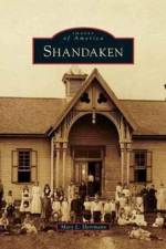
Shandaken is known as the "Heart of the Catskill Mountains." In the town's early years, leather tanning, barrel hoop shaving, and quarrying were mainstays of employment and were relied on by local residents. With time, each of these industries became obsolete due to modern advances and developments. Shandaken was revitalized with the arrival of the railroad, which enabled New York City residents to escape the summer heat and travel to the many hotels that sprang up in town. Tourism increased with the formation of the Forrest Preserve, the Catskill Park, and the New York City watershed. Later winter tourism boomed with the popularity of skiing. Although Shandaken has endured many changes, it has retained its charm and historic character.
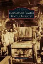
The textile industry found its roots in Connecticut along the banks of the Housatonic and Naugatuck Rivers between Waterbury and Bridgeport. From the early 1800s, when David Humphries, former aide-de-camp to Gen. George Washington, brought the woolen industry to America, to the 1950s, when the vast Sidney Blumenthal Mills moved to the South, the textile industry shaped life in the Naugatuck Valley. The industry witnessed labor actions, inspired cultural expression, and experienced the growth of shipping by road, water, and rail. Workers produced felted wool, cotton, and silk fabrics, velvet, fake fur, wool hosiery, buttons, ribbons, and various other goods, laying the foundation for the prosperity enjoyed by the valley today.
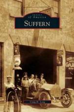
Suffern, incorporated in 1896, is the gateway to the Ramapo Pass. Thirty miles from New York City, the village is at the confluence of several major interstate highways and the Ramapo River. By the 1840s, this rural farming community was transformed with the arrival of the Erie Railroad. Trainmen, tradesmen, ironworkers, and businessmen all found Suffern to be an ideal location for their modest homes. The region quickly gained a reputation as a pleasant summer resort and with that came the influx of wealthy New Yorkers who built summer estates. A thriving business district developed around the rail depot, and an official village government was established. Through it all, Suffern's main street has remained a vital hub in the community. Its residents, both past and present, have contributed to make this community of friendly neighbors what it is today.
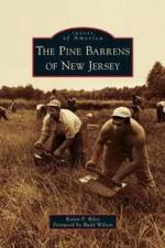
The Pine Barrens of New Jersey cover 22 percent of the most densely populated state in the country. It is the largest stretch of open space between Boston, Massachusetts, and Richmond, Virginia. It reaches across 56 municipalities and 7 counties. The name came from early settlers who thought the area was a vast wasteland, but it is anything but barren. Underneath this incredible natural resource lies almost 17 trillion gallons of some of the purest water on earth. Stands of pitch pine gave birth to the charcoal industry, and its acidic swamps were used first for bog iron and later for cranberry production. Many firsts came from this area, including cranberry sauce, cultivated blueberries, and grape juice. Numerous industries have risen and fallen over time. Remnants of forgotten ghost towns bear witness to that history, but the real stories come from the people who lived and worked there.
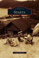
Incorporated in 1845, Sparta was once a Colonial farming village comprised of stone mills, general stores, and one-room schoolhouses. Summer visitors from surrounding metropolitan areas were drawn to Sparta in the late 1800s for the fresh mountain air. During that time, Thomas Edison came to Sparta to extract iron ore at his massive Edison village manufacturing plant on Sparta Mountain. The 1920s saw the development of Lake Mohawk, permanently changing the landscape of the township as the windswept Brogden Meadow was transformed into a sparkling 3-mile-long lake, which attracted hundreds of part-time residents. While Sparta is no longer a farming community, mining town, or seasonal vacation destination, today's residents take great pride in its small-town appeal and rich, colorful past.
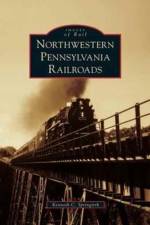
Erie's rail link to Philadelphia was achieved in 1864 with the completion of the Philadelphia and Erie Railroad, which later became part of the Pennsylvania Railroad. By 1869, railroad lines from Buffalo through Erie to Chicago were consolidated into the Lake Shore and Michigan Southern Railway, which later became part of the New York Central Railroad. Completed in 500 days, the parallel New York, Chicago and St. Louis Railroad, commonly known as the "Nickel Plate Road," was a 513-mile, well-designed railroad that emphasized excellent service. South of the lakeshore, the wide-gauge Erie Railroad enhanced east to west connections. Through vintage photographs, Northwestern Pennsylvania Railroads brings to life the history of the railroads that have served the region.
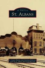
Many years after Jesse Welden became the first permanent settler in St. Albans, the town was the site of the northernmost raid by Confederate Civil War soldiers in 1864. St. Albans went on to earn fame as the "Railroad City." Over the years, the commercial base in St. Albans grew, many churches and schools were founded, and there was a sharp increase in population. Because of these many changes, St. Albans transformed from an agricultural community dependent upon Lake Champlain for transportation to the seat of Franklin County.
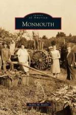
In 1783, Revolutionary War hero Gen. Henry Dearborn built Monmouth's first framed house. In his honor, the town was named for the Battle of Monmouth, where Dearborn had distinguished himself. The area's lakes, streams, and fertile soil helped early farmers and manufacturers to prosper, and soon the area was renowned for its Ben Davis apples and Monmouth moccasins. Monmouth is a compilation of historic images capturing the everyday lives of the hardy and hardworking individuals that created the town's fascinating history. Photographs document three of the five devastating fires to the town's center between 1885 and 1913, as well as the creation of the town's centerpiece, Cumston Hall, designed by architect, artist, author, and composer Harry Hayman Cochrane.
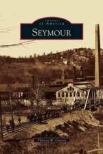
Early in its history, Seymour was a thriving Native American fishing community along the banks and falls of the Naugatuck River. As European settlers arrived, agriculture dominated the landscape. During the early days of the Industrial Revolution, Seymour flourished as a manufacturing community, and its products were in demand throughout the world. The first woolen mill in the United States was established at the falls by Gen. David Humphreys, who was aide-de-camp to Gen. George Washington. It has been said that his mill produced some of the finest wool in the entire country. The Kerite Company remains the longest-standing manufacturer in Seymour, producing electrical cable used in oil drilling and other areas. Today Seymour is one of the seven towns that make up the All American Valley.
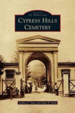
For the past 162 years, historic Cypress Hills Cemetery has quietly served thousands of New Yorkers and the public at large. This place of eternal rest obtained the distinct honor of being the first rural cemetery in Greater New York to be organized under the Rural Cemetery Act of 1847. Cypress Hills provides a perfect balance of lush landscaping, funerary art and sculpture, and a final resting place for some of America's most notable figures, such as Jackie Robinson, Mae West, and Eubie Blake. Carved on countless headstones are mysterious markings and secretive symbols that the living can ponder. Cypress Hills Cemetery illustrates and demystifies the various legends of those interred in these hallowed grounds.
Sign up to our newsletter and receive discounts and inspiration for your next reading experience.
By signing up, you agree to our Privacy Policy.