Join thousands of book lovers
Sign up to our newsletter and receive discounts and inspiration for your next reading experience.
By signing up, you agree to our Privacy Policy.You can, at any time, unsubscribe from our newsletters.
A new chapter on the material heritage of the Nabataean culture is opened in this book. The clay lamps, and the artificial lighting they provided, prove that daily activities in this prominent proto-Arabic kingdom did not cease after sunset or in dark environments. The studied items shed light on the different cultural aspects of the Nabataean society, which had been in close contact with the contemporaneous world of the Mediterranean Sea and the Arabian Peninsula.
The permanent system of coastal batteries of the Strait of Messina was erected in the late nineteenth century according to newly discovered plans of the defences of the Kingdom of Italy. Already conceptually obsolete during construction and progressively decommissioned, it was barely used for over half a century, and at the outbreak of World War II was replaced by a new defensive system. Today, it represents a significant and valuable example of Italian military architecture that has not yet been sufficiently analysed and documented.
La excavación arqueológica de la calle Hospital Viejo de Logroño descubrió un complejo alfarero de dilatada trayectoria. Consiste en tres obradores superpuestos en funcionamiento durante los siglos XIII, XIV y XV, documentándose hornos, basureros, zanjas y canteras de arcilla, una pileta, útiles de alfarero, materia prima y un abultado conjunto de materiales cerámicos, metálicos, óseos y líticos, junto con desechos de producción. Pudieron pertenecer a alfareros islámicos, quedando abandonados tras las pragmáticas contra la comunidad mudéjar de 1502. Las producciones se sistematizaron atendiendo a las características de las pastas y su tratamiento, obteniendo quince tipos que abarcan cerámicas comunes, vidriadas, esmaltadas y de reflejo metálico, con los que se produjeron treinta y cinco formas básicas y múltiples variantes, de mesa, cocina, despensa y elementos auxiliares. La secuencia estratigráfica del yacimiento proporciona cronologías muy ajustadas de inicio y final de las producciones cerámicas, convirtiéndolas en herramientas de datación e identificación cultural de los contextos arqueológicos de la Baja Edad Media.During the excavation of Hospital Viejo Street, up to three overlapping pottery workshops operating in the XIII, XIV and XV centuries were identified, with discrete spatial distributions and various production structures. These workshops were probably governed by Islamic potters, who abandoned them after the expulsion of the Moorish communityin 1502. We identified fifteen groups of earthenware, tin-glazed ware, glazed ware and luster-glazed ware, based on the ceramic pastes and processing methods used. From secondary criteria, we identified thirty-five basic forms, and multiple variants, of cooking, drinking, eating and storage vessels, along with auxiliary elements. The stratigraphic sequence of the site provides very tight timelines for the start and end of production.
A fresh and innovative approach to the skeletal biology of prehistoric South Asians is presented in this volume. It is the first comprehensive bioarchaeological study of an early Holocene human skeletal series from the Gangetic Plain of North India. New methods and techniques reveal insightful perspectives on the biological adaptations and affinities of the aceramic foragers from Mesolithic Damdama (ca. 8800 BP). Attention is given to archaeological context and to the geological and ecological setting in which these semi-nomadic, microlithic hunters lived and foraged. The integrative analysis of skeletal preservation includes documenting bone micro-structure and chemical composition, and a taphonomic approach to skeletal representation. Diverse methods of age and sex determination provide a firm basis for paleo-demographic analysis. Multivariate statistics refine the precision of: sex determination, stature estimation, and calculation of bio-distance from cranial and dental attributes. The large skeletal sample facilitates both statistical assessment of traits by sex within the Damdama series, and inter-site comparison of traits with nearby Mesolithic series and with key prehistoric samples from India and Pakistan. Prevalence of pathological lesions provides evidence of health and nutrition, while skeletal markers of activity yield insight into patterns of habitual behavior. These new data from Mesolithic Damdama contribute significantly to theoretical issues in anthropology, including health and subsistence, skeletal robusticity, and biological adaptation to a subtropical riparian environment.With contributions by M.C. Gupta, V.D. Misra, Greg C. Nelson, and G. Robbins Schug.
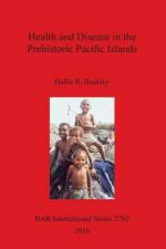
This book is an historical document presenting the author's doctoral thesis on health and disease in the Pacific Islands, completed in 2001. The study was conducted using a sample from the Solomon Islands in Melanesia and another sample from two burial mounds in Tonga, Polynesia. The primary aim of the study was to assess whether the presence of malaria in Melanesia adversely affected the overall health of these people compared to the Polynesian group, where malaria has always been absent. The Pacific islands are often forgotten when considering global issues of health and subsistence change. However, this region has much to offer with regard to understanding human adaptation to different environments during and after colonisation and the biosocial responses to disease. One of the main drivers for publishing this volume after all this time is an attempt to give this region more of a voice in global discussions of health and disease in prehistory.
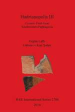
Pottery finds collected from Hadrianopolis in southwestern Paphlagonia (north-central Turkey), i.e. the region around Eskipazar in the Turkish province of Karabük are presented in detail in this volume. Between 2005 and 2008 an archaeological team from the Dokuz Eylül University in Izmir carried out archaeological field surveys, excavations and restorations in Hadrianopolis and its close surroundings. During these four field campaigns, 1550 sherds ranging between the Pre-Iron Age (2nd millennium BC) and the Middle Byzantine period (late 11th-early 12th century AD) were collected, most of which consist of Late Roman-Early Byzantine (late 5th-mid 8th century AD) coarse ware. Thirty main pottery groups were derived, based on their chronology,function and fabric. A detailed description is given of each find deposit, the typologies and fabrics of wares, and a comprehensive catalogue is included with drawings and photos of each sherd. This book is the first extensive pottery report of the Turkish Black Sea area offering a continual picture of all the wares and chronologies available. From the Foreword by Roger J. Matthews, University of Reading 23rd September 2015: It gives me great professional and personal pleasure to write a foreword to Hadrianopolis III, in which the ceramic materials from the Paphlagonian site of Hadrianopolis and its region are published in exemplary manner by Ergün Lafli and Gülseren Kan Sahin. The volume contains the fullest possible description and discussion of a wealth of ceramic material from the 2005-2008 field seasons in and around Hadrianopolis. I believe this volume can stand as a model of how to publish archaeological material in a manner of most benefit to colleagues with a wide range of professional interests... Through publication of this volume, the authors demonstrate the unique value in cherishing, recovering, analysing and, above all, fully publishing the material evidence recovered in systematic archaeological investigation. Present and future scholars owe them a considerable debt as well as sincere congratulations.
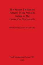
The main aim of this study was to analyse the Roman settlement patterns of the western part of the Conventus Bracarensis, located within a vast province of the Iberian Peninsula: the Hispania Citerior or Tarraconensis. In order to fully understand the Roman settlement patterns of the area under study, it was necessary to verify the political and administrative procedures carried out at the Tarraconensis province together with their direct impact upon the landscape, alongside the varied occupation techniques implemented after the conquest, assessing the different patterns impacting upon the indigenous space. The nature of the available data was analysed through G.I.S. and four operative concepts: entities, relationships between entities, scales and limits to those relationships. Using these elements, the interpretation and description of the studied centres aimed to shed some light on the basic evolutionary features of settlement patterns. Through their complex interactions, the analysed areas provided the minimum conditions with which to achieve the proposed objectives.
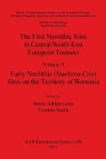
The modelling of the process of Neolithization - one of the basic tasks of the FEPRE project - requires the building of a complete data base, including radio carbon dates and inventory of FTN sites: both those excavated as well as those recorded in the course of surface surveys. In view of the fact that in the Neolithization of Europe the axis running from the Balkans to the Carpathians is of essential importance the editors have decided to compile the inventory of FTN sites along this axis and subdividedinto: I - Bulgaria, II - Romania, III - Eastern Hungary, IV - Eastern Slovakia, V - South-Eastern Poland. The result is a five-volume catalogue of FTN sites: Vol. I - Bulgaria - sites of the Monochrome and the Early Painted Pottery Phase (Karanovo I type); Vol. II - Romania (Transylvania and Banat) - sites of the Early Phase (with white-painted pottery); Vol. III - Eastern Hungary (Tisza basin) - sites of the Körös-Starèevo Cul ture; Vol. IV - Eastern Slovakia - sites of the Early Phase of the Eastern Linear Pottery Culture; Vol. V - South-Eastern Poland - LBK sites. The database and analysis of archaeological records provide the most up-to-date groundwork for the construction of the model on Neolithization of Central Europe within the frame work of the FEPRE project.Specific Targeted Research Project on the Formation of Europe: Prehistoric Population Dynamics and the Roots of Socio-Cultural Diversity.Institute of Archaeology, Jagiellonian University.
Edited by E. Photos-Jones in collaboration with Y. Bassiakos, E. Filippaki, A. Hein, I. Karatasios, V. Kilikoglou and E. Kouloumpi.The Hellenic Society for Archaeometry (HSA) was founded in 1982 and is the professional body representing academics and research centers in Greece and within the Greek Archaeological Service who employ physical and earth sciences in archaeology. The HSA is a vibrant group of researchers who over the years have made a substantial contribution to the understanding of Greeces Cultural Heritage.The 6th Symposium of the Hellenic Society for Archaeometry (HSA) took place in May 2013, at the Acropolis Museum in Athens. The HSA Symposium proceedings are aimed particularly at young researchers working on Greek materials and landscapes as a venue for presenting their work. This volume comprising thirty-two papers is divided in two parts: the first deals with materials (ceramics, glass, metal, paintings, paper) and the second with the landscape and its multifaceted aspects (dating, prospection, visualisation). Within each section issues of conservation, dating, and computer applications are interwoven together with aspects of intangible heritage.
Timber monuments form an important part of the Neolithic monumental repertoire, yet tend to play a relatively minor role in discussions of this period. This volume is an attempt to remedy this imbalance and, through an examination of the cropmark and excavation records, considers the variety of timber monuments built during the Neolithic period in Scotland. Recorded as cropmarks on aerial photographs or as chance discoveries during excavations, most are found in eastern lowland Scotland, thoughthere are hints of a wider distribution. Dating suggests two episodes of timber monument building, with a division occurring around 3300 cal. BC, reflected in the construction of new forms of timber monument as well as the way in which they were treated. The differences between earlier and later Neolithic timber monuments likely reflect different ways of conceptualising and using timber monuments as well as changing values, meanings and ideals, reflecting wider social changes obvious within the archaeological record. Timber monuments, though, were much more than ground plans. They were important spaces and places used by Neolithic communities for many different purposes, closely tied to their location and context and reflecting changing relationships with the landscape and the environment. Therefore consideration of their materiality, landscape and context serves to enrich and expand interpretations of timber monuments and to break down the classifications they tend to be placed within, revealing greater complexity and variety. Ultimately timber monuments were one part of a wider Neolithic monumental repertoire, and the number and variety now recognised means they can no longer be considered secondary or derivative of monuments built of other materials. Instead, they must be considered on an equal footing with other monuments, their form, materiality and treatment informing us about some of the concerns, values and relationships of Neolithic communities.
This report outlines the results of archaeological investigations at Old Hall Street, Wolverhampton, West Midlands, UK (NGR SO 916984), carried out between 2000 and 2007. The results of the archaeological work have been combined with documentary, cartographic and genealogical studies, together with finds and scientific analyses, to present a broad interpretation of the history of settlement in the area and the motives behind it. The site was the location of a moated Elizabethan mansion house, the Great Hall, which lay at the edge of the then settled area of Wolverhampton in an area that had once been part of the town fields. A documentary reference suggests that there was an earlier house on the site, but there is only limited archaeological evidence to support this. The building of the Great Hall was intended to make a clear statement about the status, wealth and prestige of its owners, the Leveson family, who were prominent Wolverhampton merchants, also involved in the early industrialisation of the Black Country. The aspirations of the family are clearly demonstrated by their construction of one of Staffordshire's most significant early brick buildings The later history of the Great Hall mirrors that of the Black Country, fortowards the end of the 18th century it was converted for use as a japanning factory, known as the Old Hall Works, artefacts from which were exhibited in the Great Exhibition of 1851. A large-scale map of 1852 gives a detailed insight into the layout of the japanning factory, which was finally demolished in 1883, an Adult Education College being built on the site in 1899. The archaeological excavations took place ahead of the redevelopment of the college. This report shows something of the process by which the Black Country attained its distinctive personality.
A collection of recent papers presented in honour of Mario Benzi.
Ten years of research at the Centre for the Archaeology of Human Origins (CAHO, University of Southampton)University of Southampton Series in Archaeology No.8This book includes papers from the 2011 conference marking ten years of Centre for the Archaeology of Human Origins (CAHO, University of Southampton).
The continual question of why identities are imposed, why people are excluded and why the insupportable is supported forms the basis of this study. The author takes the apparently opposing contexts of New Kingdom and Coptic Egypt as prime case studies in which to look at how and why people manage to live under extreme centralisation and under its opposite, locally based power. Chapter One places the topic in its historiographical and theoretical setting. Chapter Two looks at statements of self emanating from the centre of power, and assesses their impact. Letters in Middle/Late Egyptian from royal and non-royal contexts are discussed. In Chapter Three the author contrasts the material from the preceding chapter with evidence from New Kingdom Memphis. Chapter Four contrasts the New Kingdom world, with its superficially centralized and strong state, with that of the Coptic period. Chapter Five assesses how far beliefs expressed in textual sources were reflected in the built environment.
Edited by Maggie Morrow, Mike Morrow, Tony Judd and Geoff PhillipsonConsultant Editor Pete CherryForeword by Toby WilkinsonWe are used to thinking of Egypt, ancient and modern, in terms of the Nile valley: well-watered, green and fertile, a narrow strip of life-sustaining land between vast tracts of hostile desert. But this accustomed view is an illusion: even today, the deserts of Egypt - which seem so inhospitable - support flora, fauna and people. In prehistoric times, the climate was wetter and life was much more abundant. The deserts' early inhabitants left behind images of their environment, lifestyle and deepest beliefs in the form of rock art, etched into the landscape. One of the biggest concentrations of this ancient, ancestral art is found to the east of the Nile, in the wadis (dry valleys) that dissect the hills and plains between the Wadi Hammamat to the north and the Wadi Barramiya to the south. In the space of just five months, between October 2000 and February 2001, three teams of dedicated volunteers carried out a systematic survey of this remarkable region. They succeeded in locating and recording over 100 new sites of rock art, previously unknown to archaeology. The results, comprising many thousands of individual scenes, are presented here for the first time. They open up a fascinating and largely unexpected window on Egypt's past, and on the beginnings of civilisation in north-eastern Africa. Hence, the present volume is, without doubt, an important contribution to an exciting new area of Egyptology. As always, new discoveries raise as many questions as they answer. The study of ancient Egyptian origins has been pursued for more than a century, yet many puzzles remain. For example, how and why did a great civilisation emerge in Egypt? Did the prehistoric inhabitants already share essentially the same culture, or did rival groups play a part in fashioning the distinctive Pharaonic tradition that we all recognise? The rock art of Egypt's Eastern Desert promises important new clues to these and other unsolved mysteries - clues that scholars will now have the chance to decipher and debate. Future generations of archaeologists and ancient historians will be thankful that the study of Egypt has enthusiasts as committed as the editors of this excellent survey report.
This publication has its origin in the colloquium Animals and Otherness in the Middle Ages held at the Faculty of Geography and History at Complutense University in Madrid in February 2011. This publication aims to bring together scholars from a range of disciplines to consider the diverse use of animals in constructions of 'otherness'. It encompasses not only conceptualized difference, but also physical societal differences expressed in the varied treatment of real and imagined animals. The contributions also discuss the use of animals to emphasize contrast more broadly, such as the juxtaposition between good and evil, or positive and negative features.
This research is an investigation into the safe passage of the deceased over water as exemplified in the early Egyptian legends involving the 'Lake of Knives' and the 'Lake of Fire'. The journey of the deceased from death to resurrection is envisaged as taking place in a boat crossing dangerous places and ordeals. This journey was parallel to the sun god Re's passage over the waters of the sky, and in which he is threatened by the powers of chaos. The rites of passage focus on the safe passage of Re through chaos, and assert resurrection, rebirth and life after death for the deceased. The passage is re-enacted in mythical images and in ritual actions, and focuses on the safe journey of the deceased through the ordeals of the Netherworld. This research is divided into seven chapters. Chapter One deals with the symbolism of water, knives and fire. Water is dealt with as the discharge which comes from the body of Osiris and offered to him in ritual. The second section deals with the symbolism of knives and fire. It is concluded that water mediates the passage of the deceased when it is offered to him in ritual. Water can also cause violent death. Fire and knives are used as destructive tools in rituals. Chapter Two explores the cartographical descriptions and cosmographical locations of the two lakes, using textual and pictorial evidence. It is concluded that the Lake of Knives is envisaged as extending from the east to the west of the sky. The description of the Lake of Fire varies from one context to another. The two lakes have no specific locations, but they wind through the sky. Chapter Three is a discussion on the theme of passage over water in Ancient Egypt. The ferryman spells and the Island of Fire are taken as two examples for the passage of the deceased over water. It is concluded that the ritual aspects of the ferryman spells and the Island of Fire are not very different from the ritual aspects of the Lake of Knives and the Lake of Fire. Chapter Four is an extension of the discussion of the theme of passage over water, and deals with crossing the lake as a ritual enacted for the deceased at the day of funeral. It is tentatively concluded that the aim of the deceased's crossing over the lake is to mediate his passage to become an Ax. The crossing was accompanied by recitation of ritual texts. Crossing over the Lake of Knives and the Lake of Fire was also accompanied by recitations of ritual texts. Chapter Five deals with the Lake of Fire in the Book of the Two Ways. The journey of the deceased is constructed until he reaches the Lake of Fire. It is concluded that the Lake of Fire is a place, which the deceased visits to be reborn in the morning and starts a new journey towards the abode of Osiris on the upper waterway. Chapter Six investigates the rites of passage concerning the crossing over the two lakes. It deals also with the handling of symbols within the rituals performed for the deceased. It is concluded that the Lake of Knives and the Lake of Fire are two metaphorical places that do not exist in rituals. They do not have fixed physical locations, but they exist in myth. Crossing over the two lakes is dangerous, but is also necessary for the deceased to continue his journey and to enter into a different status, status of being an Ax. Chapter Seven draws answers for the questions of the aim of the deceased's crossing over the two lakes. It is concluded that the aim of the deceased's journey over the two lakes differs from one context to another. It is also explicit that there is no single specific explanation for the rites of passage over the two lakes, and they draw on different metaphors.
Between 1968 and 1972, ten archaeological sites were excavated in Prince Rupert Harbour on the northern coast of British Columbia. This volume focuses on the finds from nine sites, over 9,000 of which were found, dating from 3,500 BC to the modern period.
Untersuchungen zu den gesellschaftlichen Strukturen anhand der Nekropolen und Gräber der protogeometrischen und geometrischen Epoche aus Mittel-und OstkretaFreiburg Dissertations in Aegean ArchaeologyDas Hauptziel dieser Untersuchung der Grabbefunde ist der Identifizierung gesellschaftlicher Strukturen der späteren Dark Ages, der Früheisenzeit bzw. der protogeometrischen und geometrischen Zeit auf der Insel Kreta. Die älteste Forschung auf Kreta konzentrierte sich auf die Hinterlassenschaft jener Kultur, die Evans als minoische bezeichnete. Die lange Periode vom Zu-sammenbruch des ägäischen Palatialsystems bis zur Entstehung der griechischen Polis wurde sehr oft als eine in Dunkelheit ummantelte Zeitder Isolation, Stagnation und Sprachlosigkeit bezeichnet bzw. als Dark Ages angesprochen. Als Folge zweier Publikationen ist in der Tat seit den 1970er Jahren der englische Begriff Dark Age bzw. Dark Ages in Gebrauch: The Dark Age of Greece von Anthony Snodgrass und The Greek Dark Ages von Vincent Desborough. Der Befundstand der 1970er Jahre ist natürlich heutzutage nicht mehr aktuell und neue Funde und Forschungsergebnisse warfen und werfen immer mehr Licht auf diese sich stetig aufhellende Dunkelheit. In der Tat sind in den letzten Jahren weitere Nekropolen und Gräber entdeckt und zahlreiche neue Impulse in der Grabarchäologie der Früheisenzeit ausgelöst worden, die das Panorama der sog. Dark Ages allmählich erleuchten. Trotz alledem verwenden einige Wissenschaftler, wie Coulson und Nowikki, weiterhin diese „dunkle
This book examines archaeological and historical evidence for the socio-economic organization of the kingdom of East Kent, England, as a territorial and social system during the Early to Middle Anglo-Saxon period (AD 400-900). Explicit archaeological and theoretical frameworks are considered to propose a hierarchical model of the spatial organization of communities as a way of providing a micro-economic case study of state formation. In addition to other classical economic and geographical analyses applied, the distributional approach examines the frequency or quantity of commodities with respect to units of economic consumption, such as individuals, households and communities. By examining the saturation levels of community consumption as represented in burial assemblages, a hierarchical model of value regimes underlying exchange sub-systems is suggested. Taken in combination with an analysis of the geographical organisation of settlement, the author argues a thesis on the way regional space was socially and spatially constructed in ways that restricted and monopolised allocative and authoritative resources. Correlations between spatially-distributed phenomena and features of the physical environment are assessed in order to consider the social dynamic in land-holding underlying the territorial and spatially-definable conditions of reproduction. An assessment is made of the importance of restrictions on the movement of people in social formation, by analysing the relationships between routes of communication, the mortuary landscape, and the visual experience of movement. Finally, consideration of these phenomena with respect to changing exchange systems provides models of early medieval state formation.
A study of aspects of urban and rural Roman horticulture. Limited by the available evidence, most of the discussion relates to decorative gardens, making use of literary sources and depicions on wall paintings.
A detailed study of ceramics from the Iberian sites commonly known as 'Las Motillas' - arguably the most singular form of prehistoric settlement on the Iberian Peninsula. Located in the central area of Spain called 'La Mancha' they date to the Bronze Age (2200-1500 cal. BC), with the sites characterised by artificial tells produced by the destruction of complex fortifications with concentric stone walls. These sites were believed to be funerary barrows until the 1970s, when the systematic excavation of La Motilla del Azuer (near Daimiel (Ciudad Real), on the left bank of the Azuer River) was undertaken. From the beginning of the fieldwork, the nature of the fortified settlement quickly appeared, clearly defined thanks to the documentation of a central fortification surrounded by a small settlement and its necropolis. This study assesses the Bronze Age pottery assemblages from the site, presenting a typological and technological classification.
Young Lukanian Archaeologists 2The second volume in the Lukanian Young Archaeologists series concentrates on the processing of data obtained from archaeoichthyology and archaeomalacology finds from one of the most important prehistoric sites in the Mediterranean. The proto-historic settlement of Mursia (on the island of Pantelleria, Trapani, Italy) was soon integrated within the dense network of sea routes that affected the populations at the height of the Bronze Age. Chronologically, the settlement dates from the last two centuries of the first half of the second millennium BC. The town is on two terraced plateaus, of similar size, which today we call the 'Upstream Plateau' (or 'internal': excavation areas B and C) and 'Sea Plateau' (or 'headland': areas of excavation A and D). Significant information is presented on the species fished, fishing techniques, and the economic importance of these resources within the village of Mursia. The current archaeozoological research is not limited to the recognition and description of animal species but also focuses on the need to obtain information for cultural and environmental analyses and to try and reconstruct the ancient relationships between man and his natural resources generally. Through the analysis of the ichthyic and malacological samples from Mursia an attempt is made not only to identify the species present but also to process the data obtained from the taphonomic data for a reconstruction of this culturally isolated site within the context of marine resources.
The Egyptians were the only ancient civilization to intentionally preserve their animal dead using artificial mummification techniques. This practice formed part of a complex belief system which required that the physical remains of the body were preserved in order to ensure continuity of life in the next world. Consequently many thousands of animal mummies survive in the archaeological record, either at the numerous animal necropolises dedicated to the animal gods, or in the collections of museums and private collectors around the world. 127 mummified animals from four museums in Great Britain were studied using conventional radiography (X-ray) and computed tomography (CT) in order to assess the validity and potential of the techniques. The study collection was found to contain the skeletal remains (either partial or complete) of birds, cats, dogs, fish, crocodiles, snakes and rodents, the majority of which are believed to have been manufactured as votive offerings. The radiographic examination of the mummies revealed a wealth of information on both the animals themselves and the techniques which the embalmers had used in order to preserve them. Limited evidence was found to suggest evisceration, evidence of pathological conditions or cause of death; however a great deal of information regarding the positioning of the skeleton, the form of the resulting mummy bundle and the methods of wrapping were highlighted. In conclusion, the study identified the enormous potential of non-destructive radiographic techniques in the investigation of mummified animal material.
Volume 1 (BAR S1548, 2006) of the archaeological excavations conducted by the University of Arizona at the site of Mezzomiglio in the town park area of Chianciano Terme, Tuscany, dealt with the excavation results up to the year 2001. This volume by Paola Mecchia deals with the material culture which resulted from the limited soundings made from 2003 through 2006. The site at Mezzomiglio was an ancient rural spa. How close the nearest town may have been is not known; there may have been a significant settlement at Chianciano Terme itself but to date nothing other than evidence of rural occupation has presented itself. The spa certainly functioned from at least late Etruscan times and material has been recovered which allows the tracing back of the site to at least the 2nd century B.C., with the possibility of frequentation of a simple nature earlier than that.
This publication deals with the archaeological and documentary evidence for mans' activities in Binsted and Kingsley (Hampshire/Surrey, S. England) during this period between the last Ice Age and the post-medieval period. An interim publication on the Alice Holt Roman potteries contains a short section on the contemporary landscape, accompanied by a rather rudimentary map of the distribution of Roman sites in Binsted and Kingsley parishes between Alton and the Hampshire/Surrey county boundary in north-east Hampshire. The ten years following this publication saw an intensive programme of landscape study in order to explore and understand the changing pattern of human settlement and land utilisation within the area over the last 10000 years or so. Conclusions of the current research reported in this volume are based on seven years of field-walking between 1981 and 1988, as well as some carried out during the early 1970s. All but about half a dozen of the arable fields within the 42 square kilometres of land encompassed by the two parishes were walked and most of the permanent pasture and woodland was also examined. This fieldwork was backed up by the survey of a number of vernacular buildings dating from before AD 1300 to c. AD 1700. Five flights were also carried out between 1981 and 1983 for the purpose of air photography. Excavations were carried out on Alice Holt Roman pottery waste dumps and other sites of all periods in and around the forest.Contributions by C.R. Cartwright, A.J. Clark, A. Graham, D. Graham, D.F. Mackreth and D.F. Williams.
The Acheulean is the longest archaeological period in history, and was produced by different hominin species such as Homo erectus and Homo heidelbergensis. In this book the author examines the diagnostic stone tools of the Acheulean period, handaxes and cleavers, from the Hunsgi-Baichbal Valley in India. At the 1.2-million-year-old site of Isampur Quarry, the author reconstructs the manufacturing process for these tools and uses it to infer some of the social and cognitive faculties of their makers. The Isampur Quarry tools are then compared with those from other sites in the Valley, including one around a million years younger, and the author deduces some of the changes in social interaction and cognition that occurred over the vast timespan of the Acheulean.
This study deals with the significance of ritual scenes on 21st Dynasty coffins. The images on these coffins are studied as texts referring to the passage of the deceased to the next life. The aim of this study is also to argue how the Middle Kingdom Coffin Texts were replaced at this later date by such images on coffins. The work focusses on a group of coffins belonging to the priest known as PA-dj-imn, and date to the reign of the High Priest Pinudjem II. They were found in 1891 at the tomb of Bab el-Gassus, as part of the find generally known as the Second Find of Deir el-Bahri.
The present work is an attempt to give a comprehensive overview of turquoise and its role in Ancient Egypt. Turquoise was mined mainly in Sinai, at Maghara and at Serabit el Khadim, where the stone occurs in the sandstone rock. Ancient Egyptian mineralogical studies have neglected turquoise, focussing instead on the study of other minerals and metals such as gold, silver, and copper.
This work, focusing on specific categories of royal estates, concentrates on the later Anglo-Saxon period in England (the mid-ninth century to the mid-eleventh AD). These centuries were a formative period in early medieval history, in which a state can be seen to have developed from a small kingdom to take control of lowland Britain, and, indeed, exert political influence over much of the rest of Britain. The area of this study consists of royal lands in the two shires of Hampshire and Dorset as set out in the folios of Domesday Book. Royal estates were lands used to support kings and their immediate retinue, and lands granted by kings to members of the royal family. Lands of royal agents are also examined in this work.
Sign up to our newsletter and receive discounts and inspiration for your next reading experience.
By signing up, you agree to our Privacy Policy.