
Join thousands of book lovers
Sign up to our newsletter and receive discounts and inspiration for your next reading experience.
By signing up, you agree to our Privacy Policy.You can, at any time, unsubscribe from our newsletters.
This guidebook to cycling the Ruta Via de la Plata through western Spain describes the 930km route from Seville to the coastal city of Gijon in around 2 weeks (14 stages). A pilgrimage variant, the Camino Sanabres, to Santiago de Compostela is also described (16 stages in total). Empty roads and gentle climbs make the route accessible to a wide range of bikes and cyclists. Both road and off-road versions are presented, and the guide shows how they can be combined to create a perfect touring, hybrid or gravel cycling trip. The guide includes leg-by-leg route descriptions, 1:150,0000 colour mapping, elevation profiles and helpful ride planners to show where riders can swop from the off-road to the road route. There is advice on equipment, travel and transporting your bike, alongside a list of accommodation contacts and a useful Spanish glossary. The Ruta Via de la Plata is one of Spain's most important pilgrim routes. The 2-week journey takes in 7 UNESCO world heritage sites (Seville, Mrida, Cceres, Salamanca, Leon, Zamora, and Oviedo) with the famous pilgrimage site of Santiago de Compostela if the Camino Sanabrs is taken. There is lots of good-value accommodation available, from hostels to palaces, and plenty of chances to sample Spanish gastronomy.
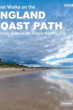
At around 4500km (2800 miles), the England Coast Path is the longest coastal trail in the world. This inspirational large-format guide presents a handpicked selection of 30 highlight sections, offering a taste of England's stunning and diverse shoreline. Routes range from 9 to 45km, spanning between 3 hours and 2 days, offering options to suit all abilities. They can be accessed by public transport and are walkable year round (weather permitting!). Route descriptions are accompanied by 1:50,000 OS map extracts. Included in each walk are comprehensive listings of public transport, toilets and places to eat and drink, which highlight the excellent walking infrastructure available in many areas. Overview information on terrain, distance and timing facilitates easy planning, a route summary table helps you to choose an appropriate route, and there are also GPX files available for free download. Fascinating snippets of history and geology are interspersed throughout, and the appendices contain useful websites and further reading. Incorporating beautiful photography of England's coastline, the guide will encourage you to explore both well-loved and less well-known parts of the English shoreline, from soaring cliffs to wildlife-rich estuaries, from huge golden beaches to atmospheric marshes. Capturing the rich heritage and glorious contrasts of England's coast, the routes offer something for everyone, whether your passion is for escape or adventure, geology or nature, castles or culture. The sea has defined England's history and the coast is a dynamic and exciting place to walk, so let these 30 routes introduce you to great walking by the sea on England's newest National Trail.
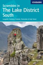
Guide to 106 scrambling routes in the south of the English Lake District, covering Langdale, Coniston, Eskdale, Patterdale & High Street. A comprehensive collection of scrambles on crags and gills, which are linked together to form 24 first-class mountain days. The carefully graded routes range from scrambling grade 1 to climbing grade V Diff, so there is something for beginners as well as veteran mountaineers. Rock climbing equipment is needed for more difficult routes. Each scramble is clearly described with notes about grade, quality, aspect and approach, with colour maps and topos to aid navigation. There is information on safety and equipment, and listings of scrambles by location and grade allow the reader to assemble their own tailor-made combination of routes. The Lake District is one of the most scenic areas in the world and this guide offers new routes in previously unexplored corners of the region alongside popular classics such as Jack's Rake, Esk Gorge and Pinnacle Ridge, as well as dramatic gills like Dungeon and Linkcove Gill. 10 classic rock climbs are also presented including Giant's Crawl, Middlefell Buttress and Crescent Climb.
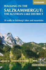
Guidebook of 30 stunning day walks in the beautiful Salzkammergut lake district of Austria. Easy to get to from Linz and Salzburg, the area is studded with lakes and bristling with mountain peaks, and has a great range of waymarked trails, from lakeside strolls to challenging mountain walks. The routes in this book are within the capabilities of any reasonably fit walker, many are suitable for family hiking, and cablecars and lifts can often be used to make walks shorter or easier. Walks range from 6 to 16km and a simple grading system makes it easy to choose the right one. Walks are centred around a number of bases, such as Bad Ischl, Fuschl am See, St Gilgen, Ebensee, Bad Aussee, Gl, and Hallstatt, and explore the mountains of the famous Dachstein and Totes Gebirge, and many of the area's beautiful lakes, including the Fuschlsee, Mondsee and Traunsee.
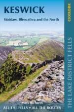
Part of the Walking the Lake District Fells series, this guidebook covers a wide range of routes to 30 Lakeland summits that can be climbed from Keswick, Whinlatter, Bassenthwaite, Caldbeck, Mungrisdale and Threlkeld, with highlights including Skiddaw and Blencathra. Includes suggestions for longer ridge routes.
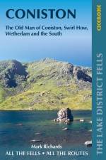
This guide describes ascents of 24 Lake District fells that can be climbed from Coniston and the Duddon and Eskdale valleys, including Coniston Old Man, Swirl How, Wetherlam and Dow Crag. The Coniston Fells - much loved for their classic ridges and wide-reaching views - need little introduction; however, to the west the less-frequented summits of the Birker and Corney Fell massifs offer more great mountain and maritime vistas, as well as solitude. Unlike other guidebooks which describe a single or limited number of routes to a particular destination, the aim of the Walking the Lake District Fells series is to offer all the options. These are presented as numbered sections which can be combined to create infinite possibilities - from simple ascents to longer ridge routes. You'll find the classics and popular routes alongside less traditional alternatives perfect for the wandering spirit. The series gives you both the freedom to devise your own routes and the information to make informed decisions, thanks to the clear descriptions of the routes, terrain, hazards, interesting features and safe descent paths should the weather close in. Also included are a handful of classic ridge routes for longer fell days. Mark Richards' inimitable text is complemented by HARVEY mapping and the author's own beautiful sketch topos and panoramas. Perfect for keen hillwalkers and peak-baggers alike and ideal both for pre-planning and use on the hill, Walking the Lake District Fells is the new incarnation of the Fellranger series, which sees the volumes updated and trimmed to a more practical size. These true connoisseurs' guides are sure to inspire you to get out and explore the beautiful fells of Lakeland. For those collecting fell summits, a 'Fellrangers' hill list register can be found on the Long Distance Walkers Association website.
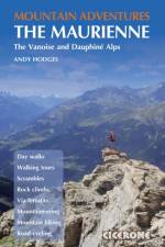
Multi-activity guidebook to the Haute Maurienne region of south east France. The book describes a wide range of the finest day walks, scrambles, rock climbs, via ferratas, treks and mountain biking and road cycling routes, offering all the inspiration needed for a multi-activity or family holiday. The Maurienne valley is served by good transport links, Modane serves as the gateway to the upper valley with links from Paris and Turin served by the TGV. Lanslebourg is the largest village after Modane and offers plenty of choice of accommodation, and Termignon is a reasonably central base for exploring the Haute Maurienne. Routes vary from pretty Alpine lake rambles to mammoth mountain bike routes and include the normal route to the summit of Dent Parrachee, the Matterhorn of the valley that can be reached without crossing a glacier, and arranged by difficulty. Information about facilities and grades for each activity are carefully explained and routes are illustrated with sketch maps, topos and profiles and inspiring photographs. The Vanoise massif is a beautiful range of mountains bounded by the valleys of the Maurienne and the Tarentaise. Sitting on the French-Italian border, the Upper Maurienne (Haute Maurienne) has a southern boundary bordering the Italian region of Piedmont. Its northern border is less pronounced, as the massif of the Vanoise blurs the boundary with the Tarentaise valley.
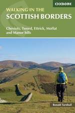
Guidebook presenting 45 day walks and one long distance route in the Scottish Borders. The day walks cover five areas: the Cheviots, Tweeddale, the Ettrick Hills, Moffat Hills and Manor Hills. The walks are a mixture of high and low level routes and can be fully customised using multiple variants.
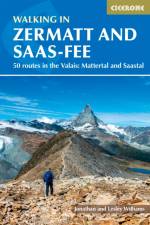
Guidebook describing 50 varied walks in the Valais region in the heart of the Swiss Alps. The graded day walks based around the popular resort towns of Zermatt and Saas-Fee explore the Mattertal and Saastal valleys and the surrounding mountains. Ranging from 4 to 18km, the easily accessible routes make use of the area's extensive network of well-made mountain paths and its lift system. There are walks here to suit all tastes, from low-level lake walks or easy strolls up to mountain restaurants, through to serious mountain outings on steep and rocky trails. Distance, walking time and difficulty are shown for each route, and the detailed route description is accompanied by clear mapping. Dominated by 4000m the giants, the Matterhorn and Monte Rosa, this is a land of contrasts, with snow-capped mountains and glaciers above and meadows and vineyards fringing the valleys below. Good transport infrastructure and plentiful accommodation make it a superb area for a walking holiday.
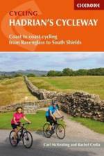
Guidebook to Hadrian's Cycleway, a 174 mile coast-to-coast route across northern England, following the corridor of the Hadrian's Wall World Heritage Site. From Ravenglass in Cumbria through Northumberland to South Shields, with an alternative Tynemouth finish, on cycle paths and quiet country roads suitable for cyclists of all abilities.
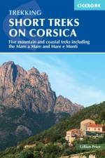
With spectacular mountain landscapes, beautiful rugged coast, forests, maquis and striking river gorges, Corsica is a walker's paradise. This guidebook details five of the islands's most popular shorter treks: the 2-day coastal Sentier du Douanier (Customs Officer's Path) around Cap Corse; two coast-to-coast routes through the central mountains, the 11-day Mare a Mare Nord and the 5-day Mare a Mare Sud; and two 'coast and mountains' routes, the 10-day Mare e Monti and the 5-day Mare e Monti Sud. (Corsica's famous 190km GR20 trail is described in a separate Cicerone guide.) The routes can be linked to create longer excursions and accommodation is provided by a mixture of walkers' hostels, B&Bs and hotels; camping is also an option. The guide presents each of the waymarked trails in daily stages averaging around 12-13km per day, with route description, mapping and notes on accommodation options. There is advice on how to get to Corsica, when to go and what to take, plus accommodation listings, useful contacts and a French/Corsican-English glossary. The guide also offers a wealth of information about the island's rich plant and wildlife. Considerably easier than the challenging GR20, these trails offer a more accessible option for trekkers wishing to experience the 'real' Corsica, away from the bustling coastal resorts. You'll find enchanting scenery - towering forests, gushing cascades, turquoise coves, aromatic maquis, rugged mountains and quiet villages nestling on hillsides of chestnut woods - not to mention a favourable climate and delicious local cuisine. Don't be surprised if you fall under the island's spell!
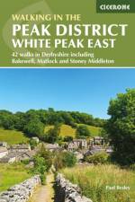
Guidebook describing 42 half-day and day walks in the limestone landscapes of Derbyshire's White Peak, part of the Peak District National Park. One of two volumes, this book covers the east of the region, with potential bases including Bakewell, Eyam, Castleton, Birchover, Matlock and Wirksworth.
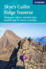
This 2-volume set provides all the information required to complete the main ridge traverse on Skye's Black Cuillin. Strategy, gear, training, navigation and logistics are covered, and 10 classic scrambles are described. A lightweight second guidebook gives the scrambler detailed maps, topos and route description for the ridge traverse itself.
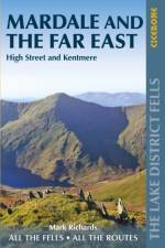
Part of the Walking the Lake District Fells series, this guidebook covers a wide range of routes to 36 Lakeland summits that can be climbed from the Ullswater, Haweswater, Troutbeck, Kentmere and Longsleddale valleys, with highlights including High Street, Place Fell and the Kentmere fells. Suggestions for longer ridge routes are also included.
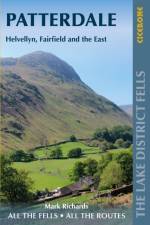
Part of the Walking the Lake District Fells series, this guidebook covers a wide range of routes to 35 Lakeland summits that can be climbed from Ambleside, Grasmere and Patterdale and the Thirlmere and Ullswater valleys, with highlights including Helvellyn and Fairfield. Suggestions for longer ridge routes are also included.
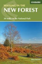
This guidebook describes 30 day walks of between 3 and 10 miles set right across the New Forest National Park. Suitable for all abilities, the walks can easily be combined into longer routes for greater challenges, through woodland, heath and along the coast, all illustrated with large-scale OS map extracts and vibrant colour photographs. The area is also an animal lover's paradise, providing natural habitat to many types of wildlife including deer, all six of Britain's native reptiles and the New Forest's very own species of pony. The New Forest is a unique landscape of open heath and ancient woodland tucked into south-west Hampshire and south-east Wiltshire. To many, a key feature is the ancient and ornamental woods, and here can be found the greatest concentration of 'veteran' trees in western Europe. And all this located within Britain's smallest national park, within easy reach of Southampton, Bournemouth and Salisbury.
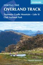
Guidebook to Tasmania's iconic Overland Track. Described over 7 stages, the 80km trail from Cradle Valley to Lake St Clair takes in glacier-carved valleys, vast buttongrass moorlands, mossy rainforests, rugged peaks, thundering waterfalls, alpine meadows and peaceful lakes. Adventurous side trips are also described.
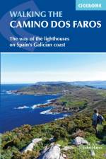
Guidebook to walking the Camino dos Faros, the way of the lighthouses, along the Galician coast in northwest Spain. The 200km route is described across 8 stages of between 17 and 29km and takes in some of the area's most wild and enchanting coastal scenery, with dramatic cliffs and deep river estuaries. Incorporates some challenging walking.
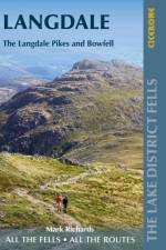
Part of the Walking the Lake District Fells series, this guidebook covers a wide range of routes to 25 Lakeland summits that can be climbed from the Great Langdale valley, Ambleside and Grasmere, with highlights including Scafell Pike, Bowfell, the Langdale Pikes and Helm Crag (the Lion and the Lamb). Includes suggestions for longer ridge routes.
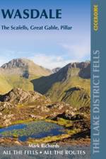
Part of the Walking the Lake District Fells series, this guidebook covers a wide range of routes to 25 Lakeland summits that can be climbed from the Wasdale, Eskdale and Ennerdale valleys, with highlights including Scafell Pike, Great Gable and Pillar. Suggestions for longer ridge routes are also included.
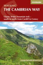
Guidebook to the Cambrian Way, a challenging three-week mountain trek through Wales from Cardiff to Conwy. The 470km unwaymarked route is presented from south to north. Often sticking to long, beautiful ridgelines, it crosses wild and rugged terrain and visits many of Wales's highest mountains, including Snowdon.
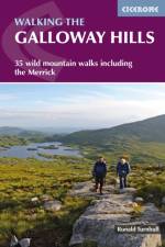
Guidebook describing mountain walks in the Galloway Hills of southern Scotland, covering Trool, Minnoch, Doon and Talnotry. Offering solitude and rugged natural beauty, this rocky, heathery wilderness presents some great hiking opportunities suitable for experienced hillwalkers. Includes summaries of longer backpack/bothy trips.
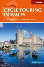
Guidebook to cycle touring in Wales. This packed guide describes a circuit of Wales - perfect for a 2-week trip - plus 6 cross routes, which range from 45 to 73 miles and can be completed as day or weekend rides, or used to create shorter versions of the main circuit. Includes all the information needed to plan and execute a successful tour.
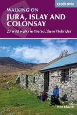
Guidebook to Jura, Scarba, Islay and Colonsay in the Hebrides, describing 22 walks plus a 5-day 89km trek along Jura's remote west coast. The routes range from 6.5 to 25km and cover rough - and often pathless - terrain suitable for fit, competent walkers. Even the coastal walks offer challenges.
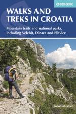
This guide describes day walks and treks in all Croatia's main hiking areas and national parks on the mainland, from the forested hills around Zagreb, to the roof of Croatia on the Bosnian border, and the national parks of Northern Velebit, Paklenica, Risnjak, UNESCO-listed Plitvice Lakes and more.
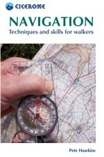
This pocket handbook to navigation will help you master the necessary map and compass skills for mountain walking. Chapters include map scales, symbols and contours, grid references, map reading, bearings, route planning and night and bad-weather navigation, as well as navigating with a GPS.
Sign up to our newsletter and receive discounts and inspiration for your next reading experience.
By signing up, you agree to our Privacy Policy.