Join thousands of book lovers
Sign up to our newsletter and receive discounts and inspiration for your next reading experience.
By signing up, you agree to our Privacy Policy.You can, at any time, unsubscribe from our newsletters.
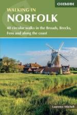
Guidebook to 40 easy to moderate walks in the English county of Norfolk. Circular routes of 4 to 12 miles show off the area's surprisingly varied landscape: the Broads, Brecks and Fens and coastal dunes, salt marsh and tidal creeks. Also includes information on Norfolk's rich history and unique plants and wildlife.
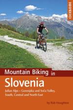
Guidebook to 35 full-day and half-day mountain biking routes in Slovenia. The routes, which are graded, range from 12 to 59km, taking in Gorenjska, Soca Valley, the South, as well as Central and North East Slovenia. Includes a Slovenian glossary plus all you need to know about getting there, getting about, bikes, equipment and accommodation.
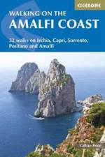
Walking on the Amalfi Coast describes 30 day-walks, ranging from 3km to 11km in length. The whole area is crisscrossed by ancient mule tracks, pilgrim routes and goat tracks, offering a variety of walking from family strolls to strenuous treks across terrain from paved paths to verdant hillside paths and rough volcanic scree. The routes in this guidebook, and every single walk can be accessed by public transport. Written by Gillian Price, the walks explore the Sorrento Peninsula, Amalfi Coast and Monti Lattari, from Positano, Sorrento and Amalfi, and also the islands of Capri and Ischia in the Gulf of Naples. The steep southern edge of the Sorrento peninsula, famous for its medieval villages perched atop plunging cliffs, with their near-vertical vineyards and lemon orchards, is now recognised as a World Heritage Site. This coastline, the rugged landscape behind, crowned by the Monti Lattari, and the idyllic islands of Capri and Ischia together also make a perfect holiday destination for walkers.
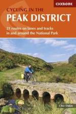
Guide to cycling in and around the Peak District National Park, on road or trail bike. 20 day routes and one multi-day cycle tour of the Peak District. All easily accessible from Sheffield and Manchester with routes starting from charming Derbyshire towns such as Ashbourne, Matlock, Bakewell and Buxton. Includes route profiles and 1:100000 mapping.
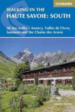
Second volume of a 2-part guide to walking in the Haute Savoie in the French Alps. This guidebook describes 30 half to full-day routes in the area between Chamonix and Annecy. Walks are located near Samoens, Sixt, La Clusaz, Thones, la Roche-sur-Foron and Lake Annecy. Includes Chaine des Aravis, Plateau de la Borne and Haut Giffre.
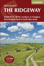
This guidebook - which includes both a guide to the route and a separate OS map booklet - describes the Ridgeway National Trail, an 87 mile (139km) route through southern England from Avebury in Wiltshire to Ivinghoe Beacon in Buckinghamshire. Typically walked in 6 or 8 days, this is a low-level waymarked route suitable for all abilities and for year round walking. The guidebook details the trail in both directions, west to east and east to west. Step-by-step route descriptions are accompanied by 1:100,000 OS mapping and a separate OS 1:25,000 map booklet showing the entire route is included. Packed with details on points of interest and a trek planner giving at-a-glance information about facilities, public transport and accommodation available along the way, this book is an indispensable guide to walking this national trail. Following a ridge of chalk hills through the Chiltern Hills AONB and North Wessex Downs AONB, the Ridgeway takes walkers through five counties and five thousand years of history. It offers a scenic and fascinating journey through our ancient and more recent past, visiting the UNESCO World Heritage Site of Avebury's Neolithic stone circle and the famous Uffington White Horse, and includes excursions to picturesque villages, thatched cottages and cosy pubs.
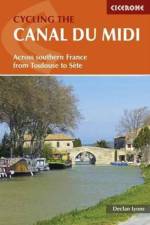
A guide to cycle touring along the Canal du Midi in the sunny Languedoc region of southern France. The 240km main canal route, and the 37km Narbonne extension are described. Information is also given on short detours to sights close to the canal, and longer excursions into the surrounding countryside. Those planning a week-long cycling holiday should concentrate of the main canal and some of the short detours. Reasonably fit cyclists should be able to complete the canal and the excursions in two weeks. A stage-planning table is also included to make it easy to work out a different schedule to suit a particular timescale and ability. For each stage a route description with sketch map in included, together with details of terrain, availability of shade, ascent or descent made, maps needed, historical points of interest and information about places passed en route.
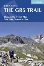
An essential guidebook for walking the GR5 trail, 660km from Lac Leman (Lake Geneva) to Nice or Menton, through the French Alps. Includes all the main variant routes as it passes Mont Blanc, then through the Vanoise, the Queyras and the Mercantour National Parks. Includes accommodation, profiles and maps. Suitable for fairly experienced hikers.
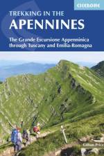
Guidebook to the Grand Apennines Trek, or Grande Escursione Appenninica (GEA). Through Tuscany and Emilia-Romagna and 2 national parks, this 400km trail takes 23 days to complete, exploring the mountains, forests and hills of central Italy. Suitable for a range of walkers, it can be split into shorter sections or day walks if needed.
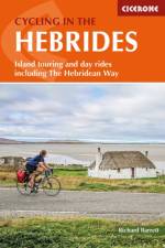
Cycling in the Hebrides is a comprehensive guidebook of routes, day rides and suggested island cycle tours throughout the Inner and Outer Hebrides and the Firth of Clyde with ferry schedules and timings. Routes range from rides suitable for a weekend break to a challenging 600 mile tour covering the entire region.
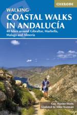
A guidebook to 40 half and full day coastal walks in Andalucia. The graded routes, which are suitable for any reasonably fit walker, range from 6km to 19.5km and can be walked all year round. The walks are located in seven of the region's most beautiful National Parks and protected areas (including La Brena y las Marismas, Los Alcornocales y del Estrecho, La Sierra de las Nieves and Nijar-Cabo de Gata) and are mostly circular in nature, negating the need for any logistical legwork. Step-by-step route descriptions for each walk are accompanied by 1:50,000 mapping, together with information about points of interest en route. Also included is a useful glossary and route summary table, plus all the practical information needed to explore Andaluca's coast on foot - equipment, safety, when to go, refreshments, accommodation and more. The picturesque coastline of Andaluca is a walker's dream. Sandwiched between mountain and sea, walkers are rewarded with both dazzling mountain vistas and stunning seascapes. The sense of history embedded in these ancient coastal byways - which dates back to ages past - is an added delight, making the walking all the richer.
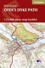
Map of the 177 mile (283km) Offa's Dyke Path National Trail, between Sedbury (near Chepstow) and Prestatyn. The trail takes 2 weeks to walk, and is suitable for walkers at all levels of experience. This compact booklet of OS 1:25,000 maps shows the full route, providing all of the mapping you need, and is included with the guidebook.
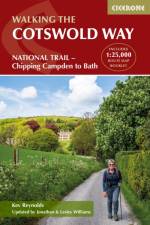
Guidebook to walking the Cotswold Way National Trail. Between Chipping Campden and Bath, the 102 mile route explores the Cotswolds AONB. Described in both directions over 13 stages, the Cotswold Way can be walked year round and is suitable for beginner trekkers. Includes separate OS 1:25,000 map booklet of the route.
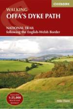
This guidebook - which includes both a guide to the route and a separate OS map booklet - describes Offa's Dyke Path National Trail from south to north, following the longest linear earthwork in Britain, running 177 miles along the English-Welsh border between Sedbury (near Chepstow) and Prestatyn on the north Wales Coast. The book splits one of Britain's classic trails into 12 stages suitable for walkers of all abilities. Step-by-step route descriptions are accompanied by 1:100,000 OS map extracts. Also included with this guidebook is a booklet of 1:25,000 OS maps, which provides all the mapping needed to complete the trail in a compact form. A trek planner gives at a glance information about facilities, public transport and accommodation available along the route. The walk is astonishingly varied, taking in the lower Wye gorge, the Severn and the Dee rift valley, the pastures and woodlands of the border country, the remote moorland of the Black Mountains and the Clwydian range, and the dramatic limestone escarpments of Eglwyseg mountain. What makes it even more special is over 60 miles walking alongside the Saxon earthwork of Offa's Dyke.
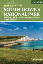
Guidebook to 40 day walks in the South Downs National Park. The walks, which are designed to suit all abilities, are dotted all over the National Park and range from 4 miles (7.5km) to 11 miles (17.5km). Each walk is circular, and where possible begins and ends at a place accessible by public transport. With some of the most iconic landscapes in southern England, including the white chalk cliffs of Beachy Head and the Seven Sisters, and such well-loved landmarks as Ditchling Beacon and atmospheric ancient monuments like the Cissbury Ring, walking in the park proves a delightful experience mile after mile. Step-by-step route descriptions are accompanied by 1:50,000 OS mapping. Also included is information on the plants and wildlife of the Downs, as well as handy practical tips on accommodation, car parking and public transport.
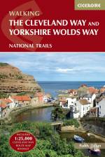
Guidebook to the Cleveland Way and Yorkshire Wolds Way National Trails, plus the Tabular Hills Walk link route. The guidebook also contains a 1:25,000 scale OS route map booklet of the Cleveland Way. The Cleveland Way National Trail, described in seven day stages, is a fine 177km (110 miles) walk around the North York Moors National Park from Helmsley to Filey. The Yorkshire Wolds Way is one of the quietest of Britain's National Trails and wanders for 130km (80 miles) through gentle, cultivated and sparsely populated countryside. Described here in nine day stages, from Hessle near Redcar to Filey, it links end-to-end with the Cleveland Way on the coast. Also described is the three-day, 80km (50 mile) Tabular Hills Walk, a Regional Trail that allows walkers to close the loop of the Cleveland Way and transform it into an enormous circular walk. The guidebook comes with a separate map booklet of 1:25,000 scale OS maps showing the full route of the Cleveland Way. The clear step-by-step route description links together with the map booklet at each stage along the Way, and the compact format is conveniently sized for slipping into a jacket pocket or the top of a rucksack.
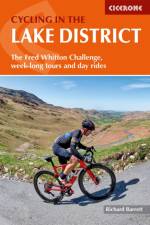
Guidebook to a 5-day cycle tour of the Lake District plus 15 challenging day rides from Keswick, Ambleside, Penrith and bases southwest and southeast of the National Park. Details 2 options each day for the cycle tour, plus a 7-day alternative itinerary. Also outlines other tours including the 112-mile Fred Whitton Challenge, which takes in 7 iconic passes. Step-by-step route descriptions are accompanied by either 1:100,000 or 1:200,000 mapping, together with details on gradient, major climbs and cafes/pubs en route. Also included is a comprehensive 'what to take' checklist plus other practical information such as preparing your bike, packing for a cycle tour, fuelling your ride and more. This comprehensive guidebook also details accommodation options and useful contacts plus information on the district's geology, landscape, plants and wildlife. With its picturesque lakes, lush green dales and high passes, the Lake District offers some of the most scenic and challenging cycling in Britain. Whether touring or day tripping, England's largest National Park will leave you (literally and metaphorically) breathless.
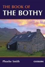
An introduction to some of the best bothies in the UK. Featuring 26 selected bothies, the author shares her memories of using these free 'stone tents' in some of the country's wildest and most remote locations. Alongside notes on legends and landscape, wildlife and history, the book is full of expert guidance and tips on how to make use of bothies, from packing lists to bothy etiquette and the best walking routes in. Inspiring and fun, the book showcases bothies in Snowdonia, the Brecon Beacons, Lake District, Pennines, the Highlands and Islands of Scotland, and Northumberland, and is a personal celebration of the world of bothying. Hidden away in the hills and mountains of England, Scotland and Wales - for years known only to a lucky few - is a network of huts, cottages and shelters. Completely free to use, these secretive refuges can be life-savers, quick stops and destinations in themselves. The network of British bothies is cared for by the Mountain Bothies Association, and day-to-day by the walkers, climbers and mountain lovers who rest there.
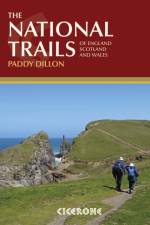
Inspirational guidebook to Britain's National Trails - 19 long-distance walking routes through England, Wales and Scotland. Together, these routes (National Trails in England and Wales and Scotland's Great Trails) cover well over 3100 miles (5000km), exploring the rich scenic and historic countryside of Britain. This larger-format guide explores the full breadth of the network, including the popular South West Coast Path, Hadrian's Wall Path, West Highland Way, Cotswold Way, Offa's Dyke Path, South Downs Way, Southern Upland Way and many others exploring the beauty and wild country of the British Isles. Outline schedules for each Trail allow you compare the routes and become inspired to take up the challenge, whether on a relatively short or easy trail, or to tackle a longer, more strenuous route. Basic day-by-day route descriptions for each Trail are illustrated with maps and profiles. Information is provided on access to and from the routes, maps, public transport, guidebooks, TICs, accommodation and useful websites.
Sign up to our newsletter and receive discounts and inspiration for your next reading experience.
By signing up, you agree to our Privacy Policy.