![History of Mecklenburg County [North Carolina] and the City of Charlotte from 1740 to 1903 af D A Tompkins](https://cdnbackdoor.tales.as/thumbnail/150x225/00065/79967/cover.1501677039.jpg)

![History of the Battle of Point Pleasant [West Virginia] Fought Between White Men & Indians at the Mouth of the Great Kanawha River (Now Point Pleasant af Virgil A Lewis](https://cdnbackdoor.tales.as/thumbnail/150x225/00065/78964/cover.1501675080.jpg)


Join thousands of book lovers
Sign up to our newsletter and receive discounts and inspiration for your next reading experience.
By signing up, you agree to our Privacy Policy.You can, at any time, unsubscribe from our newsletters.
Details the battle at Point Pleasant, (West) Virginia (the chief event of Lord Dunmore's War), fought between white settlers and Native Americans on Oct. 10, 1774.
This beautiful area of Virginia began to experience very rapid development after the Civil War, putting its abundant resources to work in the name of progress. This book deals with the reasons for the area's growth after the Civil War, from about 1870 to 1890. Part One covers southwest Virginia and begins with a history of the first settlers in the region, their way of life, their troubles with the Indians, the formation of the first counties, and the development of agriculture and manufacturing. The breathtaking scenery and healthful climate of the valley, as well as rich mineral and agricultural resources, are said to be some of the main reasons for its rapid growth. The geological aspects of the land are also analyzed. The abolition of slavery and its effect on the country, the development of New River railroad into the rich coal fields of the valley, and the establishment of influential towns such as Lynchburg, Roanoke and Salem were additional catalysts for the modern progression of southwest Virginia. Part Two is concerned with the Shenandoah Valley and also gives the history of the first settlers; information about geology, climate and agriculture; the effect of abolition on the economy; the further development of railroads and coal mines; and the establishment of influential towns like Berryville, Front Royal and Waynesboro. In addition, the history of Luray Caverns and its effect on the Shenandoah Valley is given a detailed description. A new every-name index has been added.
In 1996, the author visited all the Berkley cemeteries she could find and transcribed the inscriptions from each stone in order to preserve the inscriptions before they were "lost due to the ravages of time." Cemetery records are arranged alphabetically by cemetery name and include the location of the cemetery and "Notes" offering additional information provided by the author's research, such as a previous location of a stone. The inscriptions vary, but generally provide the full name of the deceased, the year of birth and the year of death; some also provide the name(s) of spouse and/or children, parents, or siblings. Locations include: Algerine Street Cemetery, App's Hill Cemetery, Berkley Common Cemetery, Bobbett stone, Nathan G. Bowen Cemetery, Briggs Cemeteries, Nathan Briggs stone, Bryant Street stone, Burt Cemetery, Burt's Corner Cemetery, Caswell/Clark Cemetery, Dean Cemetery, Dean/Dillingham Cemetery, Dighton Rock Cemetery, Fletcher Cemetery, Fox Cemetery, Haskins Cemetery (Bryant Street), Haskins Cemetery (Church Street), Haskins Cemetery (Myricks Street), Hatheway Cemetery, Lydia Jones stone, Norcutt Cemetery, North Main Street Cemetery, Paull Cemetery, Phillips Cemetery, Tew Cemetery, tomb, Townsend Cemetery, and Webster Cemetery. A map of Berkley cemeteries, a few charming illustrations, and a surname index augment the records.
Tennessee genealogists and historians will revere this text. Its information has been taken from the original Davidson County deed books. The work includes transcripts of deeds and new indexes of the data. Such a text as this, however, was needed because the original index is arranged solely by the names each transaction was registered under. In most cases, many more names lie within the body of the document. The author of this book has endeavored to make every recorded name accessible, via index, to aid the researcher. These records identify family members (and relationships) for both white and black families in Davidson County between 13 February 1829 and 27 August 1835, a time when the census identified only the white "head of household;" a time when many wills identified only the husband, leaving his property "to my beloved wife and children;" a time when there was no other record for the slave family. The book's index listing refers to the original deed book page entry. Included are the deed records, whose inventories of personal property give a truly unique picture of the society of the day. Indexes cover first and last names, slave names, and places.
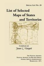
This long out of print finding aid to the collection of approximately 900 maps selected from the holdings of the Cartographic Archives Division of the National Archives. The maps date from the late 18th century to 1920. The list is intended generally for researchers who are seeking general maps of the States and Territories. For example: Entry 256: Map of Indiana and Illinois Territories, compiled from the best authorities for Governor Edwards of the Illinois Territory by R. Paul, 1815. Copy by James Kearney. Scale not indicated. 19 x 23 1/2. Manuscript. Indian villages, rivers, military posts, towns, and General Scott and Governor Edwards traces. Filed as RG 77: US 33-2.
Sign up to our newsletter and receive discounts and inspiration for your next reading experience.
By signing up, you agree to our Privacy Policy.